Ghost town in Nevada….

We have been on the road for almost 3 weeks now. We have only paid for a campground 3 nights now.  They usually cost about 40-45 a night, so about 1300-1400 a month. I guess we avoid them partially because of the cost, partially because we are to the point that we do not need them, ( we are getting by just fine on our solar power,  our 100 gallon water tank, propane for the stove, and a generator when all else fails(rare) ), but mostly because of the gorgeous spots we get to camp…… and the wild life..

IMG_2222

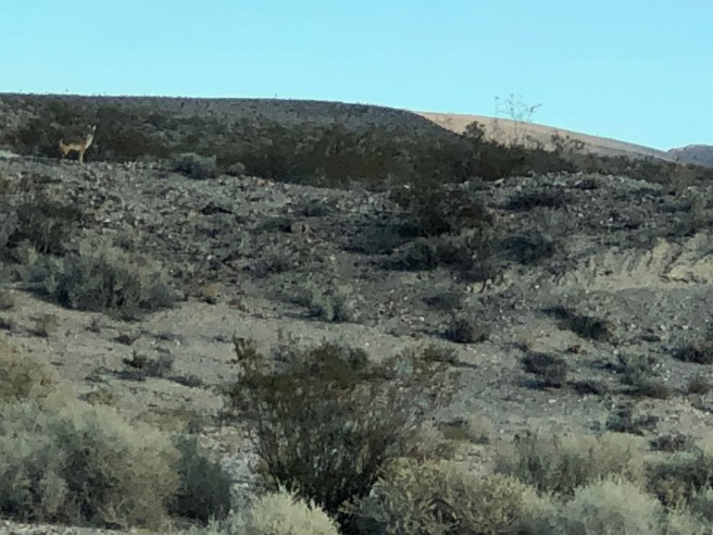
Not a great shot, but there is a coyote there, and Tucker is barking like crazy about it.

IMG_2226

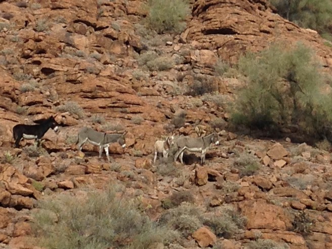
…. and the burros. Strong winds, and I just missed a few of them rolling around in the sand kicking up the dust.

We have had several days of strong winds, COLD winds.  It has been interesting having our son Josh taking geography this term, learning how weather systems form. It seems as though the dreadful winds we have been experiencing through West Nevada, is in effect a high pressure system associated with the Santa Ana winds that  fuel the fires in Southern California.  The western part of Nevada, into California is called the “great west basin” . Here is an excerpt I found in Wikipedia.

“The Santa Anas are katabatic winds—Greek for “flowing downhill”, arising in higher altitudes and blowing down towards sea level.[4] Santa Ana winds originate from high-pressure airmasses over the Great Basin and upper Mojave Desert. Any low-pressure area over the Pacific Ocean, off the coast of California, can change the stability of the Great Basin High, causing a pressure gradient that turns the synoptic scale winds southward down the eastern side of the Sierra Nevada and into the Southern California region.[5] Cool, dry air flows outward in a clockwise spiral from the high pressure center. This cool, dry airmass sweeps across the deserts of eastern California toward the coast, and encounters the towering Transverse Ranges, which separate coastal Southern California from the deserts. The airmass, flowing from high pressure in the Great Basin to a low pressure center off the coast, takes the path of least resistance by channeling through the mountain passes to the lower coastal elevations, as the low pressure area off the coast pulls the airmass offshore.”

So yesterday was the first day we have noted a lessening of the winds, and the news said also that the Santa Ana winds had decreased.  So perhaps they will cool down and we will warm up.

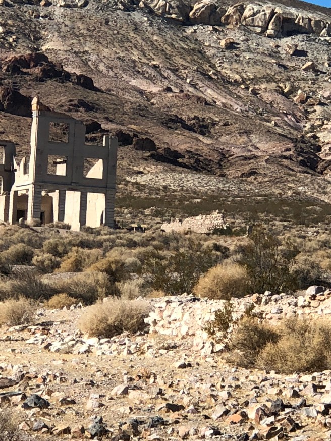
One of the places we explored was Rhyolite, a ghost town from the gold boom.  It was dreadfully windy there, so we thought if we climbed closer to the mountains we might get out of the wind….. and we did.

IMG_2274

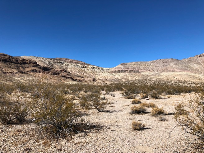
If you look at the spot up near the V,  we got out of the wind there 🙂

IMG_2252

…and this is the view from there. The flat part is Death Valley, and California in the distance.

IMG_2270

The entire valley is riddled with mining shafts like this one.

Gold was discovered here in 1905, and in 2 years it was a town of 12,000 people. It had banks, newspapers, gambling halls (of course gambling halls, it is Nevada..) … and even an Opera house.  3 Railroads had lines built into Rhyolite, but by 1911 the ores had begun to play out. Too bad they did not have RVs back then…… they could have just moved on to the next bonanza 🙂 .

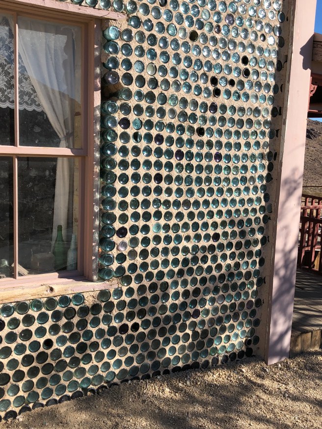
The one building that is still standing is oddly the Kelly’s bottle house, made entirely of bottles.

IMG_2292

IMG_2294

IMG_2287

I believe this was the school.

There was also “the panic of 1907”  which saw the stock markets fall 50%, so there was much less money to invest in mining, yet another factor in the demise of Rhyolite.  Interesting to read about Charles Schwab as a major investor in this.

IMG_2289

seeing the remains of this building I was wondering if the bars were to keep someone in (jail), or keep someone out (bank). Turns out it was the former.

And we can hardly have a day with out something going wrong with the motorhome, and this is what our motorhome looks like when the hood is up…. the engine is under the bed, and some spring dohicky broke off that keeps the engine from over revving or something like that. Ken managed to gerry rig it back to being hooked up again and all was good.

IMG_2291

and Tucker now has booties, now that we are into the cactus. So we do not have to use pliers to get the thorns out of his paws.

IMG_2306

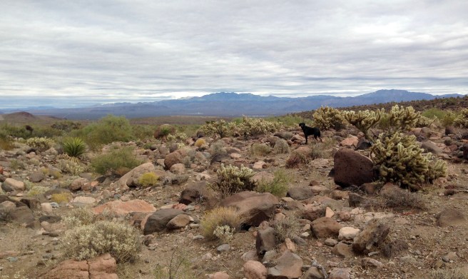
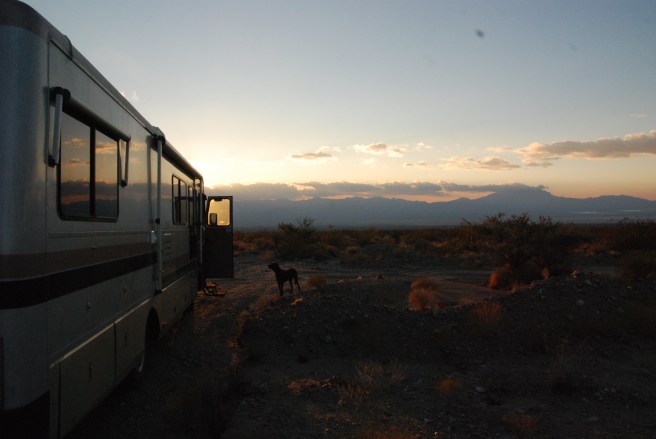
Where we stayed last night………

IMG_2314

So that is where Ken and Tucker and I are now

Much love


A life in a day….

We have been camping out in the desert for about 6 weeks now, a few nights in campgrounds and a few nights with friends outside of Phoenix. It really is the most laid back trip we have ever had. We have been back and forth across the border of California and Arizona a lot and have been near the border a lot. So rather than change our clocks over and over, we just decided to pick a time zone and stick with it.  We like Arizona time.

Our motorhome is showing some signs of abuse, with us trying to get to places we likely should not get into.  I love to see the smirks on peoples faces as they drive by us in their 4×4 vehicles, out in the middle of nowhere. We can usually see civilization from where we camp, but are usually 2-3 miles or more away from it. Tonite I can see the highway and trains 2 miles from here.  Deserts are like that.

We found that the campgrounds usually had very poor internet, so are relying on our AT&T cards. We have found that it is a pretty good deal, 10$ for a GB.  We can buy the refill cards in the grocery stores. We are not streaming anything (and have turned off automatic stream) and are able to work on the blog, check email, news, and although these days we are trying to avoid it, Facebook. 🙂  So it is costing us 40-50 dollars a month for internet.  We fill up water and dump sani at stations after every 4-5 days out.  Our only issue is garbage, which we have very little of…..  We use all cardboard boxes to fill with rocks, 🙂   not really but some.  We bury all out compost out in the desert.

We often stay at the same places a few days and cover on average 60 miles every few days driving. We walk between 3-5 miles a day looking for rocks, and some days biking (one day we biked 17 miles, half up hill in sand. was not part of the plan)

When we get back we set up our table scrub off our rocks to find which ones are keepers and which ones are not.  We smash some to make sure.  🙂   We now have several reference books to help us ID stuff.

We have wine, stoned wheat thins, and watch the sun sets. (or suns set)    We have wonderful gourmet dinners, and some days leftovers of gourmet dinners.  Then we play crib. Ken usually beats me, but last night we tried out a different deck of cards and I started winning.   Nice days. OH and reading lots of books.

These are Chalcedony Roses.  Essentially the same stuff that make up Agates, with out the lines (bands) . We have some pink ones and some white as well…..They will tumble up beautifully, when we get back to our tumbler.

img_1519

This is a geode. We see them everywhere here.  We have yet to find an unopened one though we have smashed a lot of ordinary rocks to see if there were geodes.

img_1518

This is a rockhound.img_1506

This is an agate with some opal in it, with part of a geode???

img_1514
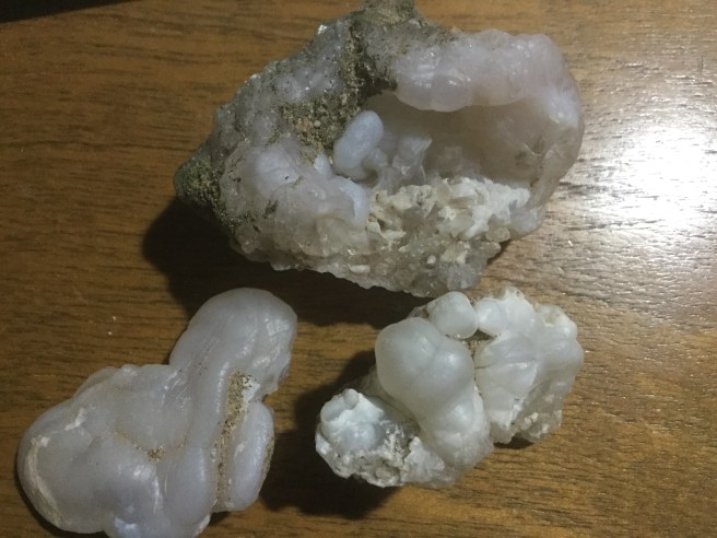
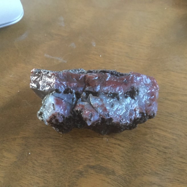
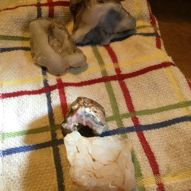
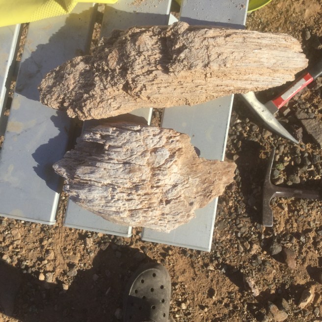
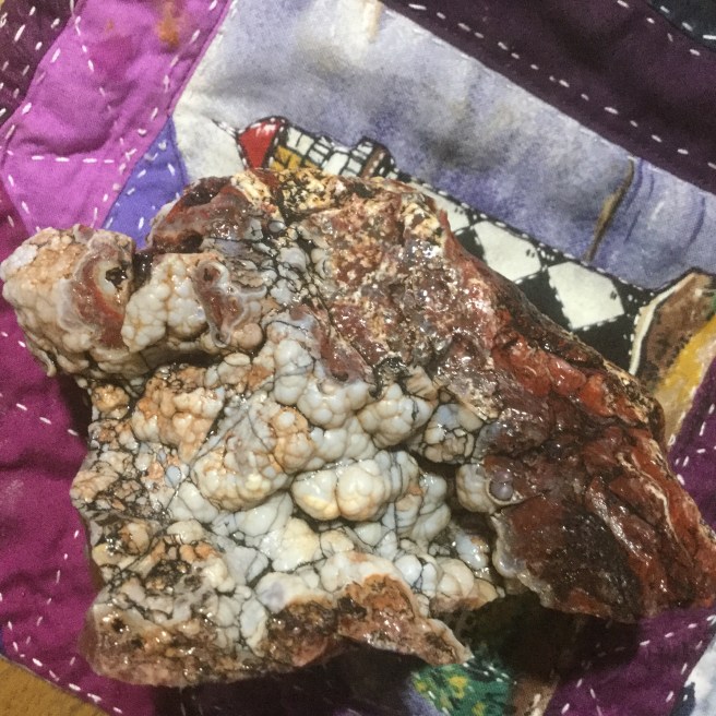
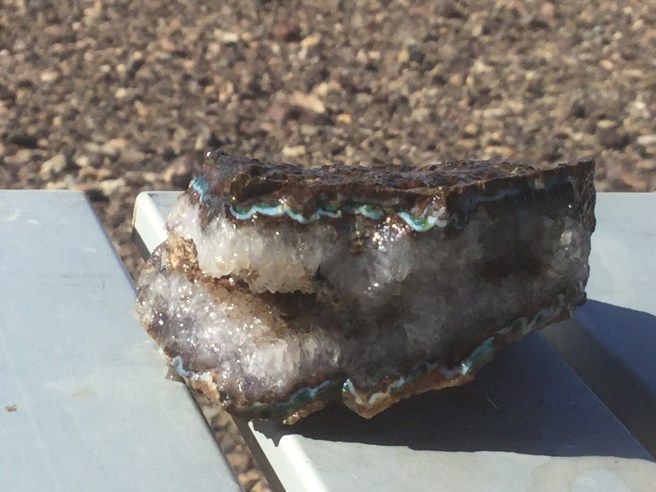
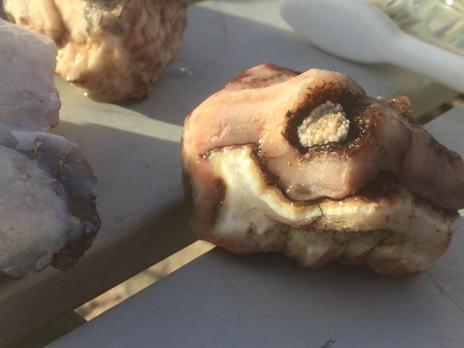
This is jasper/agate that has formed within a seam (the space between two rocks layers).  I should add that these are my interpretations
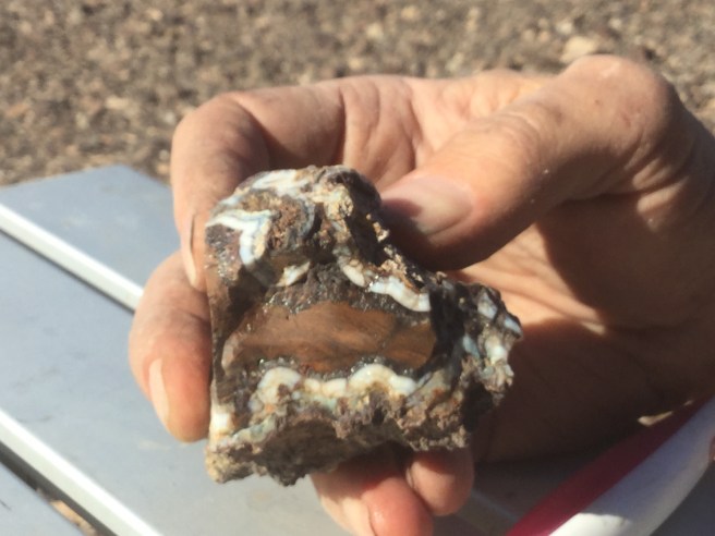
img_1505

larger chalcedony rose wth an agate geode.

img_1444

This is an agate geode with some amethyst ? centrally, and some copper minerals around the edges??

img_1496

I am not totally sure what this is, but every piece of it looked like hunks of wood, but they were completely very fragile crystals.

img_1503

I know this looks like a hunk of rotten beef… it is rather complex and will take cutting etc to bring out the full beauty.  I am hoping my friend the gemologist will add to this and I will edit this then.

img_1520

This is an amethyst geode with some…?opal, chrysocolla  around it.

img_1494

We think that this is a jasper/agate with central brown jasper and some opal around the edges.

img_1490

an agate.

img_1522

Well it is 7:30, ARIZONA time…….

BLM camping in Arizona, and cool rocks.

I have to say we are having the time of our lives down here. I had always questioned the whole snowbird thing, go south, somewhere hot, play golf and hang around a swimming pool. Besides, I really hate the heat anyways. This year to avoid the dreadful storms along the Oregon coast that we experienced last year, we decided to go inland a bit, then a bit more and suddenly found ourselves down in Arizona.  Last year we stuck to the coast to avoid the freezing temps, our RV is older and not set up for really cold temps. This year the weather was good in early November, so we cautiously went down through Nevada, closely watching temperatures and elevations.  We took 95, which  runs down a long valley with mountains on both sides. Essentially high desert. We did not spend as much time as we would have liked to, as we were trying to stay ahead of a storm that was bringing colder weather. (Perhaps next year we will hit this area earlier).  Arizona is lower in elevation, and further south, and so warmer.  Even where we are (near Quartzite) it gets down close to freezing at night.

img_1823

We have also been staying out in the desert on BLM land. It is free and the views cannot be beat. Most of Nevada and Arizona are public land, and we have an APP, that shows is where BLM land is. Also signage usually indicates where private land is.  We are self sustained, with 3 solar panels and an inverter to convert the power to ac power. SO if our water tank is full, we can actually spend several days out in the desert quite comfortably.

dsc_0686

I had never really understood the beauty of the desert, but I realize it is more than something a picture can take. I am not even sure I can describe it in words. I guess it is one of those “you had to be there” things.  I would have to say “solitude” would enter into the descriptive terms.

img_1834


What has led us out here, has been the search of rocks, but we still love the days even when we find nothing.  We have “THE BOOKS”, rockhounding in _______.  You can get one for each state (and province by the way).  They give descriptions of places to find certain “gems”.  Then they describe how to get there. Usually they are at best vague, and at worst misleading. HOWEVER that just adds to the fun. I am up every morning studying the books, and have 3 different map types on my iPad. Oddly enough, often the RV camping app has the best maps.  Oh and google earth as well.

So I start with a place that is interesting, then I have to figure out if we can get there. Our RV is not a 4 wheel drive, although we do get as far away from the main roads as we can. THEN WE WALK, or cycle to get to the designated places that most people take ATVs or 4 wheel drives. WE GET MORE EXERCISE, and find more rocks on the way  TO the designated places.

img_1846

We likely also see more of the wild burros when walking. They were apparently let loose by  prospectors who had run into bad times or other issues….and they have multiplied out in the desert over the many years. I wish I could get a better picture of them.

img_1822

There is so much about all of this type of travel that I have found hard to find the info I wanted, so thought I would write a bit about it.

img_1853

The sun has just come over the nearest hill, so I had better get to the books and plan today out.