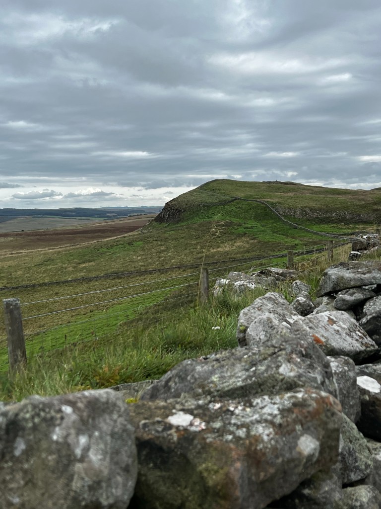
As you can see, the Romans took advantage of this geography and didn’t have pesky things like borders to deal with. This looks like a perfect place to have a wall and nearly impossible to penetrate. Essentially because there is a cliff on other side.
The area we were in right now, is supposed to be the most interesting, beautiful, and with the least accommodation. Since very few towns ended up along this part of the wall that is felt to be the reason so much of the wall remains here.
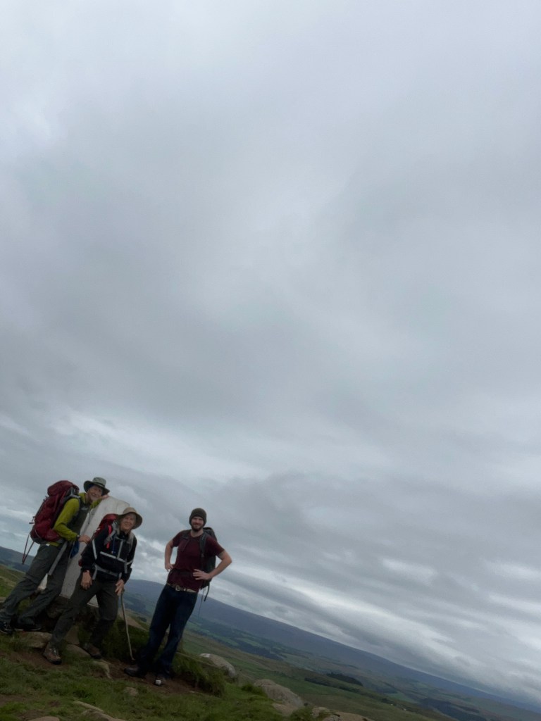
We did reach the high point of the wall today I managed to get a photo there, dark as it looks
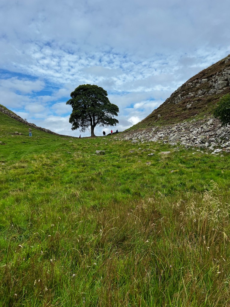
Another highlight of the day today was seeing “the sill”. Apparently one of the most photographed places in England the claim to fame is it is where the famous scenes from Robin Hood Prince of thieves movie.
The walk we were doing today is probably the most popular and the most walked part of the path. We got to the spot and people were all around taking pictures, but there didn’t seem to be a tree. In all the pictures there was a tree? I guess something could’ve happened to the tree and the site still remained?
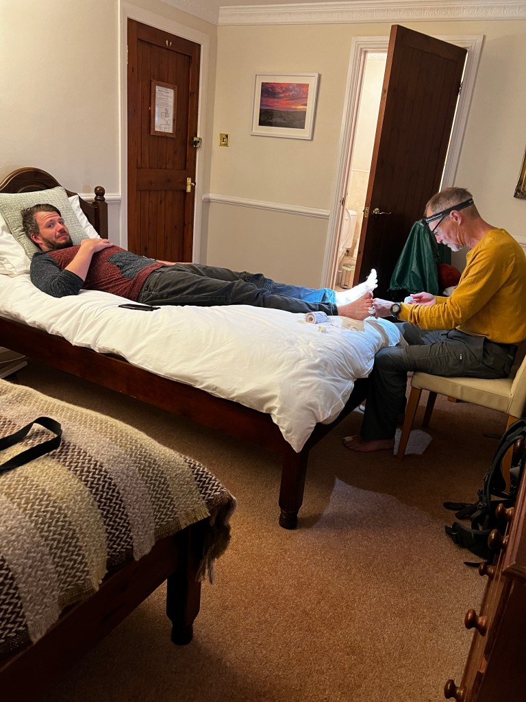
We had the most wonderful stay last night at the bridge bed-and-breakfast. And then an amazing dinner at the Mile castle.Inn. Many delicious vegetarian choices, as well as roast beef and Yorkshire pudding so all three of us were happy.
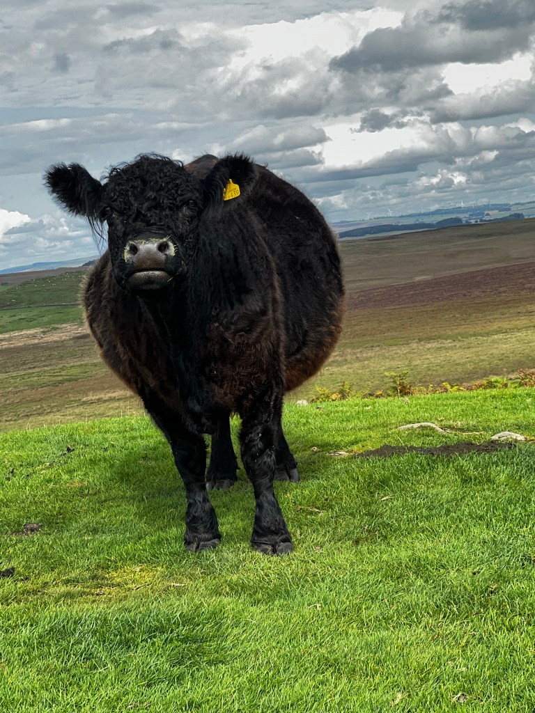
Large lipped Scottish cow.
Well, further, along on day four, we did find the tree. The area is called “ the sycamore gap” and once again there were people mulling around taking pictures. People can take a short walk to these areas from the highway. They do this for some of the more spectacular spots on the wall. I will have to go back and watch the movie to have a closer look at the site, Robin Hood Prince of thieves that is.
This picture is a little bit like the Multnomah falls pictures are to Oregon ……quintessential.
The way the story goes he was fighting the crusades with King Richard, was captured and then escaped and made his way back to England. Geographically this scene does not fit.
Nottingham is south of here and so is where they were fighting the crusades wars …… apparently in Jerusalem. So they would have had to of taken a very circuitous route to get all the way up to Hadrian’s Wall from Dover on the way to Nottingham.
But it was a good spot for that particular scene
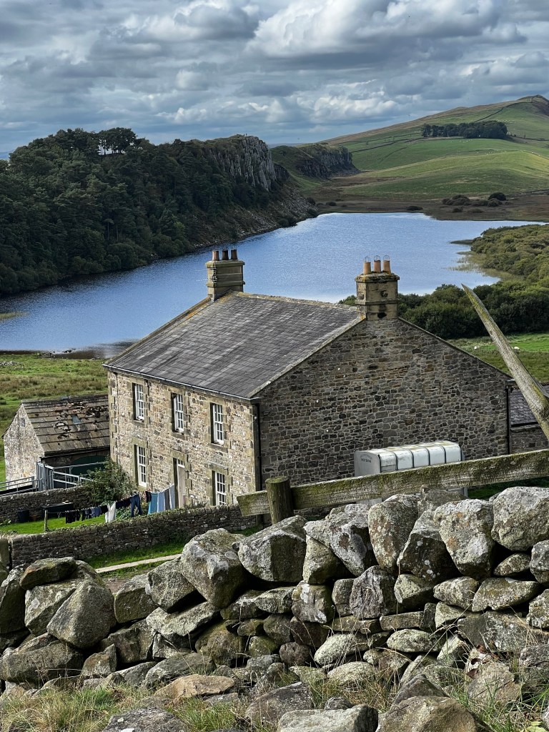
Day four was an extremely long day with lots of climbing, and going downhill and going uphill and going downhill. Unfortunately, it was also a day that there was no amenities along the way such as places to fill our water jugs or get beer. When we are done about 12 miles blistered and beaten, I tried that little transit thing on Google maps and lo and behold in an hour a bus was coming to a place near where we were take us to Chollerford. Typical evening photo
Today we are taking a day off let a few muscles and skin issues heal
Ah England, though hast not failed thee for the heavens have opened and we are cooled. And Kenneth, my betrothed. Doth be vindicated for all the rain gear he doth brought. Me not so much.
Josh has joined us.
One of the exciting stops along the way on our second day was a small eight year old girl was doing the Hadrian’s Wall kicking a soccer ball as a fundraiser. They were celebrations along the way and kids had joined her for parts of the adventure. It was all great fun, and she certainly looked like an avid soccer player.
The bar we stopped at for this titbit of information was the Stagshead, which had thankfully opened an hour early for the event
I was talking about the differences and similarities between Hadrian’s Wall and the Camino. One major difference is that the Hadrian’s Wall as a Path has only been an entity since 2003. It is a path that follows along the Hadrian’s Wall much of which is impossible to actually see. The Camino is a Path that has been walked on for hundreds of years. I guess a Path stays where it is as long as you’re still going between the places however, a wall stops being useful once you stop wanting to keep somebody out. For some crazy reason I just remembered that I actually have a song recorded about just this issue.
So one main difference is that there’s very little build up along the path. We go by a small hamlet every 2 miles or so but each of these is really only 20 or 30 lovely brick houses and no businesses to speak of.
It is for this reason that the trip was very difficult to book. The wall itself is not on most, maps, and on the apps that show the wall they often don’t show the towns around it. most people , it seems, tend to book accommodation through a company. The company charges about 900 pounds a person and takes care of your lodging and moves your luggage from place to place. For whatever reason, I decided that seemed like a lot for three of us so I decided to do the booking myself.
It was essentially sitting for a full day with multiple Maps calculating how far we would go in a day and then trying to find a place for us to stay at around that spot.
And then many of the smaller places get booked up early, and some close early i.e. the beginning of September. They don’t encourage you to walk the Hadrian’s Wall past the end of October because it’s too wet and hard on the trail.
Our other big issue is that we purchased Sim cards from England that we set up once we arrived in England. We were told that we could keep our same phone numbers, but that was not the case. This didn’t seem to be too much of a big issue until we realize that anytime you access the bank and they need to verify things they send you a text your phone number, so anything to do with our bank that we want to purchase, Unfortunately we cannot put through
The other issue is that an Airbnb that we stayed at wanted to verify if we were coming for supper because they are quite isolated. I did not get the email and they did try to phone me but of course the phone number was not working.
So we did 12 miles yesterday and towards the end of the day it started pouring apparently it rained 27 mm yesterday so we were quite soaked when we arrived at the Airbnb and the people were a little ticked off at me because I hadn’t gotten back to them. A little much after 12 miles and being soaking wet but obviously that was my issue and it was resolved. We had a lovely evening at Flossie’s on the wall.
Another major difference between the Camino and the Hadrian’s Wall path is that for the Hadrian’s Wall people tend to go either east west or west to east and so we often have people come in the other direction we are going west to east
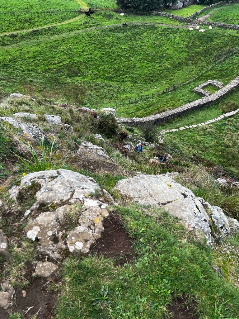
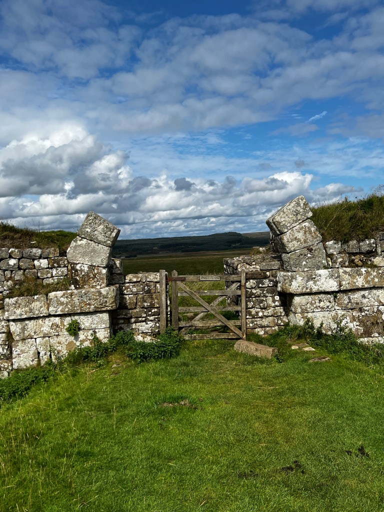
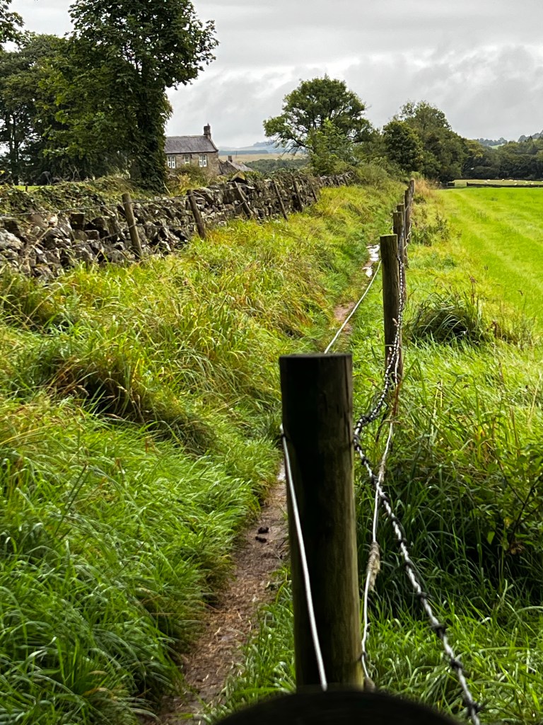
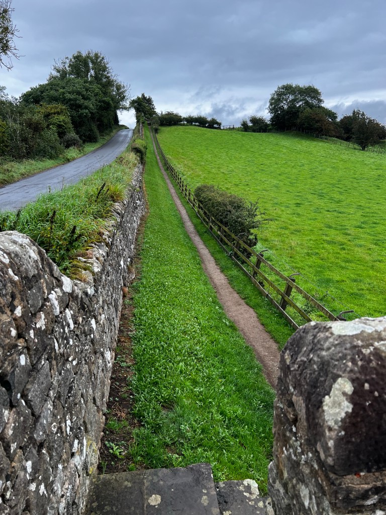
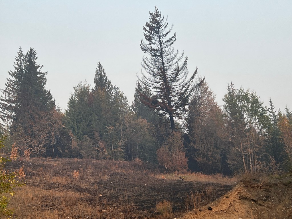
We are starting to see bits of the wall today. There are Rock walls everywhere in England and so we have had a tendency to say I wonder if that’s the wall? …or could that be the wall?” But given that it is on average 10 to 12 feet high and. 15 feet wide it is more of a concept than an actual structure for the most part it seems. At least for us now.
As far as how the wall has disappeared over the years, I’m sure a lot of it is erosion and the buildup of soil, but a lot of the structures in this area are built from the rocks from the wall because they have all been taken for miles around to build a wall so churches and walls that are currently here came from “ the wall”. Recycling at its finest.
It’s like we’re walking along a high mound and trying to imagine that below us there is 10 feet of wall that is 15 feet wide
Well, for today, we are going from Walton to Haltwhistle. Starting uphill now, so will close for now. I apologize for any grammar mistakes as I have dictated this while walking along much love to all.
We have completed the first 16 miles of the Hadrian’s wall path……and need a day off 😳. All estimates were 10…. Maybe 12 miles and so we were not quite prepared for 16.
Oh, I did think about packing it in about 4 miles into the hike, everything hurt, and I was so tired. Then I remembered to start drinking water amazingly everything went away. I tend to never get thirsty, so I have to remember to drink. Some days I am so sleepy in afternoon only to realize I have had nothing yet to drink, water IS the energizer. We took a bus from Carlisle to Bowness on Solway, which is where the path begins. All on the bus were also hiking, and all quickly bypassed us. A father and son on bus had planned on hiking the whole Hadrian’s. wall in 3 days, of course they disappeared right away. As we got off the bus, so too, another group got on, having just completed the hike, going from east to west. I guess that will be us in a week at WALLSEND, on the east end.
Josh is down in Liverpool and taking a train to meet us here in Carlisle tonite. Josh’s birth father lives in Liverpool.
We did the Camino several….maybe 6 years ago and we are looking at similarities and differences. Not sure if it is age, memory or distance, but this seems much harder than the Camino was. I do not remember the daily distances we did then.
There ARE characteristic signs to follow, signs you grow to seek out and find comfort in. The Camino was a shell, and we have not yet ‘sorted” what these signs are, either an acorn, or a helmet. Speaking of helmets…..This is King Edward the 1st, who was killed in battle by Robert DeBruce……. Apparently he took off his helmet (a plug to wear helmets 😒
The walk began somewhat boring, along roads and paths near roads.
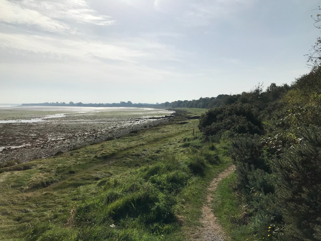
We walked along Solway bay, but there were many signs warning of soft shifting sands, in the low tide, so we did not venture onto the sand, despite evidence of rocks out there. We figured it was a devil we are not familiar with. The second half of the day was much better walking along trails through fields, and we had LOTS of company.
We stopped for lunch on the side of the road, and later at the Greyhound Inn for beers and a chance to fill up our water camelbacks.
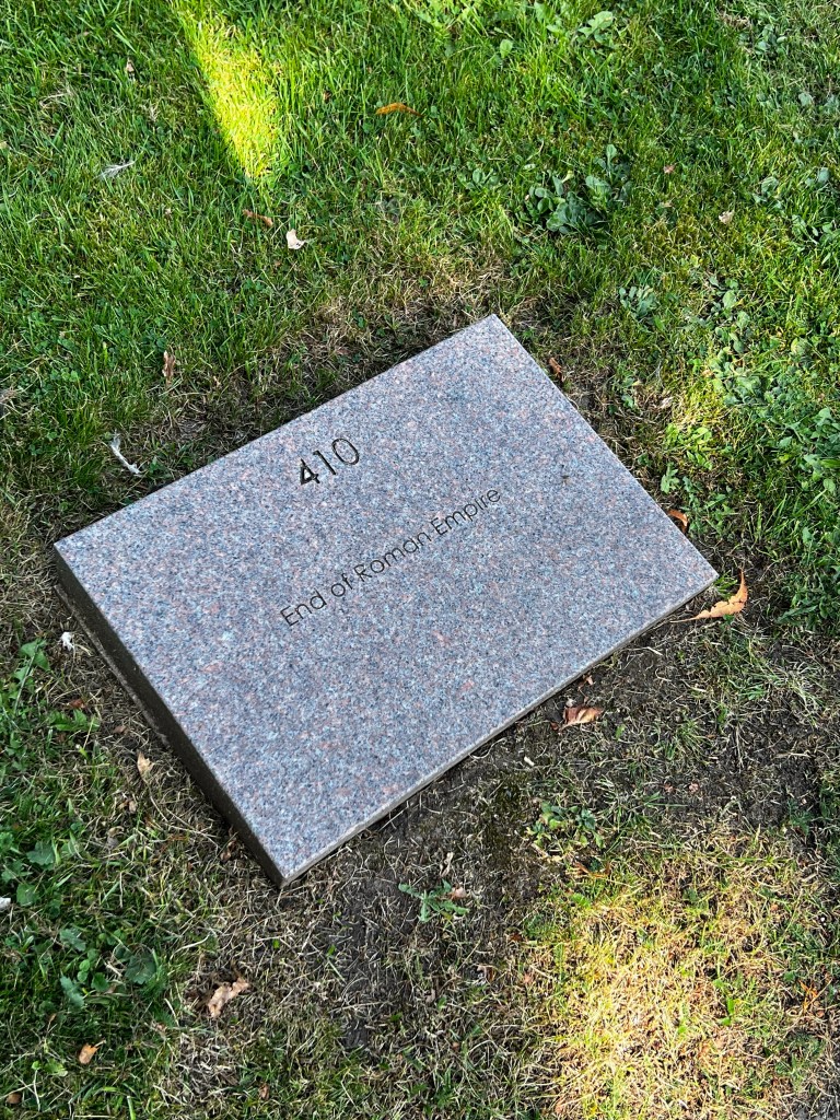
We did happen by some elder graveyards, and thought that this seemed a rather unceremonious end documented. Made me ponder how the end of the “current” empire shall be memorialized.
Hadrian’s wall was constructed 2000 years ago and very little remains of it,and we have yet to see any of the “wall”. However this church and graveyard apparently sits ON the wall, the only graveyard to do that.
Well that is a brief summary of our first day.
Thanks for reading, Janet, Ken and Tucker, whom we miss SOOOOOO much.
I’m not sure what is worse, an overnight flight or a colonoscopy. One has a day from hell before and one has a day from hell after.
The morning after
Either way after a good sleep, all is well. We are currently in Carlisle, England. Carlisle is the birth place of Woodrow Wilson’s mother. His father was a minister here, so there is frequent reference to him.
Also the site of many wars with Scotland.
For the most part England won, Scotland did win a few and Carlisle castle DID spend some years being part of Scotland. The Roman’s had a fort here 48 ad onwards, but the Romans left England in 400 A.D. the Carlisle Castle was built on the site of the Roman fort. The castle was built after 1000 A.D..
With all the chaos in our lives recently, we decided to come to Carlisle to stay for a few days prior to starting the hike. The actual hike starts west of where we are. We are taking a bus today to Bowness on Solway, and walking back to here Carlisle. Josh is meeting us tomorrow and then we head out for the rest of the hike.
I must say that yesterday was a day with a lot of twists and turns. We are getting more adaptable all the time. And they say old people are set in their ways.
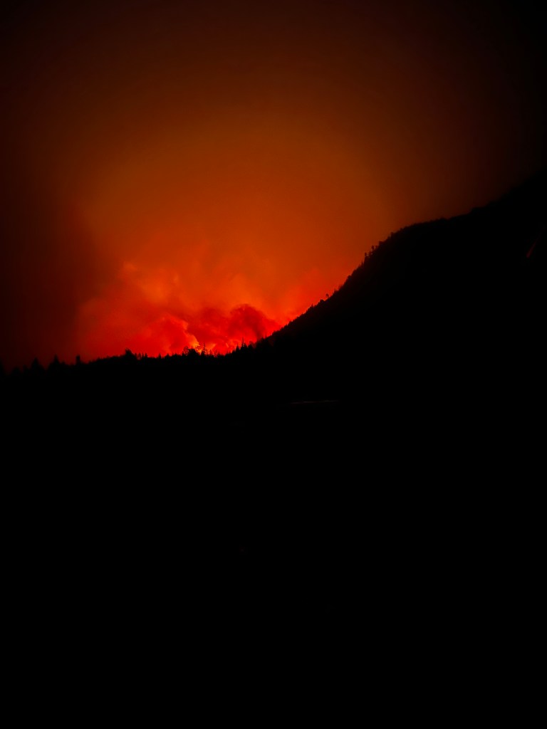
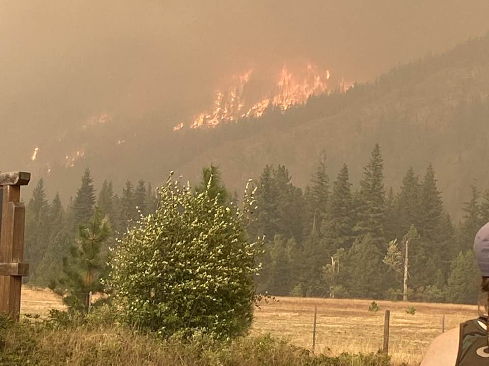
Yesterday started at 0100 hours (one in the morning) sitting in our bathroom watching this to our east.
It was unclear which way it was going, OR if it was flames or we were seeing of just the reflection of flames on the clouds? This would be 1/2 KM-1 KM from us. The wind was strong and seemed to be blowing towards us. I was afraid to go to sleep. Started putting things closer to the front door.
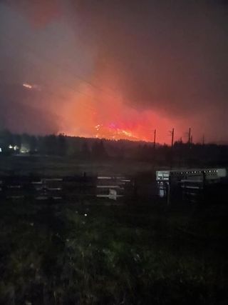
Although the wind was blowing towards us, the fire seemed to be moving to the left (north)
Gradually this all went to the left, and was no longer bright. So we went to sleep. I was thinking that this was GOOD for us, but likely NOT good for someone else. Sure enough the following pictures were posted the next day… the people east and north of us in Sorrento were seeing something totally different from we were seeing.
AND in Sorrento there had been sirens going all night. It was like about the same time we went to sleep, everyone else WOKE UP. There is a chicken farm over there and all the fire departments in the area were over there working on those structures and apparently ultimately saved them all. The animals had been moved. We had not heard any sirens.
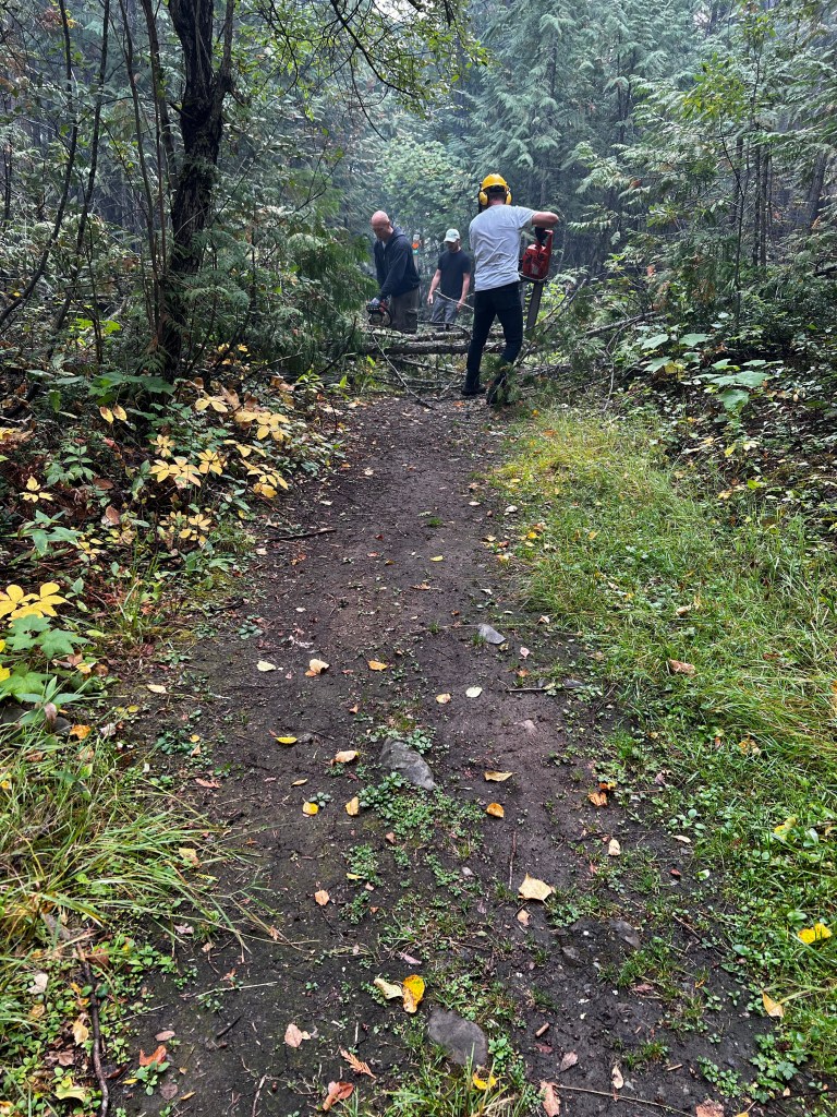
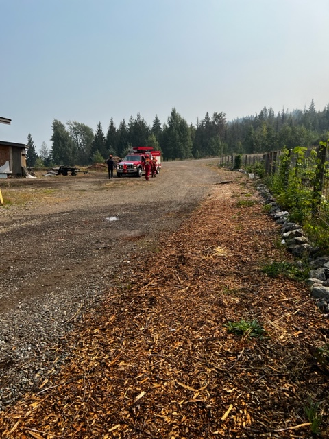
It started to rain somewhat heavily in the AM, and with the wind, the smoke all cleared and finally we could see the mountain behind us, after being shrouded in smoke ever since we got back there. With the cooler, moister air, we decided to hike up to Mount Baldie to have a look around. We have a trail through our properties that leads up to Baldie, separate from the formal trail. We ran into these guys, our neighbours, on ATVs, with shovels and chainsaws.
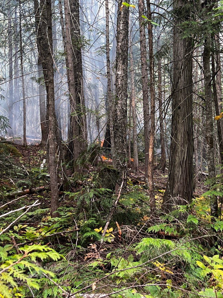
So we joined up with them, very interesting seeing inside where the fire has been. They were clearing a lot of the fallen trees, many that have been there for years. It is not a maintained trail. They were clearing it so that they would have access up to Baldie area AND the area over their homes to be able to see what is going on. The 5 homes that sit below us are essentially backed into the forest, so it must be hard to tell where there is fire from down there. We saw lots of totally green areas, and then areas like this, smouldering along. Some of the areas of fire were amenable to just stomping them out, or covering with dirt.
(I should point out here that this area is the area that was burned a week and a half ago, NOT the area of the fire pictures I showed at the beginning of this blog.) )Mount Baldie is west of us and a wee bit south) People in our area have been going up into the woods and dealing with the small hot spots ever since the big fire went through.
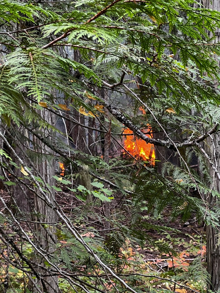
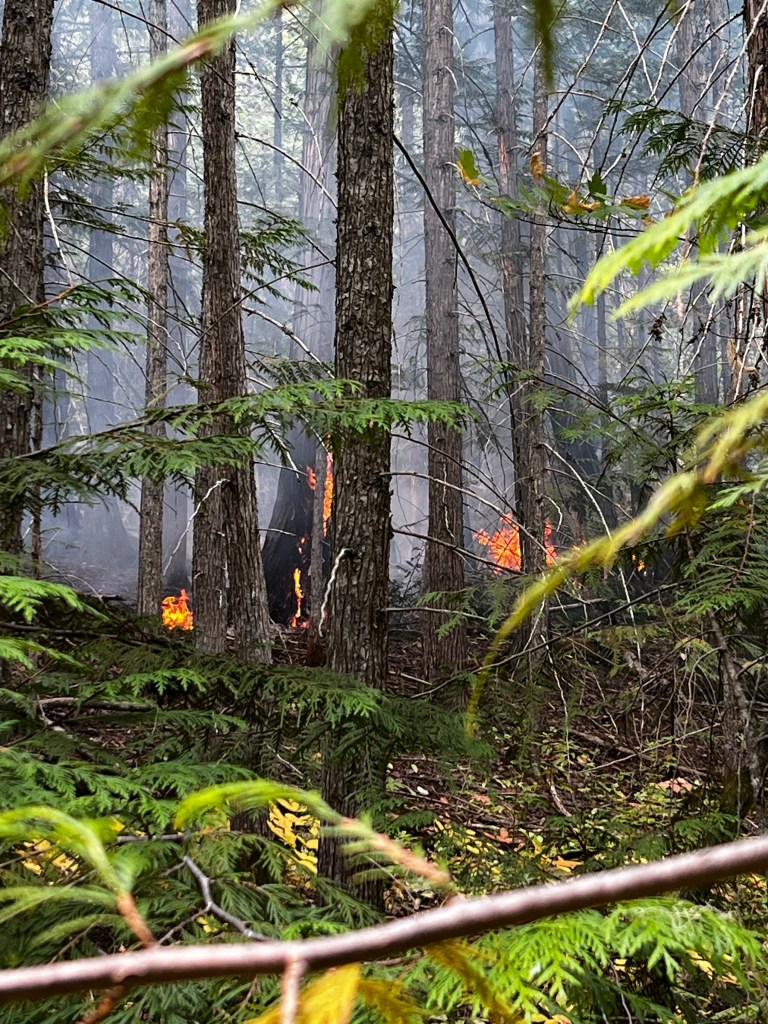
THIS sort of stuff looks more concerning, and the crew we were following did not have equipment to put this sort of thing out.
Ken and I decided that with this fire, the wind, and we could hear the helicopters over head … we decided to head back to our house. I DID have bread rising on counter. 😊. On our way back down the hill we got the call that we were being ordered to evacuate again.
So we went home, I baked my bread, we did a load of laundry, and dried it on the line. We figure that we will not be home for awhile, because we are leaving on Monday on a trip to England. So we took longer to pack this time because we needed to make sure that things were OK with the house etc. Just when we were ready to leave, Search and Rescue came up to record that we were leaving and how many of us lived in the house etc. (and animals)
AND more plumes coming up again…. You can really see how fires go on for months and never really go out until it gets cold and rains…. a lot.
Thanks for all of your wishes, Ken and I and Tucker are doing well. This is nothing more than a frustration, we have been through MUCH bigger challenges in our lives that this one
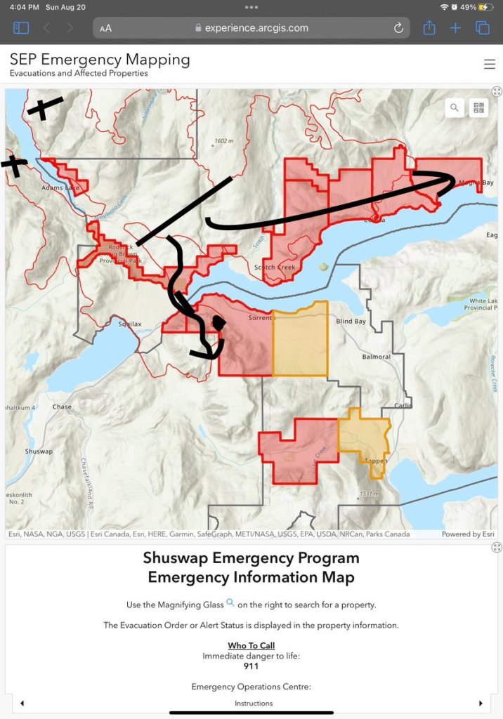
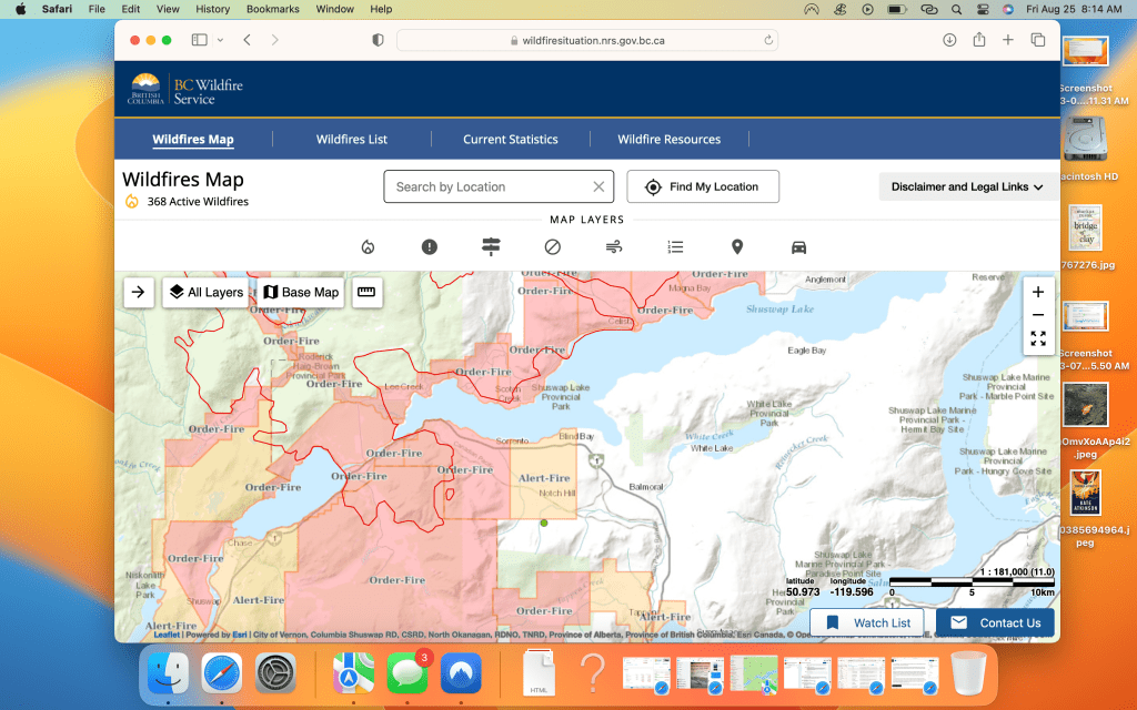
We are starting to really appreciate the path of the fire and how very fortunate we are that our house survived. We all think in terms of streets, roads and avenues, but the fire only knows north south east and west. This is an older map (august 20) but shows the lay of the land. The x’s show where the 2 fires began over a month ago, the big line shows approx where the fire was on Friday August 18th, the day that in the media they were saying could be the most challenging weather for fires in BC history, with the heat and the strong winds in forecast. The night before the huge fire in West Kelowna has come from out of nowhere and crossed the lake taking 60 homes with it. The arrows show where the fire went that night. The 2 fires on both sides of Adams Lake joined and crossed the land tract that separates the little Shuswap from the main Shuswap Lake.
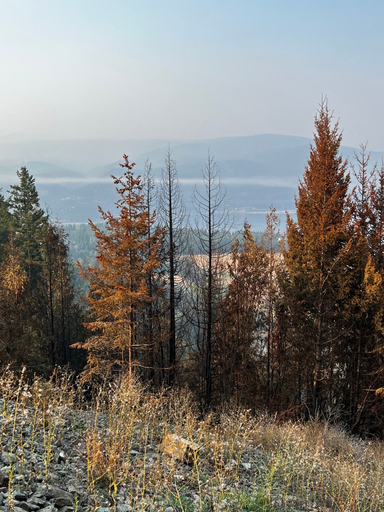
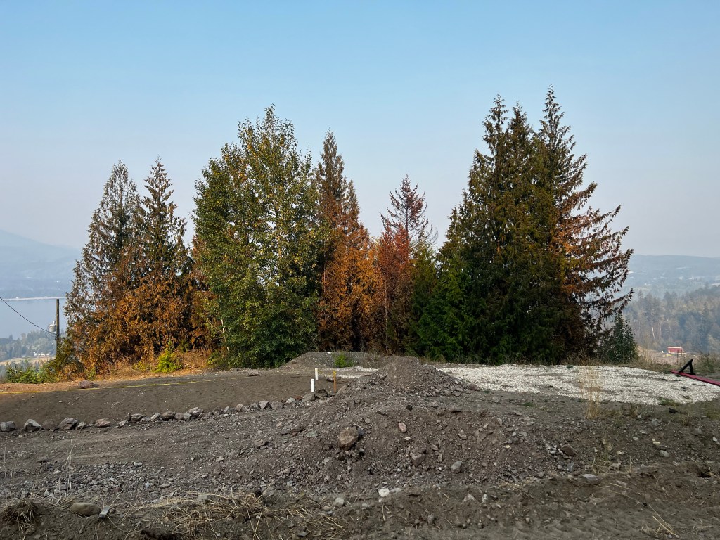
We live where that blob is west of Sorrento in a ~40 acre strata that has 4 lots each about 10 acres. All of the properties here have lost trees to this fire. There are 2 finished homes including ours and a third under construction, all of which survived the fire. Only a small part of our lot is forested, since our lot is where the main gravel pit used to be. But these pictures are of our forest on the west side of our property.
I have never fully believed the adage that the fire preferentially burns the conifers over the deciduous trees, but it is clear from our property that it is so.
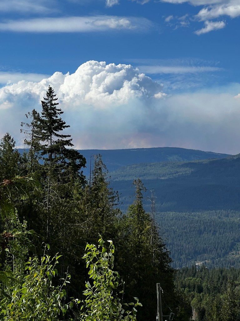
The very aggressive stage of the fire seemed to end around the area we are in and we are on the edge of a more smouldering fire. We wake up to something like this picture where the coolness of the night has controlled the small fires creating mostly smoke.
Then it clears a bit and these little “spouts” start to come up, encouraged on by the heat of the day.
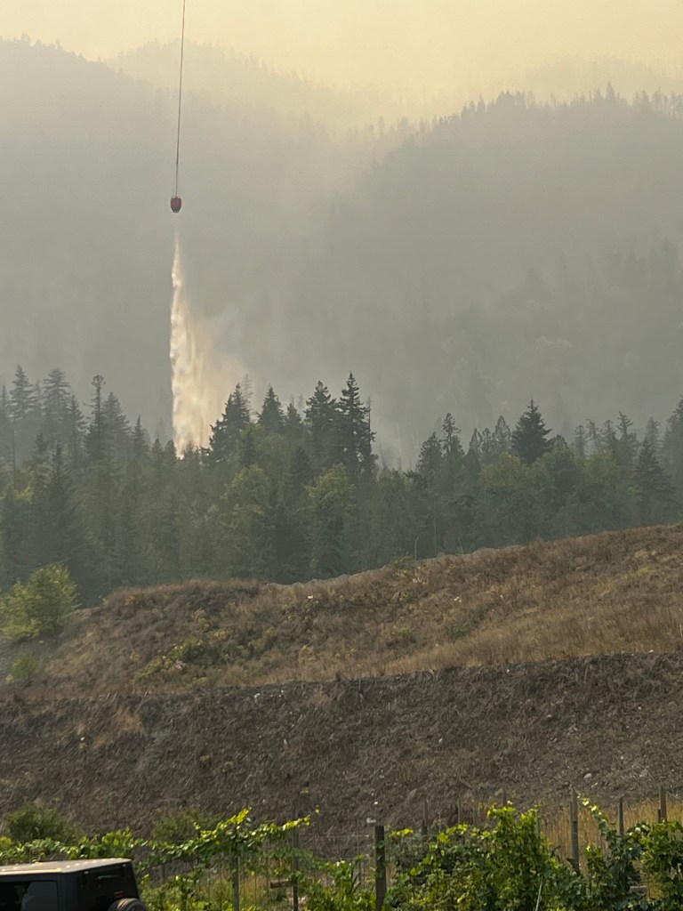
Then they get more active…. and then the helicopters come in and start dropping gallons of water on them.
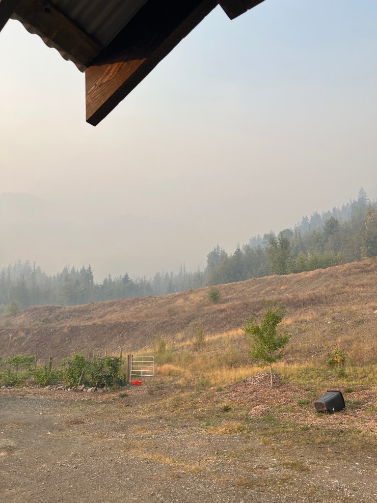
It has been 3 days now, and actually quite exciting watching helicopters up close like this, flying directly over our house starting around noon and going until 8 pm. There are usually 2 helicopters and they large one apparently carries 2500 gallons and the smaller one about 1500 gallons. Since we are only 1km from the lake it only takes them about 5 minutes to refill and then dump, and so there is a phenomenal amount of water being dumped on the area just behind us. Last night we sat under the patio roof that Ken just completed prior to the fire and watched the helicopters, drank beer and ate chips with salsa (just made with the tomatoes, peppers, onions and garlic from my garden). The air is much better than this in the afternoon, because the air goes up the mountain during the day and down the mountain during the night. We WERE nervous the first night here, but watch the daily BCWS, CSRD reports and feel quite comfortable that we are safe. Most of the “fuel” around us is already burned, and it took extremely unique weather conditions to create that aggressive fire on August 18th, quite different from what we are experiencing now. Our area is patrolled day and night. Our area seems to be the keyhole that allows authorities to monitor this fire. Sorrento is only 5 Km from here, and they are working hard to keep it stable to prevent further extension east.
On to the worms….
We have a worm farm that a few years ago I moved outside and deep under our compost bins. The have done well in this situation for 3 winters, covered over with tarps etc. Yesterday was clean out the fridge and freezer day. Our power was out for 4 days, it came back on 4 days before we got home. I spent some time researching this before we got home. There are those who are saying that after 4 days without power you should just tape up your fridge and take it to the dump, and that opening it will release a smell that will take forever to get out of your house.
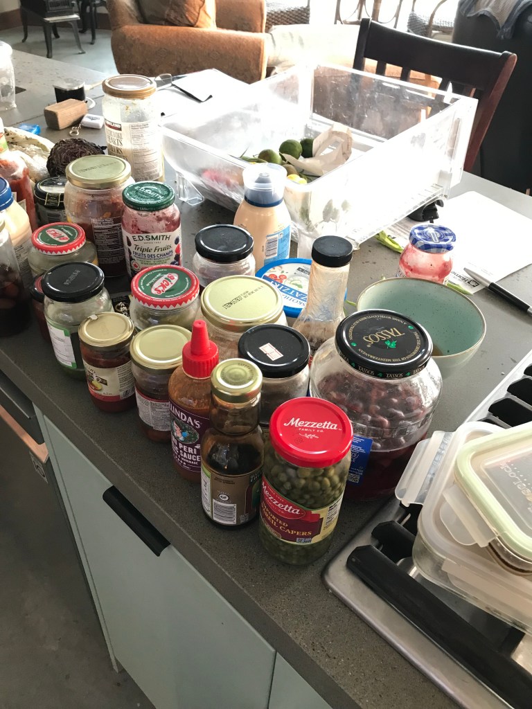
That certainly was not the case for us, in fact we have an ice maker that deposits ice into a bin in the lower freezer of our fridge. The ice cubes were still mostly formed which for us was enough to know that it never fully thawed. We do not, as a rule, eat meat or dairy, and most of what was in our freezer were fruits that we have harvested this year and bulk nuts. So we mostly threw out the stuff from our fridge that had been without cooling for 4 days, so our worm farm/compost got all the Kalamata olives, artichoke hearts, capers, and sun dried tomatoes. We did take a small load to the dump of some meat we keep for when our carnivorous kids come to visit. I was thinking about the wildlife and and tried to think of a way to provide this to the critters who might be hungry right now, but could not come up with a way that did not risk our safety or theirs.
If the truth be known, it was quite exhilarating getting the fridge cleaned out as it is not something we do regularly, and….. we have only had this fridge for 3 years, …🤔😀. There ARE all those jars of stuff that you buy, do not love and never get around to throwing away. So for a few minutes we have the cleanest fridge around.
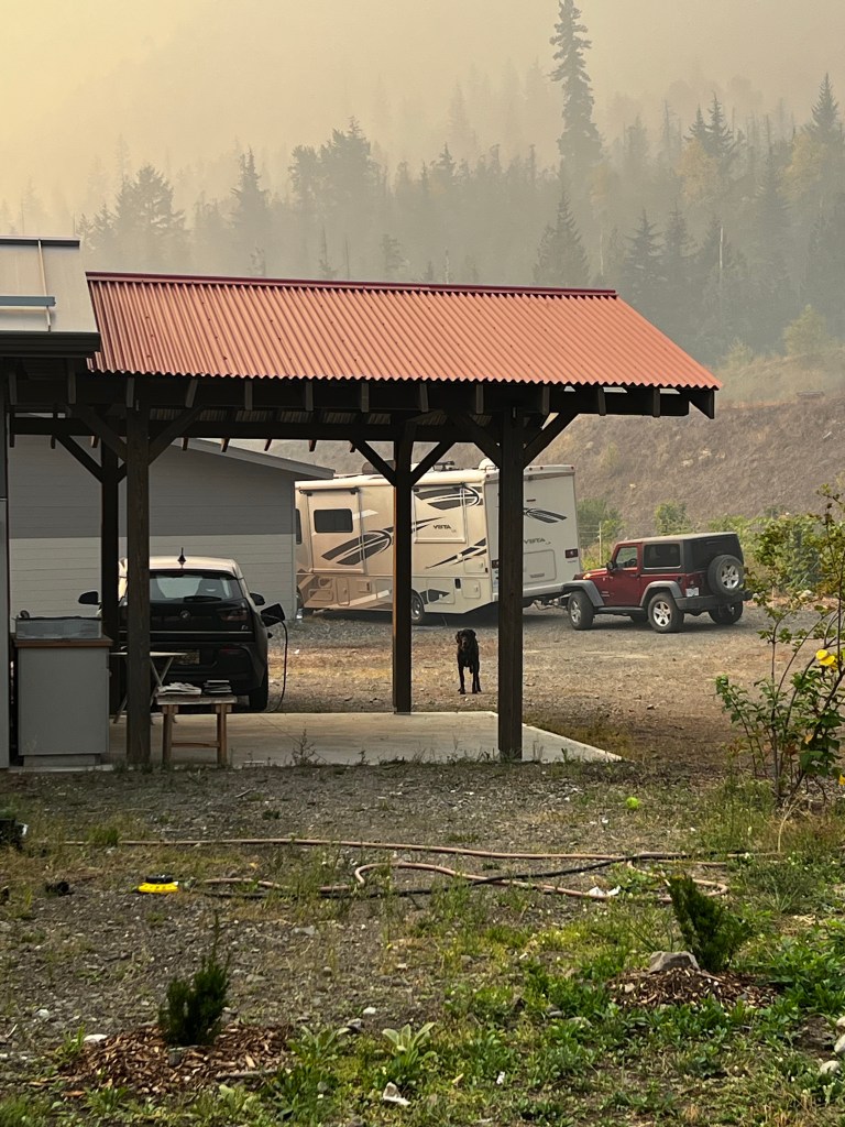
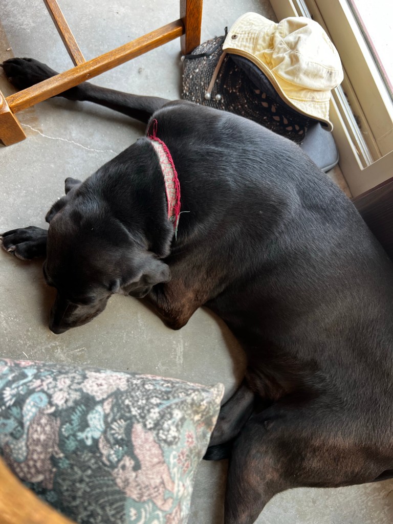
and then there is Tucker, who is being a very good dog and not chasing all of those fire trucks going past our place all day long.
We ARE safe and sound and have a box of N95 masks.
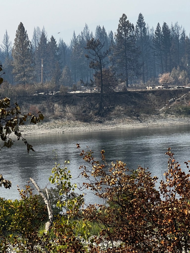
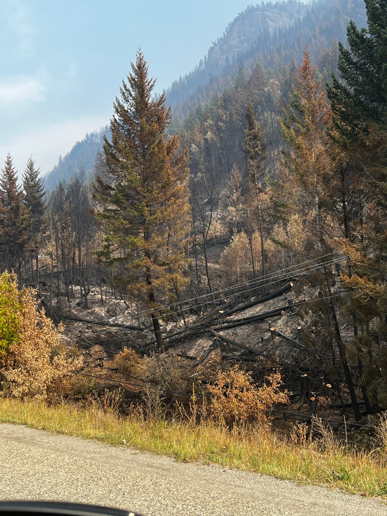
On Friday when the trans Canada highway (which goes through Sorrento the town we live just outside) opened, we took a drive outside to see the “scene of the crime”. We saw all of the destruction from the end of Little Shuswap Lake almost to the turn off we usually take to our house. You could see where the fire has crossed the highway from the north, and gone up the hill on the south side for a distance of 7-8 KM of highway, taking all the of the power poles, and any structures in its wake.
This area is largely the Little Shuswap First Nations band. It was interesting in areas of total destruction to find a house standing here and there, bright and perfect, almost out of place, amidst the ruin.
Instructions were not to stop anywhere along the way. All of the turn offs on the road were barricaded or manned with a security car. We stopped at the end of Elson Road with a hope of getting a glimpse of where we live. We talked to the security guard who made it clear that we could not even walk up the road and in fact if we were stopped more than 5 mins we would be ticketed by the CSRD. We could not see our house, as the area, in particular, was very smokey. There were 2 helicopters actively dropping buckets of water in the area. It was hard to really see anything, so I tried unsuccessfully to get a good video of the helicopters filling with water. Tucker was pretty pissed that we did not drive home. We then drove back to Kamloops and got back at about 4 pm. At 5:30 pm the powers that be, changed the designation of Sorrento from evacuation order to Alert, allowing everyone to return home. Since we live about 5 KM west of Sorrento, I phoned them to make certain that it was safe for us to go back (I guess because where we live appeared to be where the remaining fire was), they said for sure we could go back. We opted to wait until the morning, just to make sure.
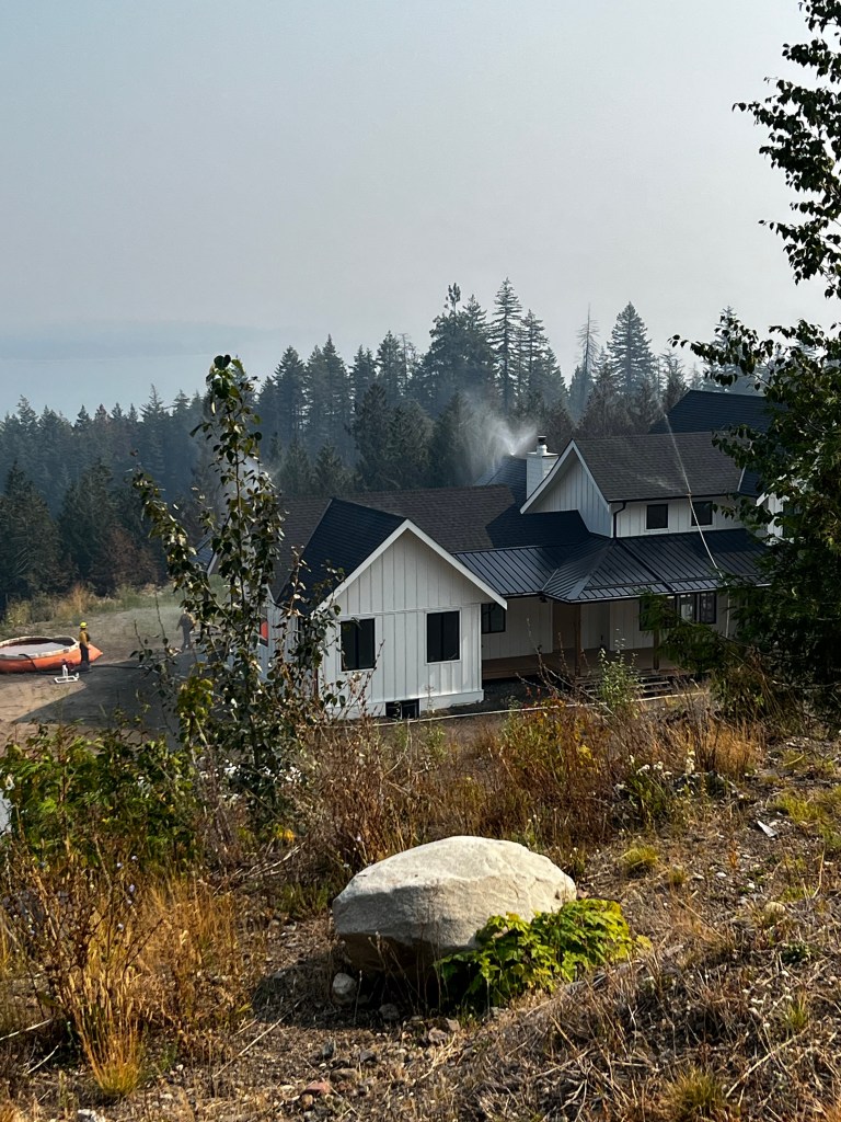
So I drove ahead to see if it seemed OK for Ken to bring Motorhome. The air was good, it more smelled like smoke, than actually smokey. It appears that some of our larger trees at the top of our property have burned, and will need to be taken down. The weeds coming down the bank have also burned, but house seems to have been missed by the fire. AND MY GARDEN looks GREAT! albeit a bit weedy🤔
our biggest concern about fire has always been the road leading up to our place, and should a fire happen that might block our ability to exit. There was clear evidence that the fire had involved the trees alongside our road.
We had LOTS of company when we first got home. The various neighbours, some of whom I had never met came up. Most of them have stayed throughout the fire. They live 1/2 KM down the hill. We only have one neighbour up where we live. Both of our homes sit on what used to be a gravel pit, lacking any trees or foliage, and both survived. I believe that the fire in its fury has a mind of its own, the strong wind, the heat, the wind direction and the amount of fuel in its path. It is evident that the main fire would have passed our houses hitting just the top of our property. It is the flying embers that would likely have burned our house. We have a metal roof, metal siding and concrete patios around much of our house. The fire department who were the second visitors we had, complimented us on our house being very fire proof. The firefighters who have been working up here are a local fire department and have been working hard up here to prevent this fire from moving on to Sorrento the township. Apparently they heard that we were doctors and so have been awaiting our return because one of them had a medical concern 😀
There was even a photojournalist from Los Angeles who came by to take photos.
We have been lamenting how very hot it is up here with no trees to provide any shade on these very hot summers. We have also been planning on planting many trees. Well this is likely what saved our place. A “fuelless” property.
The COMOX fire department came up and put sprinklers on our neighbours house and refilled the reservoir there. There are fire crews from all over the province in our area.
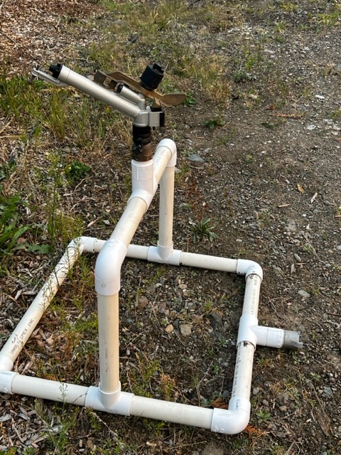
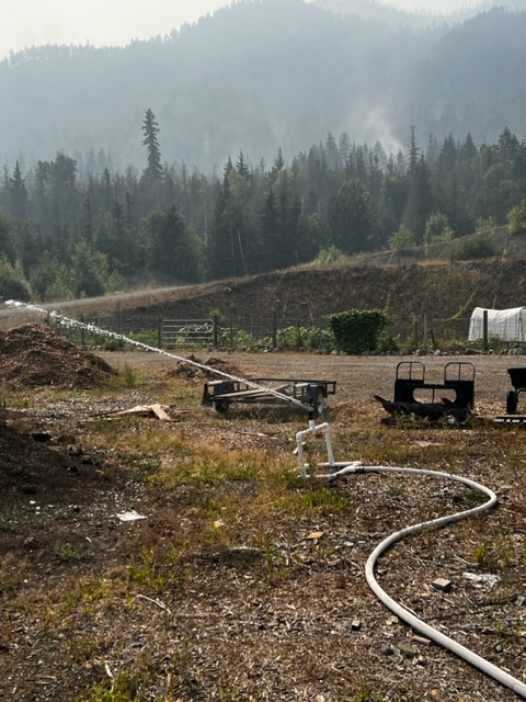
SOOO This is our secret weapon, our son Dylan made us a few years ago during the fires. It attaches to a fire hose and shoots LOTS of water a LONG distance. He IS willing to make these for other people…..
So as the day went on, and it got hotter, the fires behind warmed up and from about noon until 8pm the helicopters (2 of them) were continually bucketing the area behind us.
it DID get quite smokey into the evening. We did get a bit nervous being alone up here, but the firetrucks came up about 9 pm and told us that everything looked pretty good. So glad it gets cooler at night.
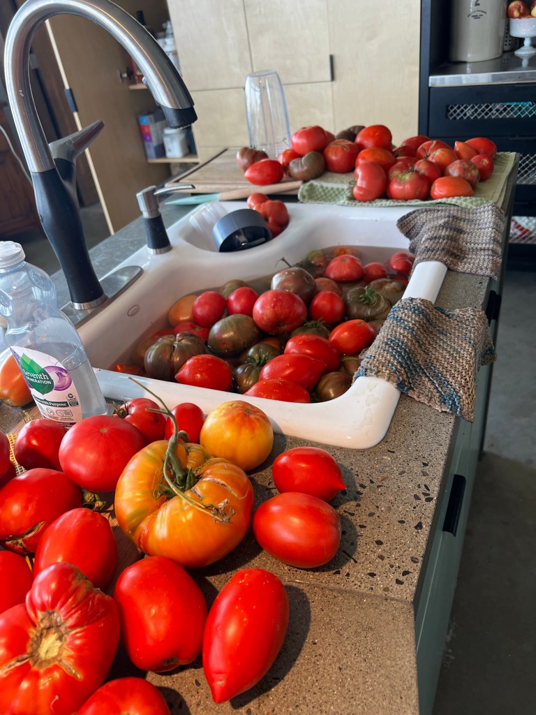
This morning it is very smoky and we have lots of N95 masks. many many many tomatoes to process, I planted 150 plants this year with hopes of selling at the market, but I guess that is out, so tomato sauce, salsa, tomato paste etc etc etc.
We have opted to stay, trusting in the local fire dept telling us that we are safe. The family below us have 5 kids and they too are a “little ” wary.
coming up next…… dealing with the freezer etc
so for now
thanks for reading much love from Janet, Ken and tucker the fire dog
5 firefighters have died this year in BC …..It is so incredibly sad…. and it sounds like there may have been as many as 1000 people died in the fast moving fire in Lahaina, with the very strong wind.
On Friday night the fire that has ravaged Lee Creek, Scotch Creek and Celista (which also came in the direction of where we live) was the fastest moving fire in our history. On the way a gas station actually blew up.
When a fire is moving this fast, it is clear from all accounts in Fort McMurray, Paradise, Lahaina, etc that NOTHING can stop it. All conditions were right for a horrendous situation. When it is too dangerous (IE when they are risk of falling burning trees) (2 firefighters have died this year in this situation) they cannot stay in the situation. They have been heavily criticized for not staying and fighting an impossible situation.
Many people who live in Scotch Creek, Lee Creek and Celista have taken to firefighting themselves, which includes mainly putting out Hot spots which are when an ember from the big fire lands somewhere and continues to smoulder, they can later light up and lead to a major fire. It has been said on a radio interview with a local firefighter that these fires are easy to fight, and that attending to these HOT SPOTS can save homes.
It is quite understandable that there are those who want to stay and protect their homes, since the BC wildfire service is spread fairly thin, this being the worst fire season on record. Again NO need to criticize firefighters, they are risking their lives, even though you cannot see them.
So a few evenings ago the convoy…. remember the convoy? (the large group of truckers who drove across Canada to Ottawa to protest the Covid Mandates, most of which had been lifted before their ridiculous prank) issued THIS post. They met in Blind Bay and drove to the blockade to attempt to dismantle the blockade. You can see on the map below that the transCanada highway goes through Sorrento the town that we live west of.
This encounter between the “protesters” and police did not result in any arrests, however it changed the “tone” of the conflicts on the North Shuswap between the locals, the police, and the firefighters.
The police and the BCWS (firefighters) posted on website that they were pulling out of the north Shuswap out of safety concerns. This post was quickly taken down, however the firefighters WERE reassigned to different fires, and according the BCWS this was only partly because of the protests. The locals on the North Shuswap made it clear that they were not in any way associated with those who participated in the “convoy protesters”
There have been extensive negotiations between the locals of the north Shuswap and the police and BCWS and the CSRD, and apparently now, they are working together. In any situation like this, there are many different types of responses, and I totally understand those who have chosen to stay and fight the fires, however I struggle with those on the north Shuswap who have essentially blamed this horrendous fire on the BCWS. There have been extensive posts being shared hundreds of times by people critical of firefighters for not risking their lives in the face of an out of control fire, and blaming the firefighters for the fire. It is sad that people like this are given such a widespread voice in times of crisis.
The fire on the North Shuswap has settled down, especially in Lee creek. As many as 13 people in Lee creek have lost their homes, many of whom, had no insurance. Parts of this community do not fall under the rules of CSRD building codes and are uninsurable. I must admit I do not know the exact details of this other than I do know that many have lost everything, with no insurance. I certainly hope that much of the money that is coming in to the area in donations and funding will go to help these people the most.
We live on the South side of the lake now, but lived on the north Shuswap for 7 years and that was where we had our medical doctors office.
Our current situation is that we are hanging out in our motor home, moving every few days, which is our nature. Ken spent 2 days in Armstrong, then I joined him at our sons place in Barnhartvale(Kamloops) and yesterday we cane up to the Casino in Kamloops for a few days on our own to get our thoughts together
The only estimate of when we might be able to return is 1-2 weeks. On the map above, you can see the dark red line on the south side of the lakes, that is the fire perimeter. The BCWS yesterday said that they are “building a fire guard” around the perimeter of the fire. They expect it to be complete today or tomorrow. A fire guard, I believe, is where they create an area a designated distance wide that is free of anything combustable. They are also opening the TransCanada highway today, which will allow traffic to travel through Sorrento. I am sure that this will be good for the truckers who currently are having to detour quite a distance to get from BC to Alberta.
We are doing very well. We have good insurance which even covers us for costs while we are under evacuation. So essentially any food or clothing we need will be reimbursed by insurance. There is nothing available to us through emergency services or the Red Cross, which is totally fine with us. Moving around in the motorhome is what we do all winter, so a bit like that. We are afraid to go too far away in case they open up our area suddenly. From what we can get out of reports we have been given, the power was out to our place for 4 days. Will have to sort out the fridge and freezer.
Our only concern at this point is that we are leaving on a hiking trip to England on the 5th of September and it might be hard to leave without being back in house. A few things in the house that we will need for the trip. So we shall see.
Well this has been an attempt to explain the situation here from our perspective and there certainly are others. I am certain we would feel very different if we did not have insurance. We “sprung” our grandson from daycare for 3 days and had LOTS of fun.
Today we found a wonderful beach in Kamloops past the water treatment plant, past the pulp mill and past the dump.
Thanks for reading this, much love to all Janet Ken and Tucker.
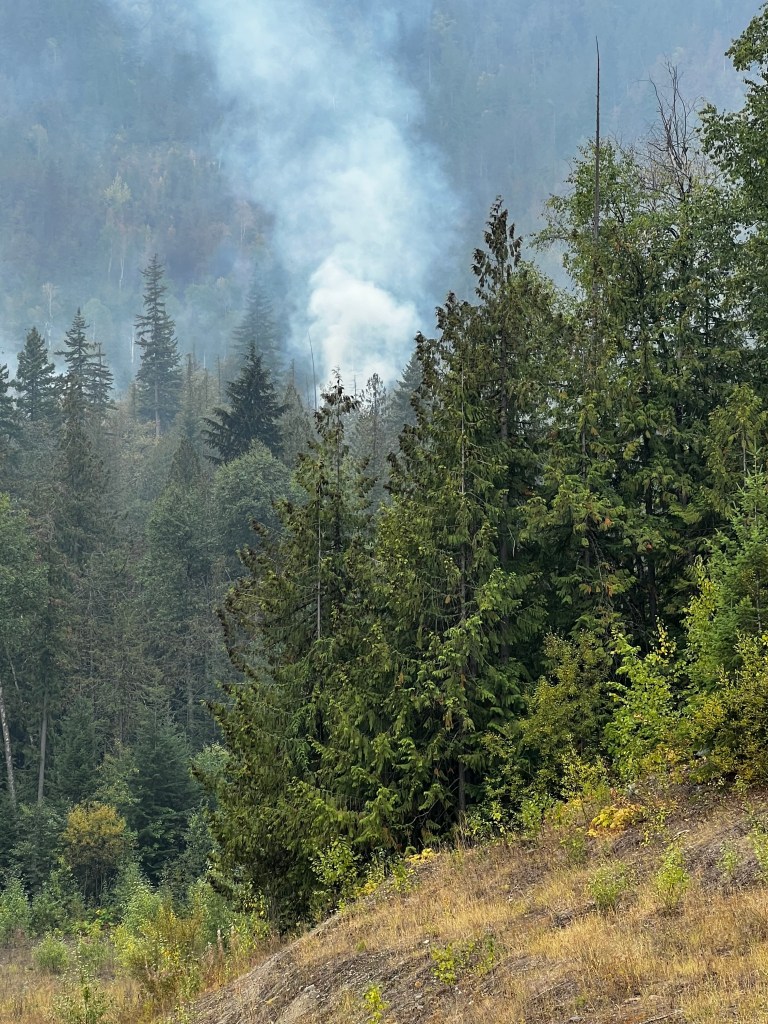
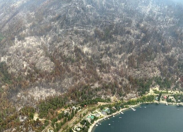
I thought I would write about our recent adventures with “the fire”. Friday night I was in Victoria for a “life celebration” for an uncle of mine, and Ken was at home with Tucker. The Lower East Adams fire was across the lake from us and we had offered our house as a place for friends from Lee Creek (across the lake) to stay. One couple had arrived and were just setting up their RV, and our other friends had found a place elsewhere when I got a call in Victoria from our neighbours below us to say that there was a fire up on the mountain behind us and that they were packing to go. This blog will not have pictures from our place, as we have none. So I will put in a picture from before the fire🤔 This is the view that will be changed forever, because everything in this picture has burned. (well except the 2 houses shown as of now)
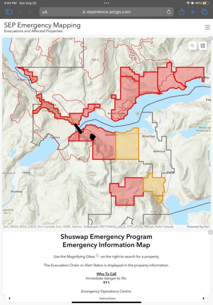
SOOO… they did get ahold of Ken and so did I, he had the motorhome in place and the jeep behind it, and threw in a few coats, a few beer and a few guitars. THATS ALL. So he headed down the hill and turned on the highway below left towards Kamloops.(where our sons live) Turns out the fire was crossing the highway there and so everyone was being turned around. Ken said that the vehicle at the front of the line was a double tanker truck (?gasoline) Each truck had to drive into a turn on the left and then back out and then head east. Ken was worried because with the jeep behind and the hitch, he cannot back up. Our neighbour was ahead of Ken with a 5th wheel. Ken and I were chatting while he was waiting and I was quite worried knowing that the fire there was VERY aggressive, and I felt very badly not being there….. (in which case we likely would have unhooked the jeep and the turn around would have been much easier, and I would drive the jeep). Decisions at times like this are very important, especially if the fire turns quickly. He did get turned around by doing a U turn, and got the tire in the ditch but in the end got it turned. On the map below …. the black blob is where our house is and the line at the bottom is where the bridge crosses Little River and that is where the fire crossed.
I should explain that this fire actually started over a month ago after a lightening storm. It was on the east side of Adams Lake which is the lake in the top left corner of this picture. As you can imagine it has been its worst when the wind blows from the north west. A few weeks ago the fire aggressively bore down on the cabins along the lake in the top left marked in red. This area can only be accessed by a small car ferry which holds about 10 cars. The fire dept were able to save all of this homes at that time. This is a picture of that area. I have a sister who has a cottage there.
The fire then moved slowly towards Lee Creek, which is a small community between Scotch Creek and the black bridge line I have marked on the map. On Thursday morning this fire was still several kilometres away from Lee Creek, however it was becoming much more aggressive and the smoke was very bad. The fire department had Lee Creek on alert, and they felt very certain that they would be issuing an order soon, so some of my friends left on Thursday. This map below shows where the fire was on Thursday. The yellow is the fire and the blue is where they did a planned large scale ignition to attempt to protect homes in Scotch Creek. This is done, I believe with gasoline and they attempt to burn an area, so that when the fire gets to that spot …. there is no fuel left.
“We are still anticipating that at around 11 p.m., midnightish, winds will start to become pretty erratic and variable and then eventually switch over to come from the north,” said Tower, noting the burn was successful in scorching fuel north of the Scotch Creek area.
“When those winds switch, the fire now tries to come south, but it’s already burned all that fuel.”
This is what the media said on Thursday night. At this time they had not done an evacuation order for the north side of the Shuswap. You cannot see it on this map, but just below where it says Lee Creek, there is a bridge that is the only way out for all of the communities on the North Shuswap. (There is a small logging road that leads from the northern most part of the Shuswap Lake over to Malakwa) a many hours trip that only certain vehicles could take.
SOOOO this is a picture from a place in Scotch Creek on Friday afternoon.
SO while all of this was happening on the other side of the lake on Friday afternoon, Ken and I were thinking of offering our place to people from the other side of the lake on Facebook. GOOD thing we did not do that.
So back to Ken’s story. He was then driving east, the only way he could go, and the friend I was staying with in Victoria called her brother and sister in law in Armstrong who are also friends of ours and arranged for him to go there. THEY were at the Salmon arm roots and blues festival which had just started at this point. They called back a few minutes later to say that the power had gone out there and the festival was ended.
Ken got over to Armstrong and spent 2 night there and then he brought the motorhome to Kamloops yesterday and I drove here yesterday as well. So we are together again. This is the only picture we have of where our house is and it was taken at the beginning of the fire on Friday night. I believe our house would be to the right and below where this fire is. We currently have fire protection up there, and I will write more when I find out more. Our house is still standing but not sure about anything around it
This video is taken by a person driving from Celista to highway 1 while road was still open.
Much love to all, and especially to the friends who have lost their homes in the past few days. I also have a close friend in Ventura that while I was texting about our situation, texted me back to say that they had just had an earthquake. So much tragedy around.
Here we are once again in Forest fire season, hearing about the millions of acres of trees that have been burned in Canada. Trees that provided us some protection from Climate change, creating more climate change in their demise. Hard not to dwell on, but……. Looks like a full…. sun?
Perhaps in remembrance of all of those trees lost we can start using Bamboo (or recycled TP) to wipe our butts, instead of having more trees cut down for that purpose. I read once that Costco was using old growth forest trees to make toilet paper. I guess we never talk about these “things”. ( I remember wondering, as a kid, if the Flintstones ever used the toilet. )
I guess we are puttering along attempting to do our part in cooling this planet, or at least not warming more. I am sure that there are those whose carbon footprint is much smaller than ours, but also there are those with greater footprints too. We have found that many of the changes we have made have actually started saving us money as well.
In March of this year we tripled our solar panels.
There is a government program that provides for a 5000.00 grant as well as a 10 year interest free loan for solar panel installation. (Our additional panels cost 14,000). So we figured that we pay an average of 180 per month for electricity, it would not make a lot of difference to be making loan payments instead, so technically we figure we got the solar panels for free. Our loan payments have worked out to 120 dollars a month for 10 years interest free, and our electric consumption looks like this.
So this is what the usage looks like. All the power we generate that we do not use, goes back to the grid giving us a credit. (you can see the negatives on this graph) What this means is that we are actually making money in this heat. The way BC hydro does it is that they balance all of the numbers each March and if they still owe you, you get a check. We actually have 2.5-3 months in the winter that the sun does not hit our panels, so the money we are “making” now, might just be spent in the winter 🥶
8 years ago we bought a fully electric car, and the power that our solar panels capture, is actually charging our car. SOOOO for most of the year we are not affected by gas prices. We essentially drive for free from energy from the sun.🌞
It is a freeing feeling, not being affected by the price of oil, or the price of electricity.
I should point out that I never took on any of these endeavours to save money, and am reminded all the time that these changes in energy consumption are expensive. But they have worked out well for us at a time we are heading into retirement and lower income.
I am continuing to make my toques, despite poor sales in this heat. 🥵 (but fall is right around the corner, RIGHT?) The yarn is made from recycled plastics, which is where fleece also comes from. I have recently read a book called “Unraveling” that defends the use of wool over recycled plastics (fleece) because tiny particles get into the water system and eventually to the oceans. There are apparently special filters you can use on your washing machine to prevent the particles from getting further down the water chain.
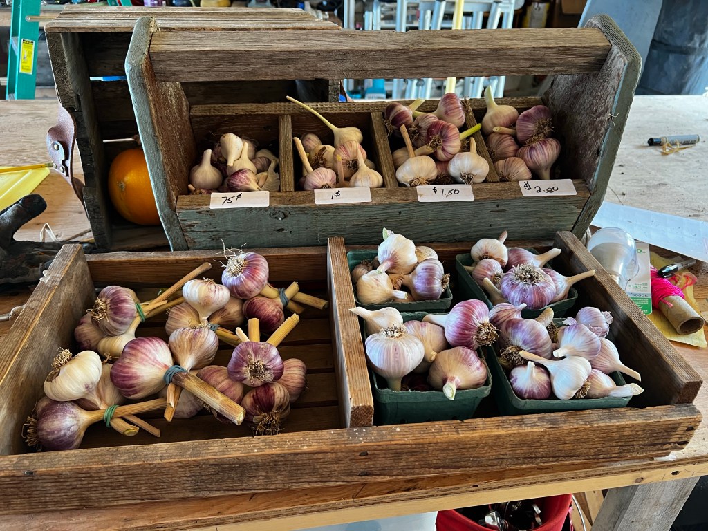
We have completed our garlic harvest and they are hanging to dry in our shop. We are thrilled with the size our garlic. We owe that to the large load of compost we had delivered from Spa Hills, a company that has bins all over Salmon arm and area, that composts everything, from animal remains at the chicken farms to food waste from restaurants. They compost at a very high temperature to ensure the material is disease free. SOOO it is strong stuff, and….. yes, smelly to begin with.💩
We have been selling “fresh’ garlic at the market for now before it is fully dried.
We did make a large batch of dill pickled garlic scapes and are now waiting the 6 “recommended” weeks to try them.
We have been camping at some lakes near where we live, and I discovered that you can really sneak up close to a bear in an electric car. …… to get a great picture. He did not ..hear… me coming. Isn’t he HUGE? (or she)
We have become a smoothie family, in trying to have smoothies for lunch each day. We have picked and frozen 20 lbs of fruit so far this year with direct plans for Smoothies. Although we get all of the recommended vegetable servings each day, I find it hard to meet the fruit recommendations. Hence the smoothies. We just put whatever fruit we have in freezer plus some cashew milk and then veggies such as celery and cucumbers. I throw in some rolled oats as well. We are studying up on the best machine for making them as my mini bullet is on its last legs.
Well so there is another blog, I have fallen behind as I let my subscription lapse, but am all paid up now.