In search of Palm Canyon…

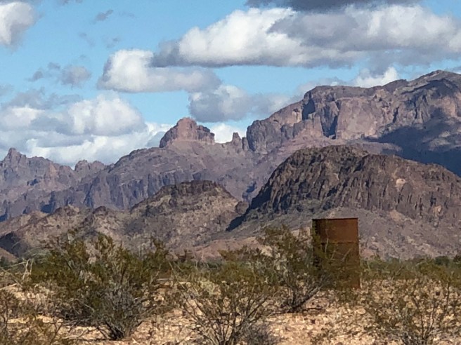
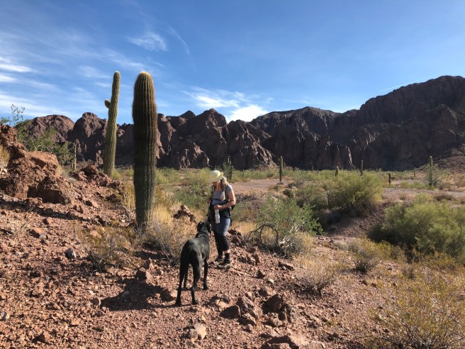
Yesterday we decided to do a hike to find out where all these lovely stones come from, to a place called Palm Canyon, which is the only place in Arizona that native palm trees exist. The canyon is part of the Kofa mountain range.  To make a long story short, Volcano, volcano, 25 million years, then earthquake…..  then erosion.

img_2001

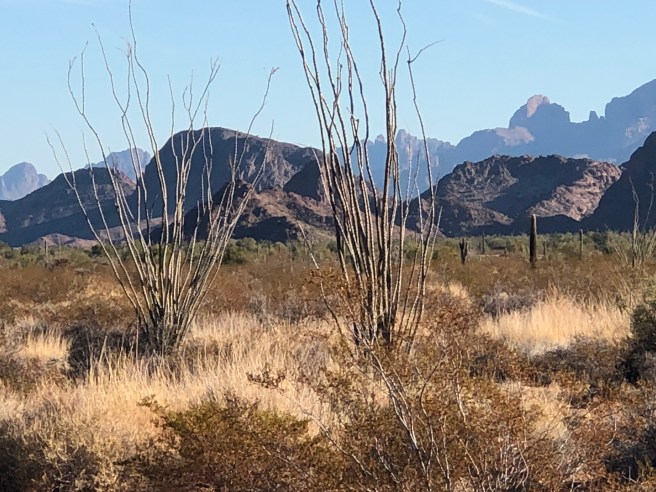
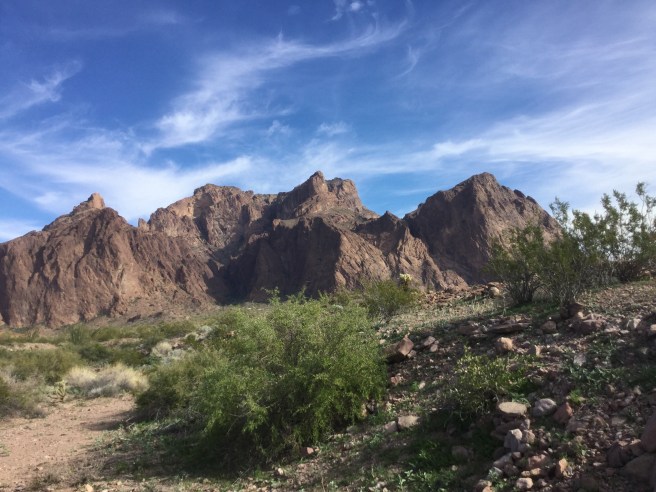
We have come back to this area, over and over, as it is so breathtaking…. but I can never quite capture this in my pictures with my phone, perhaps we shall get a new camera so we can share the beauty of this area with everyone else.  So if you look closely at the picture below you can see the windy road heading into the dark area at the centre of the mountains. It almost seemed to have a fairy tale feel to it, a windy road leading to a craggy rock cliff with a castle on it.  THAT is where we are going..img_1990

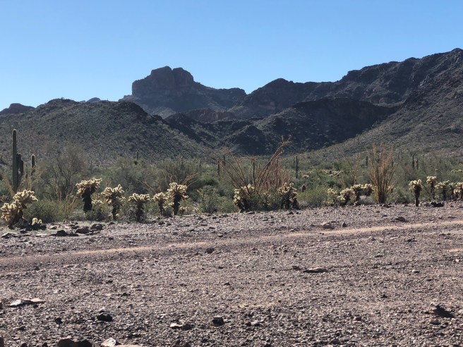
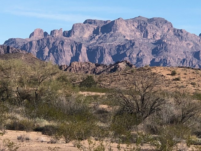
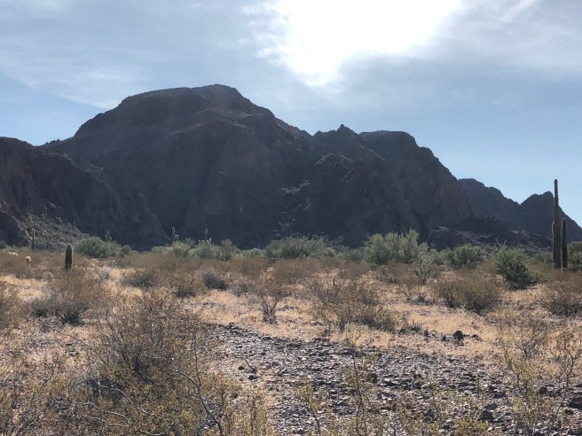
This is looking into the canyon from just outside.

img_4182

img_2012

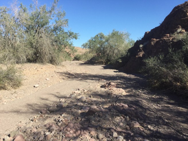
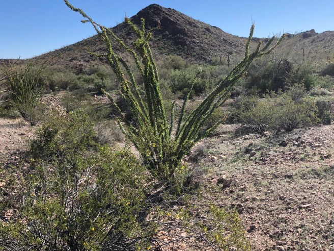
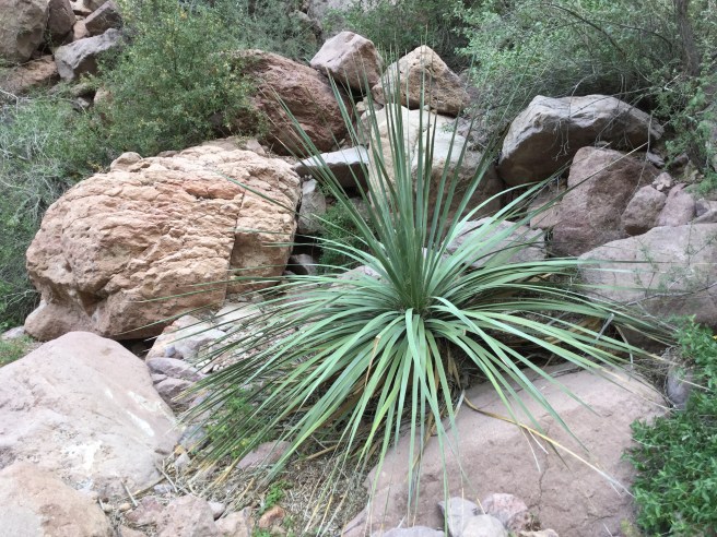
So as you get into the canyon, suddenly everything becomes lush, and there are plenty of plants that we have not seen anywhere else. For instance, HOLLY, which we have never seen down here, and represented a whole new issue for Tucker. (can  you imagine walking on Holly with bare feet)img_2016

img_2032

img_2024

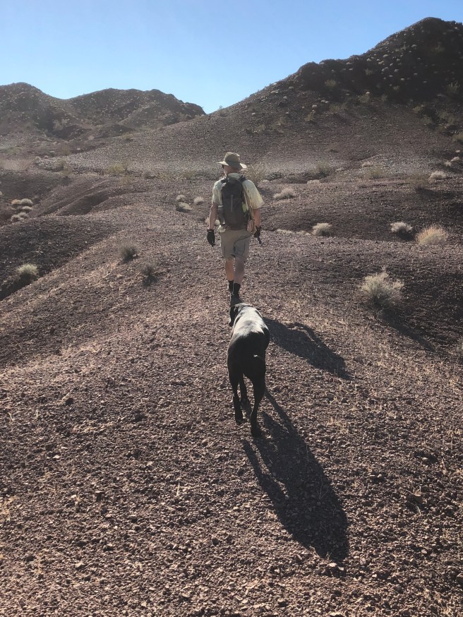
Well we climbed higher and higher up the canyon, in search of palm trees…

img_2021

img_2019

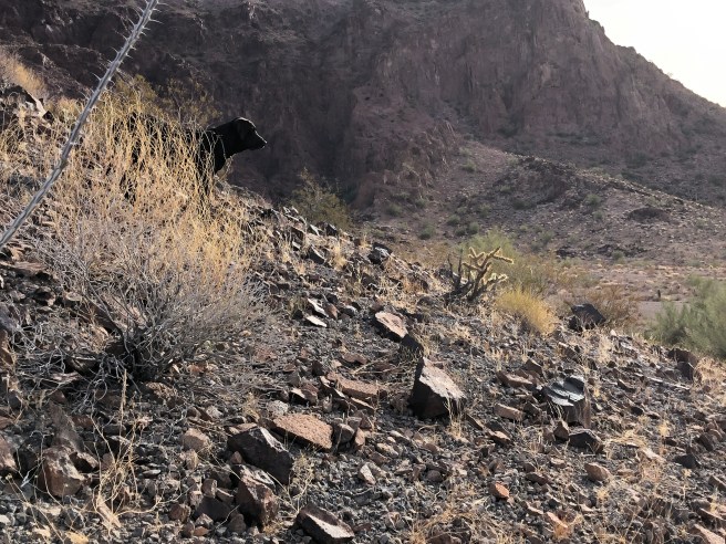
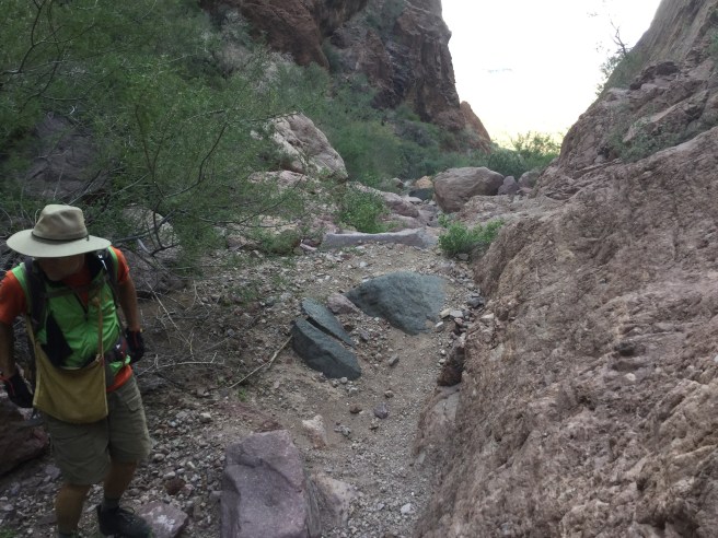
THEN the trail started to look more like this…. It essentially disappeared and we were just trying to find a way upwards.  It started to become more like rock climbing and there were a few places where we COULD have maybe used some rope…

img_2023

img_2028

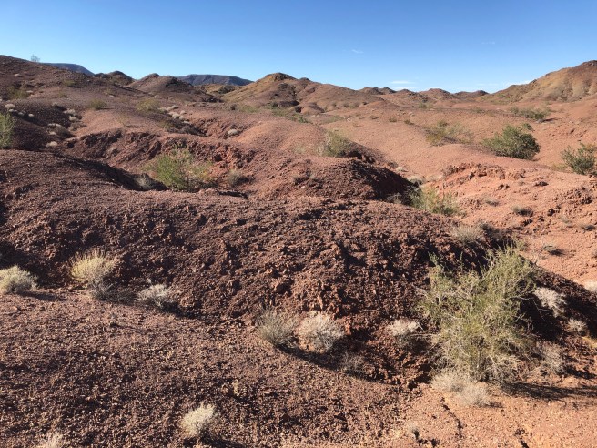
It was starting to get a little scary… and I was thinking to myself that this hardly seemed the kind of trail that they considered mild to moderate in the brochure, and only suggested bringing water. We had seen NO sign of Palm trees, and the people who HAD been coming behind is never seemed to get any closer, they just went back. 🤔 🤔 🤔img_2034  So I said to Ken, this seems like more than a half a mile. He said that it HAD said a mile in.  So I pulled out the pamphlet and read it AGAIN.img_2033-1

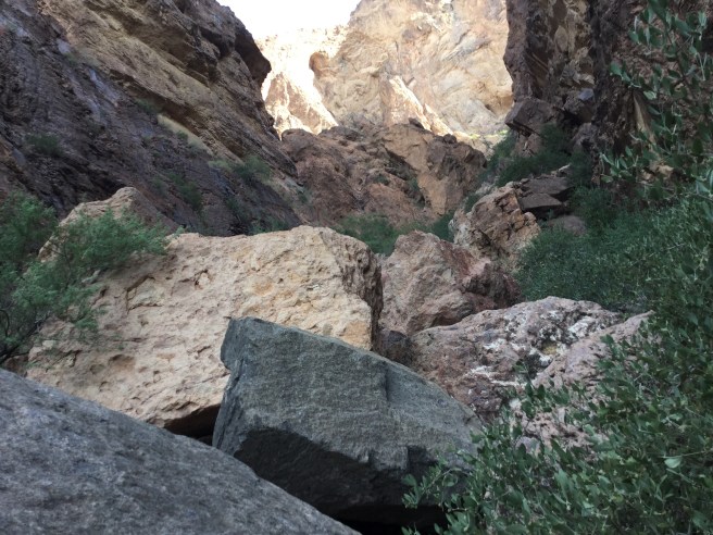
It SAID about half way up the canyon (1/2 of a mile) there is a sign that says palms with an arrow point towards the palms.  WE HAD seen the sign, and thought it was pointing to where the trail led. So we hiked half way DOWN the canyon and found the sign and sure enough it was pointing up a narrow crack between 2 cliffs… to, sure enough, ….the palms….img_2037

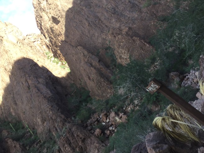
So for certain you would have to be standing right there to see them. You go into the canyon from west to east, and this  little crack goes north. I guess it also explains how the trees survive there, they are  sheltered from all sides and they have this canyon pointing directly south.

img_2036

So we laughed all the way back to the parking lot.img_2039-1

img_2040

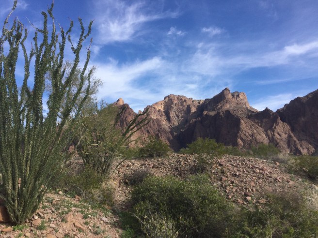
I have tried to include more “awake” pictures of Tucker, as so many people commented on how tired he looked. I was just taking a picture of every extremely uncomfortable place he seemed to fall asleep.

Another funny story of the day was the intense echoing you got in the canyon. When we were WAY up the canyon, we felt like we had microphones on.  Then part way down, Tucker barked at something, and we could not stop him from barking, because he kept hearing another dog. img_4181

Much love…. thanks for reading, Janet… and Ken and Tucker.


All that glitters, is not broken beer bottles

Our rockhounding outings usually follow some sort of a similar script. We go to our rather “extensive” library of rockhounding books.   Find the book/books for the state we are in and find a site near where we are.

img_4013

We then have a look at a map that looks something like this:

img_4014

I/WE then study the map and say “yup… looks pretty straightforward”  “Just turn onto 4th street in Palo Verde and go 5 miles west.”  At this point we usually leave the book behind because it seemed SOOOO straightforward.  Then you get out there and there ARE no roads heading west, there is one going south west, and so you take that one thinking that perhaps writer was just vague… So you follow THAT road for about 7 miles. Now I should tell you here that the term “road” is also somewhat ambiguous. It can mean many things.  It can look like this:

img_3953

Or something like this:

img_1947

And you never really know if you are just following the tracks of some crazed ATVer……

And then when you come to something like this you KNOW  you have been following a crazed ATVer….  WHOOPS dead end.

img_3972

At the end of a wash. To fully understand the area, you have to take into account that when it rains a lot in a short time the water takes out the roads and leaves you with “washes” which are basically “part time” rivers.  So we hike up to get some sort of an idea of where we are, and at the top of the hill, there is just a bunch of OTHER hills. The glitter is just the sun shining off of the Rhyolite…. no beer bottles.  We have found that when we are searching for a site, and come across broken beer bottles… that we must be close, because at least someone else has found this place.  I can only imagine what broken beer bottles and rockhounding have in common…. but Broken Beer bottles = you are close!

img_3975

So when you look out at a landscape like this you have to think how easy it would be to lose the JEEP….

img_3976

JEEP, what jeep…?  🙂 Makes me think of Fargo. It was down one of these dips 🤔

img_3977

NOTE to self, NEVER forget where you left the jeep.

ON this particular day we did not find the place they were talking about, but on the way back we DID see a road that DID actually go west, that MIGHT be the one we were looking for… I guess another day.

I wish I had better camera skills, or perhaps a better camera (I just use my phone, or iPad) But these mountains are truly breathtaking. These are the mountains within the KOFA wilderness refuge, and with the jeep we were able to drive right up into the centre of this HUGE area, so see these mountains from the other sides.  Having the jeep is definitely worthwhile getting us to places we would never have gotten to without it.  The motorhome just sits in one place for a few weeks, while we take side trips in the jeep.

img_4006-1

The area in the centre of this range was more green than anywhere we have been locally. Apparently there was more rainfall in October than is usual as well

img_3964

img_3951

And as usual we are eating well.  We bought a Paella pan last year thinking it would fit in the small motorhome oven. WE did have to make some minor adjustments to make it fit…. but had our first vegetarian Paella.  I used my roasted tomato sauce instead of the canned tomatoes that the recipes all call for, and I think it was the very best Paella we have ever had.  Peas from our garden as well.img_4007

Today we head off into the Palo Verde wilderness in search of….. broken beer bottles.

MUCH LOVE to those who “travel” along with us.  Janet


KOFA… and the YUMA proving grounds

We have spent a few days at different parts of KOFA national wildlife reserve.  It was established in 1939 to protect the desert bighorn sheep, following a campaign by the Arizona boy scouts. Major Burnham who was  a frontiersman, and become and conservationist observed that the populations of bighorn sheep were sharply declining and encouraged the boy scouts to take up the campaign.  For 2 years, 10,000 boy scouts  campaigned through a “save the bighorn” poster contest.  The name KOFA, was derived from an acronym of one of the areas most notable mines the King OF Arizona gold mine.  Oddly though, hunting IS allowed for the big horn sheep, but limited.

IMG_2748

The mountain range although not particularly high, is extremely rugged, so provides excellent habitat for plant and animals adapted to the harsh desert climate.

IMG_2684

The larger mammals like the bighorn sheep and mule deer find refuge from the heat in the caves. We did not actually see any wildlife, as we stayed outside the refuge with the road looking a little much for our rig.  The closest we came was Tucker found a shell of a tortoise.  Looks like a piece of paper in front of him…

IMG_2758

These area are all close to each other, Brenda, Quartzite Blythe. While hiking around Brenda, we were hearing VERY loud sounds…. ….. Guessing we thought they sounded like thunder, or the sound a jet makes when it overcomes the speed of sound (sonic boom).  We just did not get what these sounds were. We thought we might come over the next ridge to see that a huge bomb had been dropped.

We put it all together yesterday, hearing these sounds again, realizing that they actually DO test bombs at Yuma proving grounds, which is adjacent to the KOFA wildlife reserve.

Interesting bedfellows?  The first area we camped alongside the KOFA mountain range, we had to travel 5 miles along a road going through the proving grounds.

IMG_2682

I did not get a picture of the sign as you start into this. It basically said that you were not allowed to stop for any reason over the next 5 miles, as it was military property.  Driving south from Quartzite to Yuma, there was a figure in the air that you could see for at least 40 miles in each direction.  When we stopped to camp for the night we looked up and OMG, of all the places we could have chosen to camp for the night, we were directly below it. Tucker looked up and barked at it. Ken looked with binoculars and it is attached by cables and the whole lower part of it is cameras…… hmmmm

IMG_2679

Yuma Proving Ground (YPG) is a United States Army facility and one of the largest military installations in the world. Situated in southwestern La Pas county and western  in southwestern Yuma county approximately the proving ground REALLY IS used  for testing military equipment.  And here I thought we would be safe by avoiding malls and theatres.

In a typical year, over 500,000 artillery, mortar, and missile rounds are fired, 36,000 parachute drops take place, 200,000 miles (320,000 km) are driven on military vehicles, and over 4000 air sorties are flown from the proving ground’s Laguna military airfield. Though about 90 percent of the proving ground’s workload is devoted to the test and evaluation of weapon systems and munitions, training activities are important. Dozens of units visit the proving ground each year for realistic desert training, especially before deploying overseas.

With regards to the blimp, I found this information. We had thought it was to do with Yuma Proving ground, but turns out it is more about border surveillance.

“For the past two decades, a large aerostat balloon maintained by the U.S. Air Force has rivaled Castle Dome as a fixed point of reference over the southern portion of YPG’s range.
Providing an important link in the “radar fence” along the international border that detects drug-smuggling airplanes, the same principle has been applied to supporting American forces in Iraq and Afghanistan.

For nearly a year, motorists traveling the isolated stretch of Highway 95 that passes through the northern-most section of Yuma Proving Ground have been treated to the site of several more white blimps floating high above the desert floor. They look quaint and placid as they hover, but these dirigibles are being rigorously prepared for action overseas.

Persistent Ground Surveillance Systems (PGSS) marry the most cutting-edge, high-tech detection sensors to an inexpensive platform: an ordinary blimp. The moored lighter-than-air craft float as high as 3,000 feet above the ground, lofting a sensor suite that allows ground controllers to continuously monitor a huge swath of land.”

Which would explain the ever apparent border patrol vehicles.

IMG_2716

Ken and I were looking for a certain rock site 2.5 miles south of ” STONE CABIN”, and the directions in the book were a little vague, so I drove the car back up to get my bearings from STONE CABIN and had to go through a border patrol  inspection site, complete with dogs etc.  This site is permanent between Yuma and Quartzite.  I was wondering what they thought about us going back and forth through the site …… looking for a rock site.

Although I do not believe my photos do it justice, these mountains are the most spectacular that we have seen on this trip.

IMG_2677

IMG_2738

IMG_2727

AND then the kitchen sink drain started to leak…..

IMG_2732

…. and one more BRAND NEW part to our motor home, gradually we are getting a new motorhome.

IMG_2733

MUCH LOVE TO ALL

Janet