It is the awkward time of our winter…….. that we are confused. We are racing to avoid snowstorms and dreadful cold temperatures in an RV when we would be totally warm and dry at home. In fact many nights would have been warmer had we stayed at home. It is the unfortunate truth that to get to somewhere warm for the winter, you have to go through somewhere colder. Last night we camped near Tonopah and it was -7 degrees this AM and there was frost on the inside of the front window. There is a blind that comes down that prevents the heat from within to warm the inside of the front window.
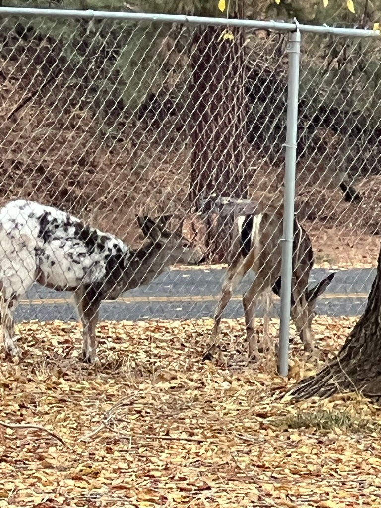
I guess it was an achievement as (-7C) (19 Fahrenheit) . the lowest temperature we have managed without any frozen pipes etc…while camping without hookups. Our furnace keeps the underneath part of motorhome warm (the basement) where all of the pipes and water tanks are. We are getting more confident with our winter conditions camping. This is never our intention, but nice to know we can get by in a pinch…. and weather IS getting more and more unpredictable. We camped at the Wasco county fairground campground which is further just south of the Dalles, in Oregon. It was a. wonderful site, and we saw a very unusual looking fawn. Instead of being brown with white spots it was mostly white with brown spots. Sadly….. easier for hunter to spot?
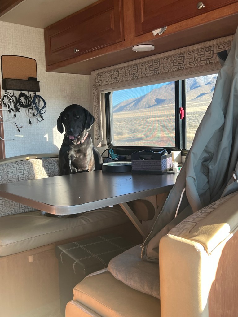
When we travel in Motorhome, Tucker usually rides right between us in a dog bed, and when the roads get too curvy, OR too up or down he squeezes in in front of me until things settle down, so you can imagine my thoughts when I looked down to see he was not in his bed! My first thoughts were that …. could we have left him behind at our last stop??? 🤔🤔 NOT very likely, in that his every move is closely monitored when we are anywhere away from home….So I looked back and ……… I guess after all of the years we have been traveling with him, he has decided he wants to try out the “other seats”. I guess he wants a better view🧐😎
Then today I looked back and WHERE IS TUCKER??
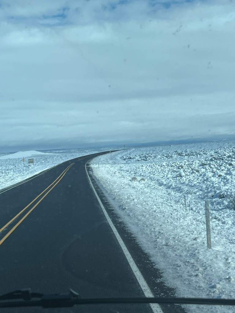
We have hit snow a few times now at the higher elevations, but we were lucky that by the time we came along the roads were bare and dry. The route we took was likely more likely to have snow in that we went through eastern Oregon into Nevada through a higher pass. But it really is quite beautiful and we have been driving the coastal route for SOOO many years, the change is nice. I have shown on this map the route we took from Burns OR to Winnemucca NV.
With any luck we will be somewhere that does not freeze tonite. We have heard that it IS snowing at home.
So for all of our friends who are staying home this winter in Canada, we admire you for your strength and endurance.🍻🍻🍻
Much love from Janet, Ken and Tucker, the dog who likes to sleep all over the place
We headed south a little later than usual this year…… so that we could come back up a little later… with the hopes of hitting a few places on the way home that we usually cannot get to because of the cold/snow. We usually go down through Nevada on our way down, when we go in November, but most years we are in a rush because some weather system or other is “encouraging” us to go south and fast…
So we usually come down I5, and over to Susanville California and enter Nevada near Reno/Carson city area. We go down through Hawthorne, then Tonopah and Beatty (essentially HWY95).
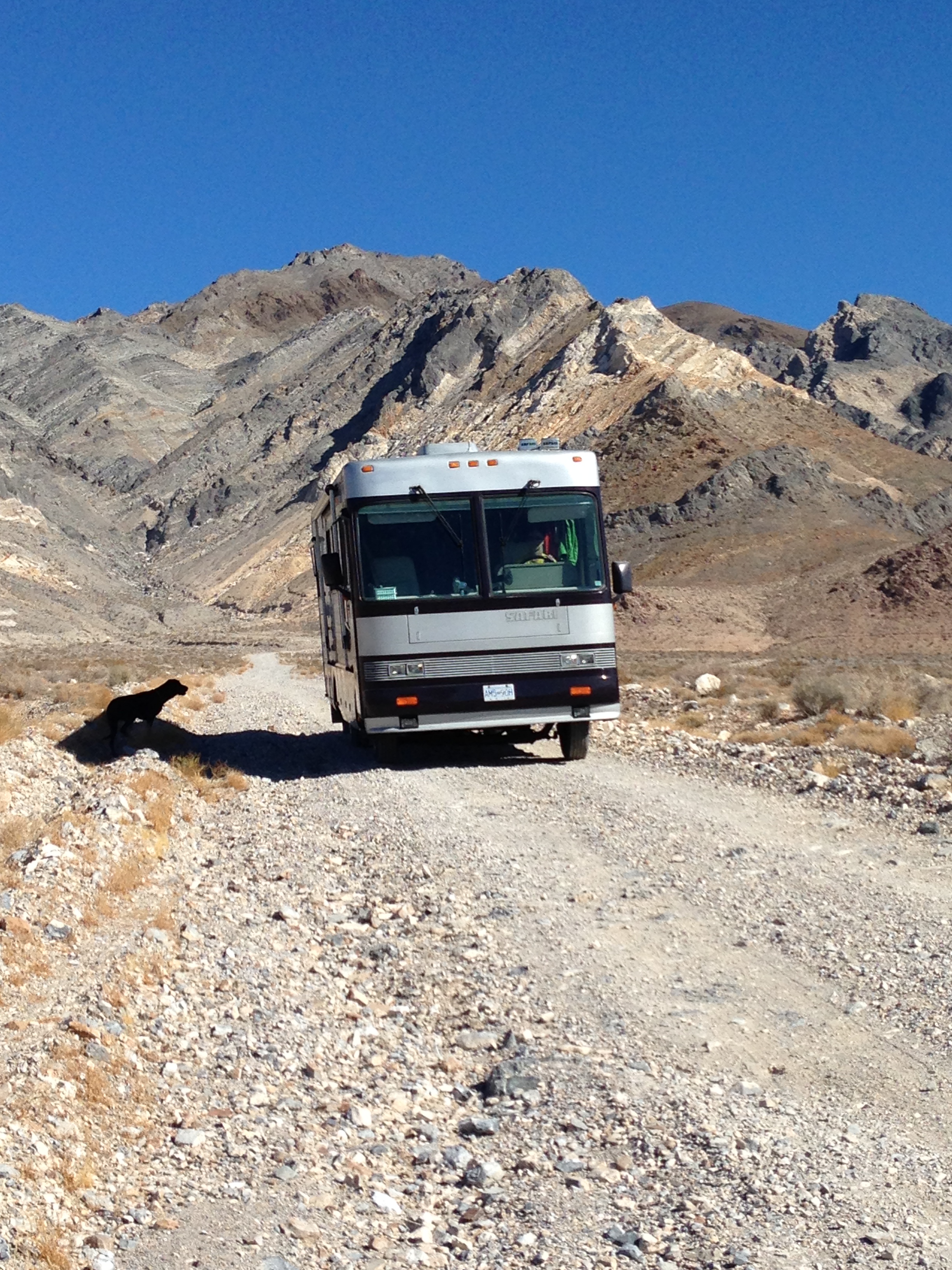
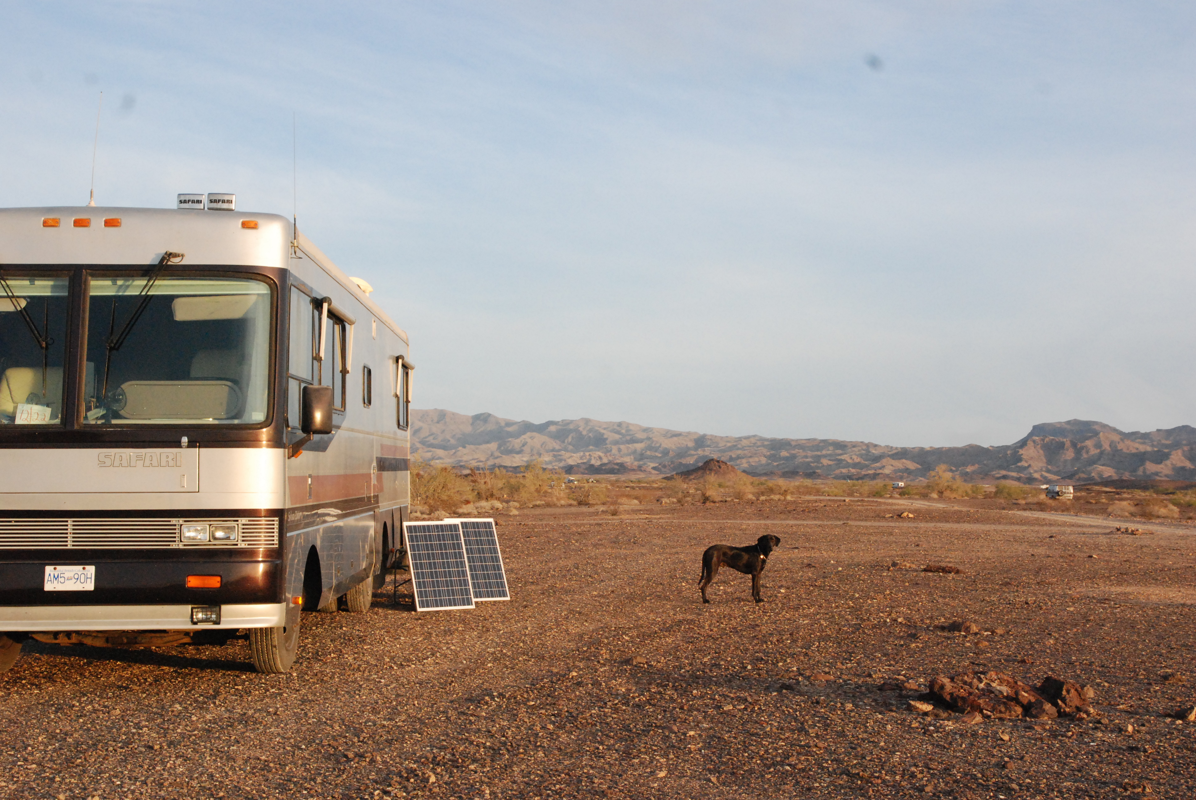
Nevada sits at a higher elevation, and so the nights can be cold, below freezing, which has always steered us to find a different way home. This year with our new battery…… etc… we are able to fully charge each day and discharge down to 70% (battery charge) during the night. SO we are able to camp in “dispersal” camping areas, which are areas designated for camping with no formal amenities such as electricity, water etc. Usually they are not far off the road, on BLM land, and also usually quite scenic.
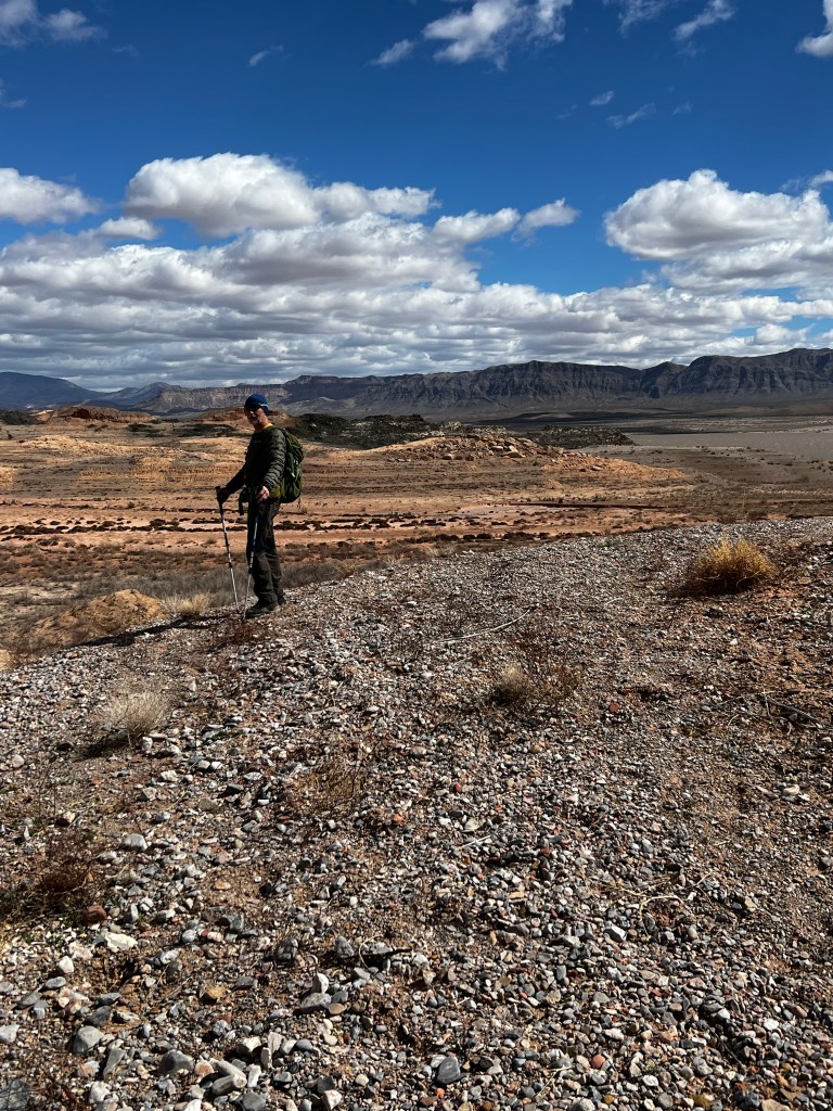
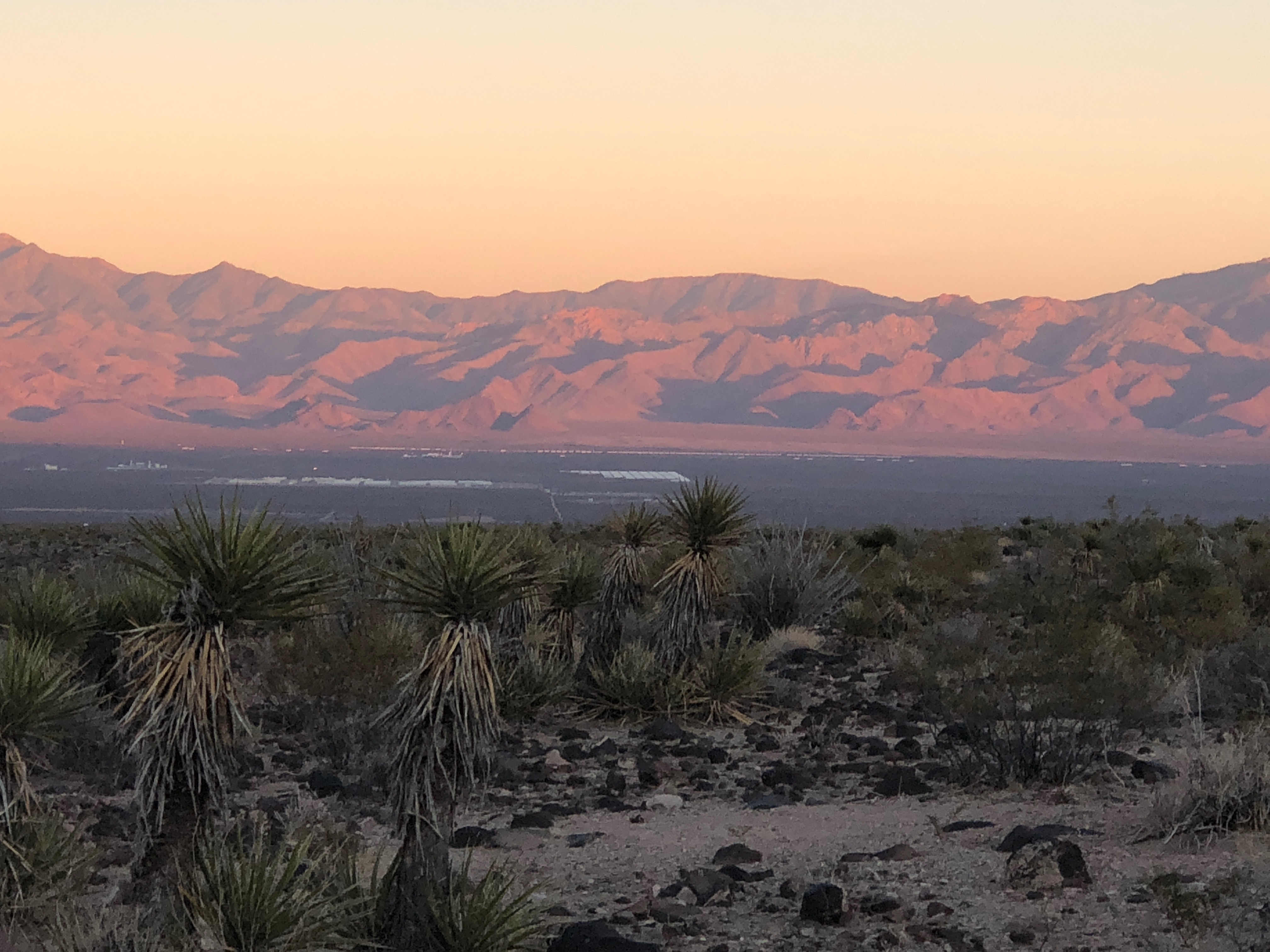
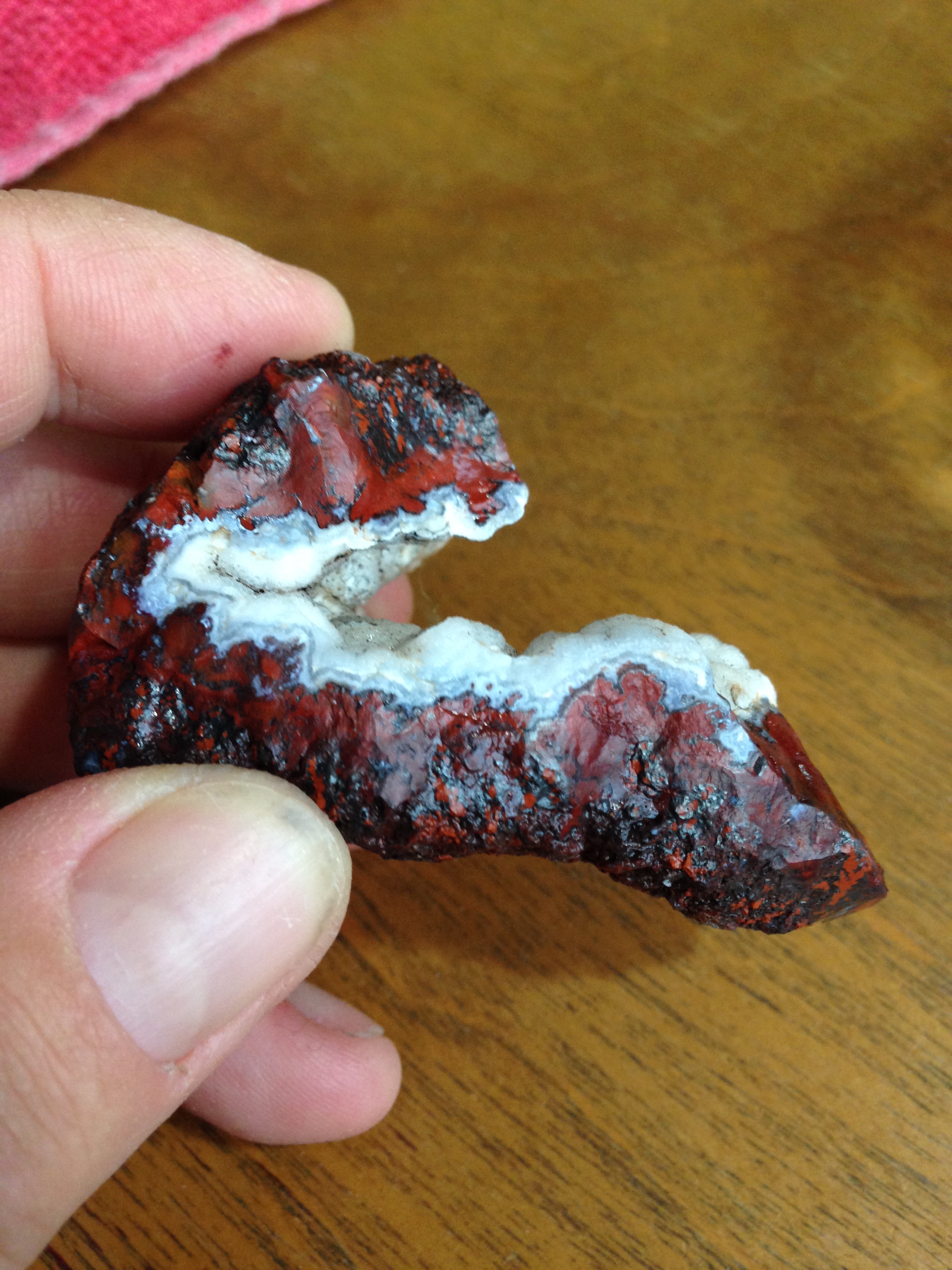
THIS was from a dispersal site out side of Tonopah. We love Tonopah because of the amazing rocks we find near there. Miles of open area (BLM land) (kind of like Crown land in Canada) to wander all day long, looking for cool rocks. This year we have learned the many faces of petrified wood and so stuff we thought was nothing we now realize can be beautiful agatized or opalized petrified wood.
Well this picture is from Lake Mead, but you get the picture of what we do all day almost every day, wherever we happen to be.
I have not taken many pictures of rocks this trip, because they tend to be more “photogenic” once they are cut, or tumbled.
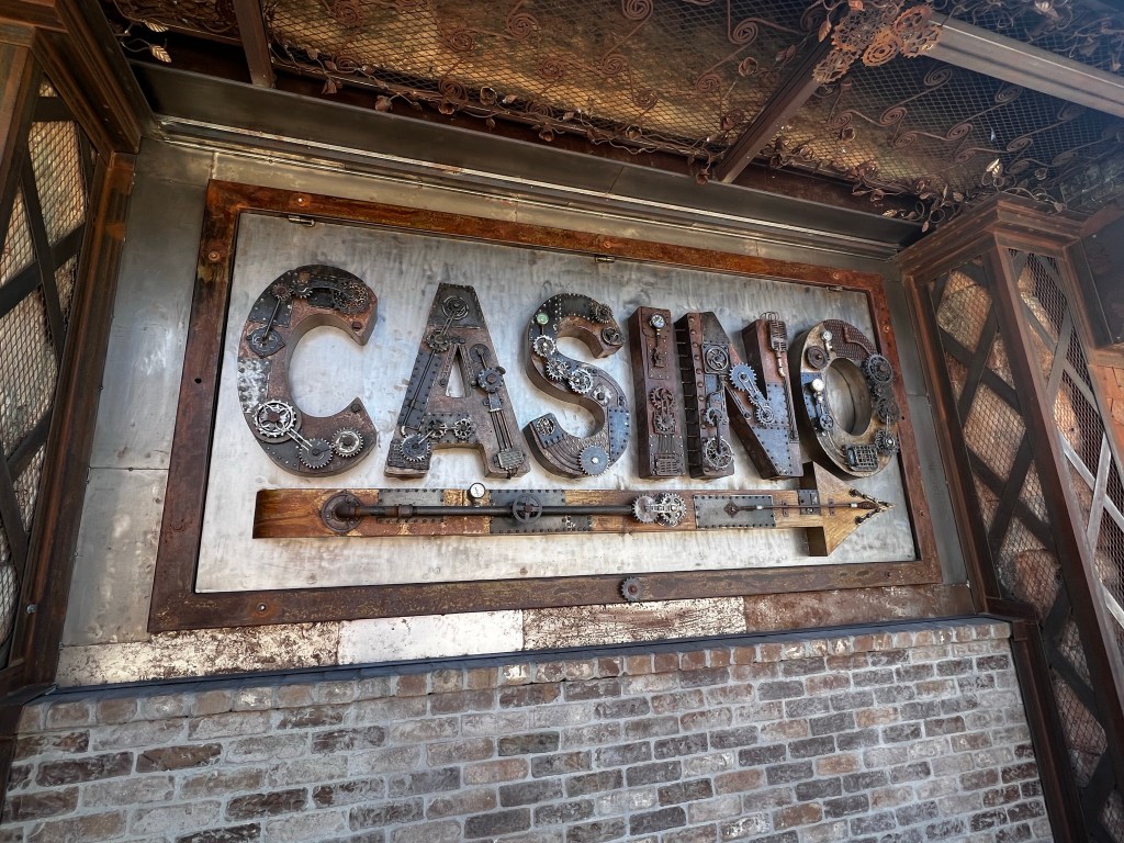
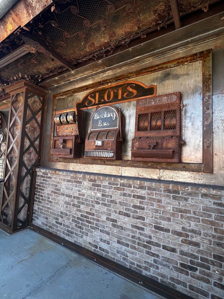
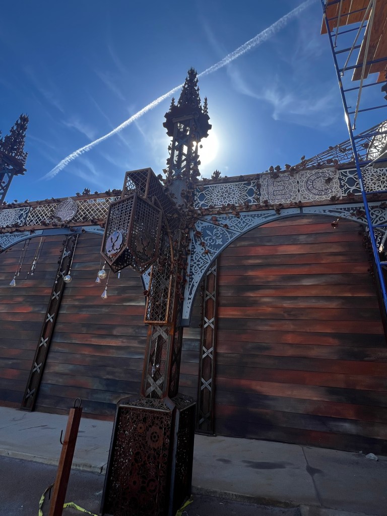
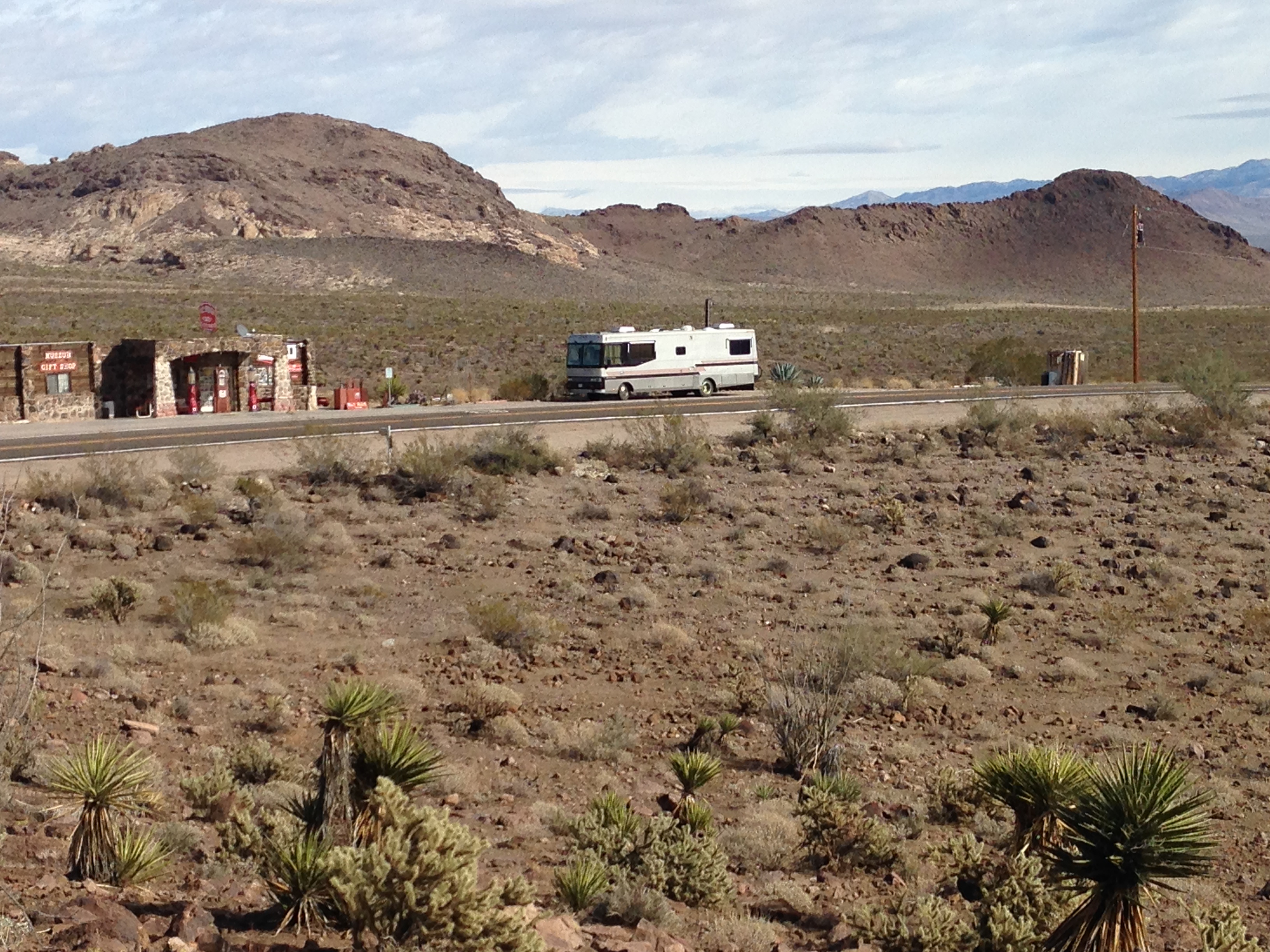
Beatty is a town in the south west of Nevada, that is at a lower elevation, so basically the last warm spot heading north. ( 🙃 OR the first warm spot heading south). It is the gateway to Death Valley heading west. There is not much there to interest us usually, but while searching for a store, I discovered an old historic casino that they are apparently remaking into perhaps a coffee roaster place??? Ken and I LOVE steampunk stuff, and this old casino has been completely refaced, resurfaced in Steam punk.
as you can see, the buildings around are totally PLAIN…
I guess what struck me is that this amazing building appears to be done up SOOO well in a town that …. we will just say is ….not so amazing…… Whatever this place will be, it is not there yet and the work is continuing. It must be quite a labour of love, as this town is far from anything. I know myself, I will be anxious to see what it looks like next year.
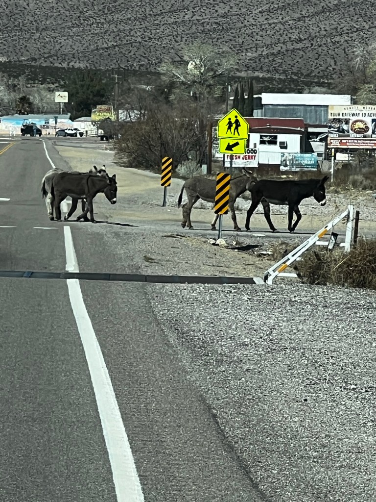
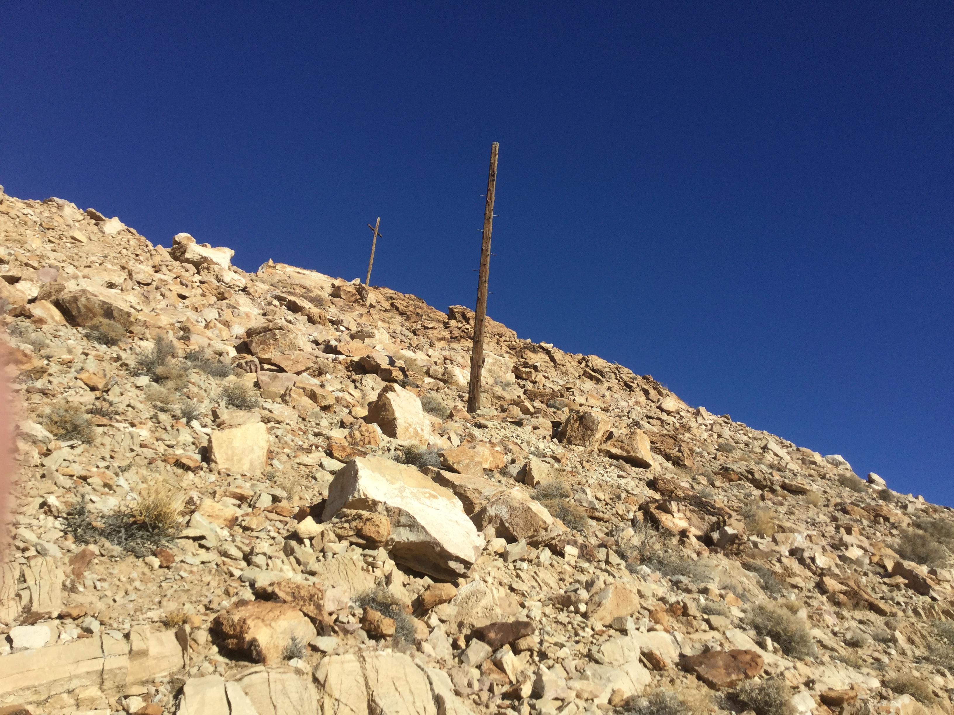
Tonopah ……..photos…
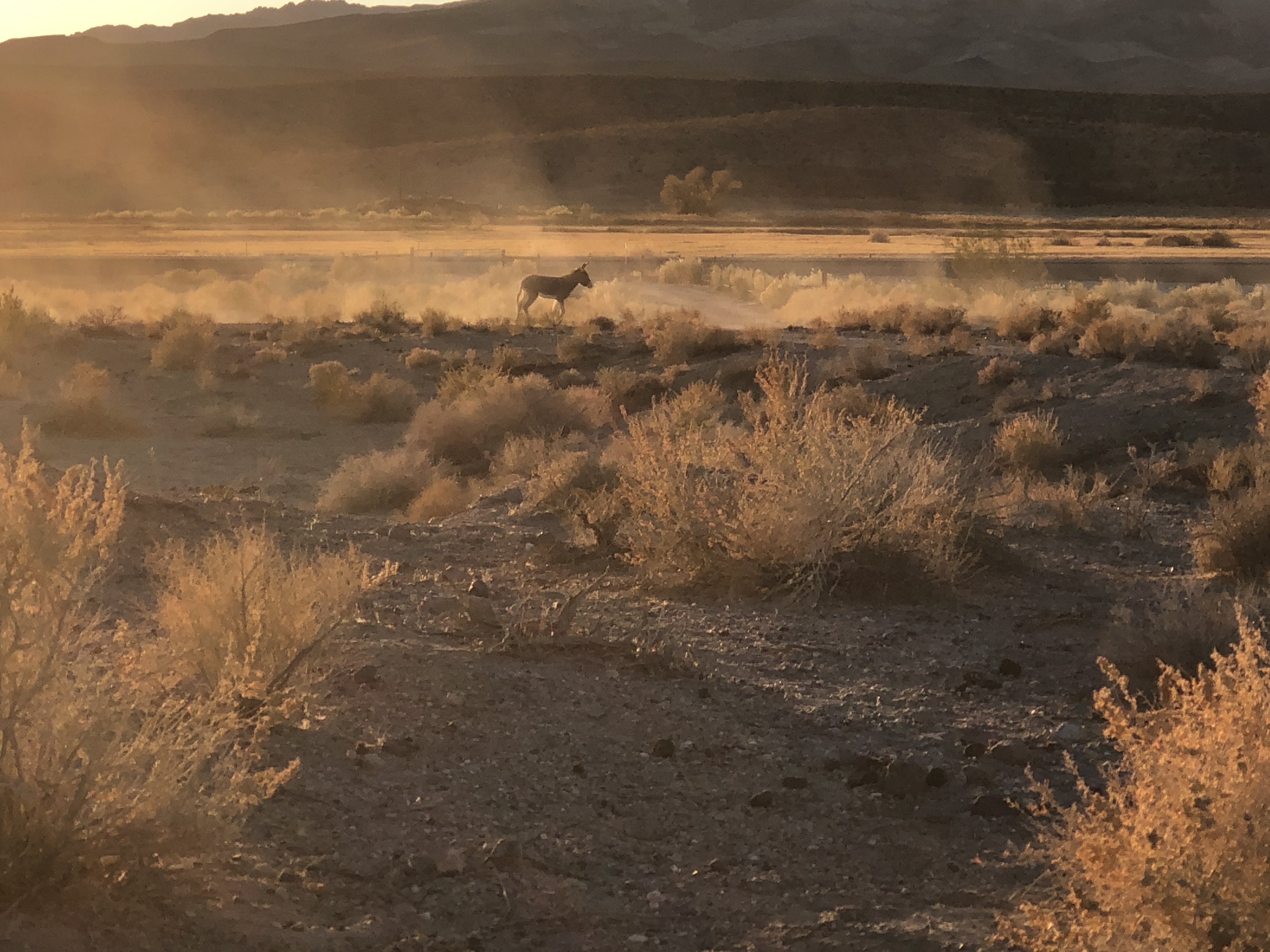
… and always the ever present Burros…. just sitting watching what we are doing…. so cute.
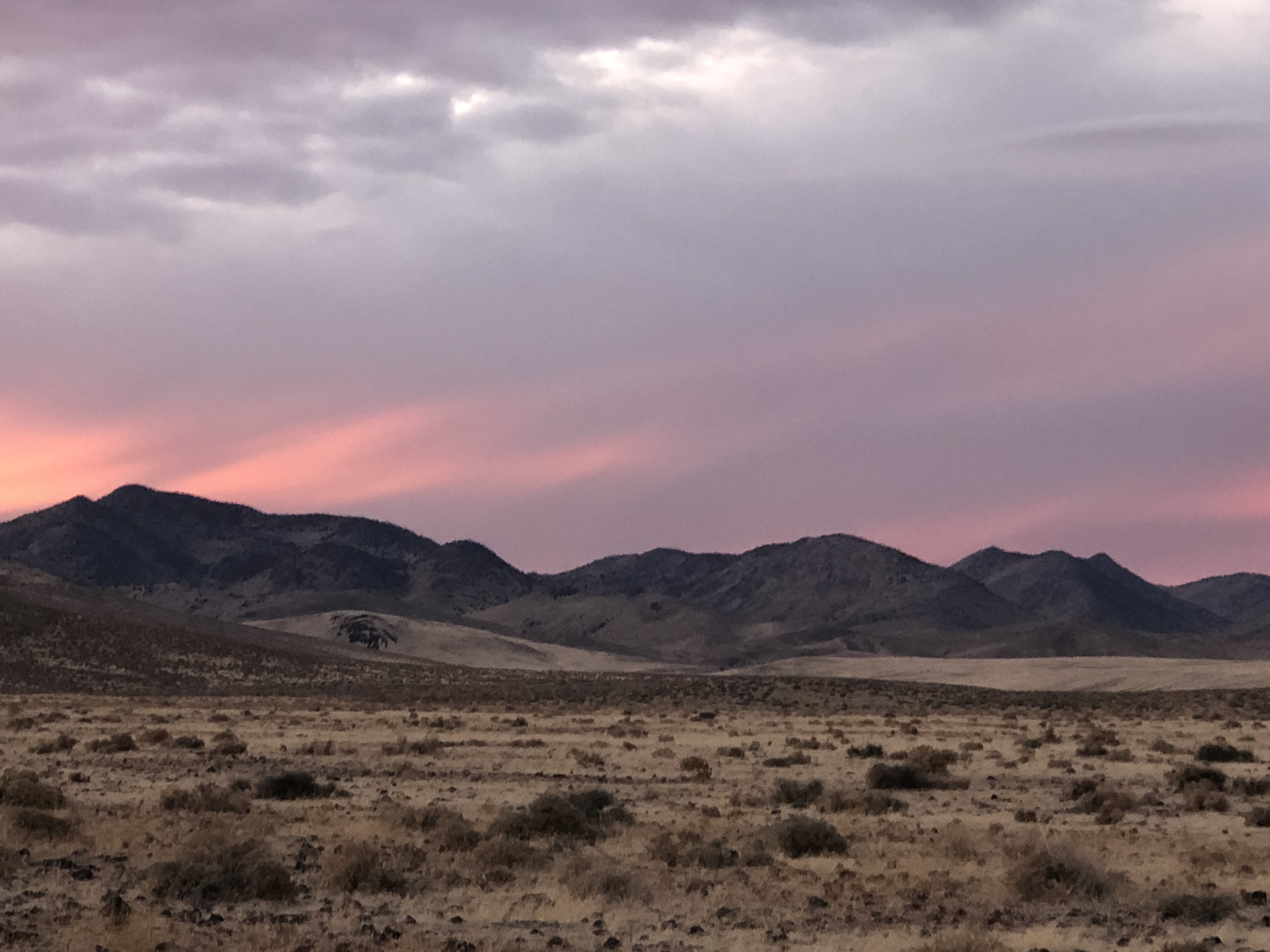
To go back to the map at the beginning, we drove a highway between Tonopah and Austin,( that does not show on that map), but is a great highway, along a long valley with snow topped mountains either side. I am not sure that they are snow topped in the summer time, so it seems early spring or late fall might be the most scenic times to travel this way.
We are currently just south of Mcdermitt, which is a border town between Oregon and Nevada. It seems that every border into Nevada has a number of casinos…. but this one only has one, it is called the SAY WHEN CASINO. 🫢I like that name. Today we are on the hunt for opalized petrified wood, which we have never really seen, but might have.
It IS getting down to 27-28 F (-2, -4C) at night and it is quite freeing to know that we can weather these temps with no hookups.
petrified wood from Tonopah
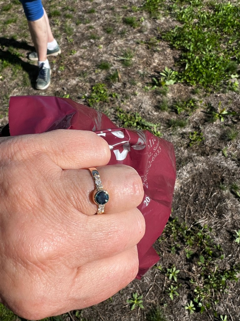
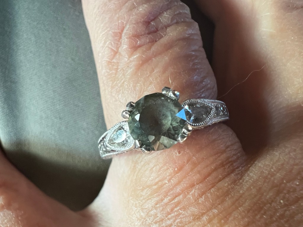
Although I have likely mentioned this in this blog before.. I lost the diamond from my engagement ring out in the desert while rockhounding… about…7 years ago. We always jested that perhaps some rock hound might find it in the desert and think he had discovered a new diamond mine
I have gone ringless for all those years and last year at the Tucson gem show, we searched for and found a beautiful sapphire. We went home and I found a jeweller to take my engagement ring and wedding ring, and salvage the gold, and the create a new ring with the sapphire and leftover diamonds
I was never really happy with the ring, I think because I had chosen not to have claws on the ring … this is “bezelled” which is a safer setting but allows less light under the gem.(better for rockhounds and gardeners….)……. soooooo
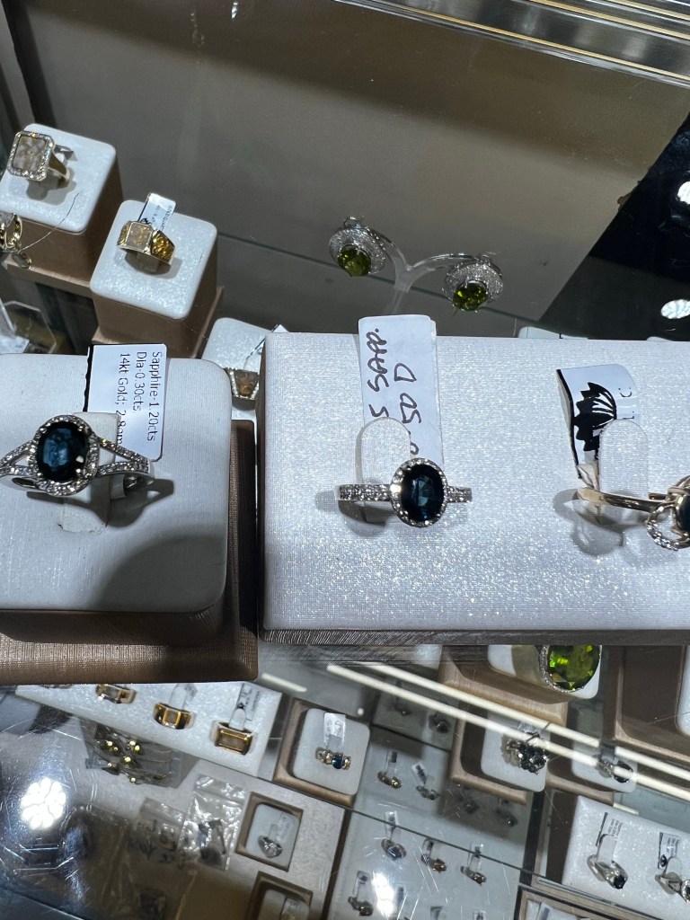
This year we decided to once again look for a sapphire at the Tucson Gem show and were drawn to the booth with the Montana sapphires which are not so much blue as more of a greenish colour. We spent quite a bit of time going over all of the choices there and found the gem we liked the most (we also got to know the guy quite well, he cuts all of his gems and had lots of stories to tell)
….oh and BTW. …. MORE STEAMPUNK…. Each year the Tucson Gem show has a competition for ART made from recycled stuff.
LOVE THIS STUFF….
Now THIS… stuck me a picture worthy…perhaps someone else might feel that an antitheft device on the steering wheel is an important accessory, but my thoughts were … why bother?
some early thoughts, but the wrong shape….
so in the end we bought the sapphire we liked the best, then went in search of a setting, not really expecting to find something I liked… but I did…. The setting was priced at 6000 but he sold it to me for….1500… (MUCH less than a transmission)…. and there was a jeweller at the Gem show to put the sapphire into the setting and so we went home with a new ring
I cannot honestly say I have ever had much of an interest in jewelry…. but for some reason I tend to stare at my new ring all the time…. I guess after 40 years of marriage it was time for a new one. Ken on the other hand lost his ring in our first 5 years, and so his is also a replacement.
So looking at the maps between here and home, there is STILL severe weather warnings, so shall hang out here for a few more days…
Bye for now, much love from Janet, Ken and Tucker.
We have been on the road for almost 3 weeks now. We have only paid for a campground 3 nights now. They usually cost about 40-45 a night, so about 1300-1400 a month. I guess we avoid them partially because of the cost, partially because we are to the point that we do not need them, ( we are getting by just fine on our solar power, our 100 gallon water tank, propane for the stove, and a generator when all else fails(rare) ), but mostly because of the gorgeous spots we get to camp…… and the wild life..
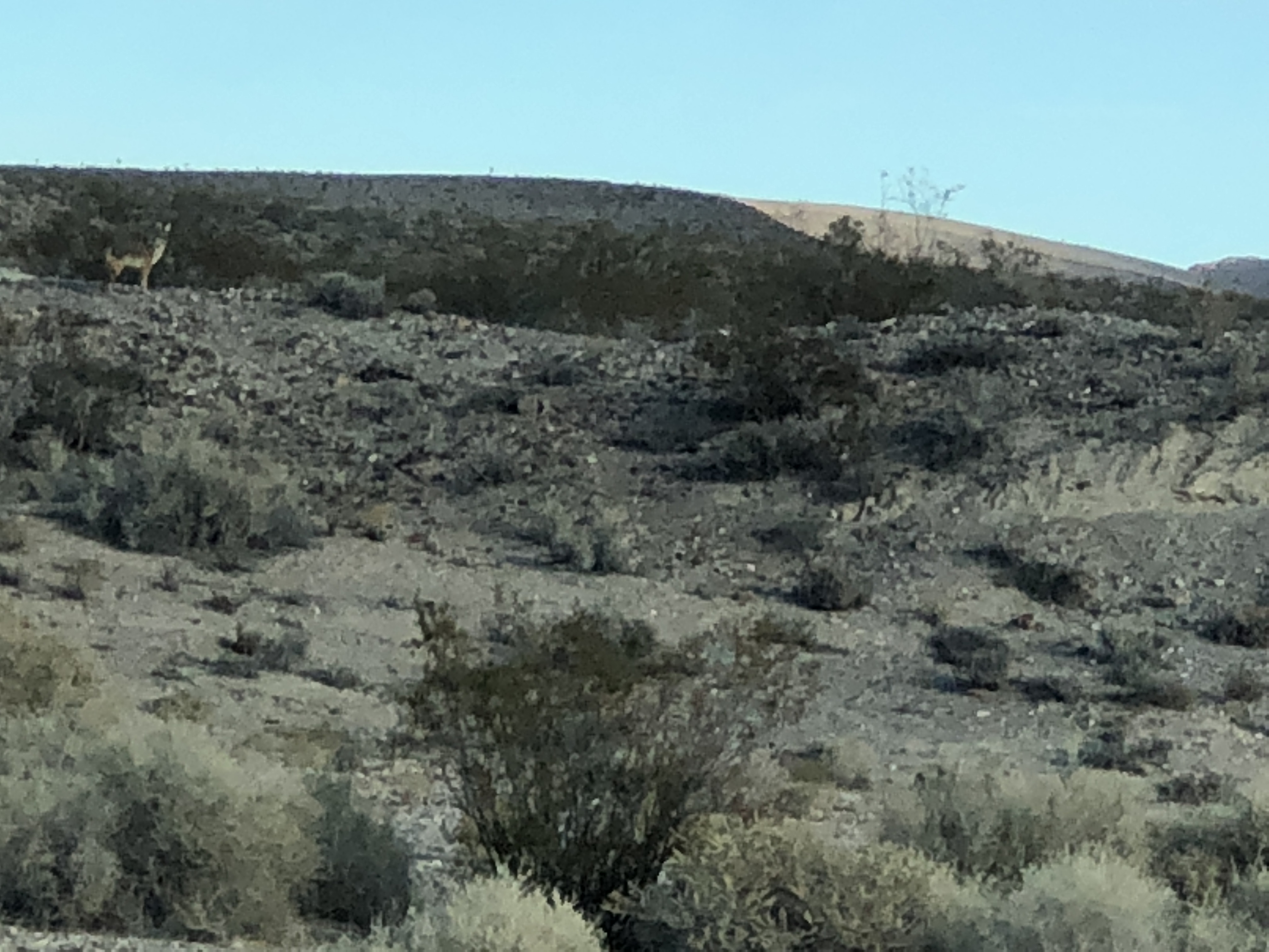
Not a great shot, but there is a coyote there, and Tucker is barking like crazy about it.
…. and the burros. Strong winds, and I just missed a few of them rolling around in the sand kicking up the dust.
We have had several days of strong winds, COLD winds. It has been interesting having our son Josh taking geography this term, learning how weather systems form. It seems as though the dreadful winds we have been experiencing through West Nevada, is in effect a high pressure system associated with the Santa Ana winds that fuel the fires in Southern California. The western part of Nevada, into California is called the “great west basin” . Here is an excerpt I found in Wikipedia.
“The Santa Anas are katabatic winds—Greek for “flowing downhill”, arising in higher altitudes and blowing down towards sea level.[4] Santa Ana winds originate from high-pressure airmasses over the Great Basin and upper Mojave Desert. Any low-pressure area over the Pacific Ocean, off the coast of California, can change the stability of the Great Basin High, causing a pressure gradient that turns the synoptic scale winds southward down the eastern side of the Sierra Nevada and into the Southern California region.[5] Cool, dry air flows outward in a clockwise spiral from the high pressure center. This cool, dry airmass sweeps across the deserts of eastern California toward the coast, and encounters the towering Transverse Ranges, which separate coastal Southern California from the deserts. The airmass, flowing from high pressure in the Great Basin to a low pressure center off the coast, takes the path of least resistance by channeling through the mountain passes to the lower coastal elevations, as the low pressure area off the coast pulls the airmass offshore.”
So yesterday was the first day we have noted a lessening of the winds, and the news said also that the Santa Ana winds had decreased. So perhaps they will cool down and we will warm up.
One of the places we explored was Rhyolite, a ghost town from the gold boom. It was dreadfully windy there, so we thought if we climbed closer to the mountains we might get out of the wind….. and we did.
If you look at the spot up near the V, we got out of the wind there 🙂
…and this is the view from there. The flat part is Death Valley, and California in the distance.
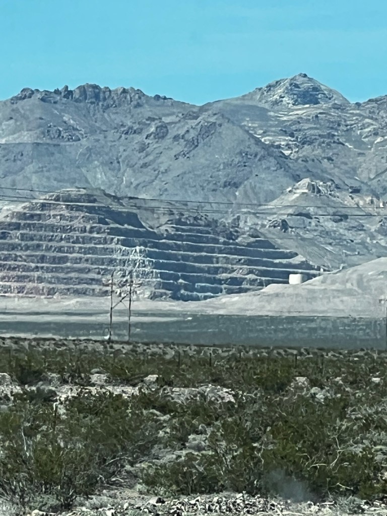
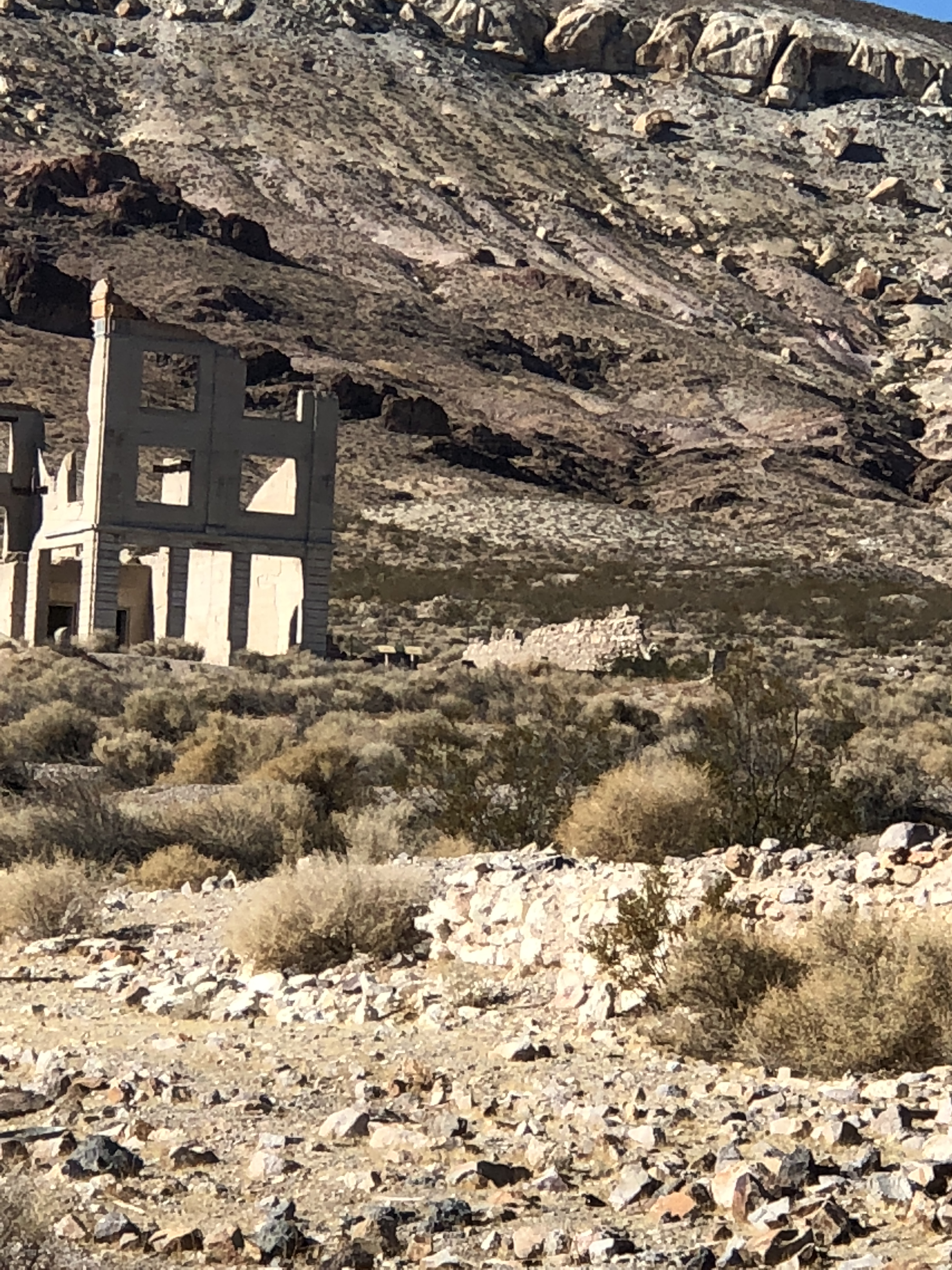
The entire valley is riddled with mining shafts like this one.
Gold was discovered here in 1905, and in 2 years it was a town of 12,000 people. It had banks, newspapers, gambling halls (of course gambling halls, it is Nevada..) … and even an Opera house. 3 Railroads had lines built into Rhyolite, but by 1911 the ores had begun to play out. Too bad they did not have RVs back then…… they could have just moved on to the next bonanza 🙂 .
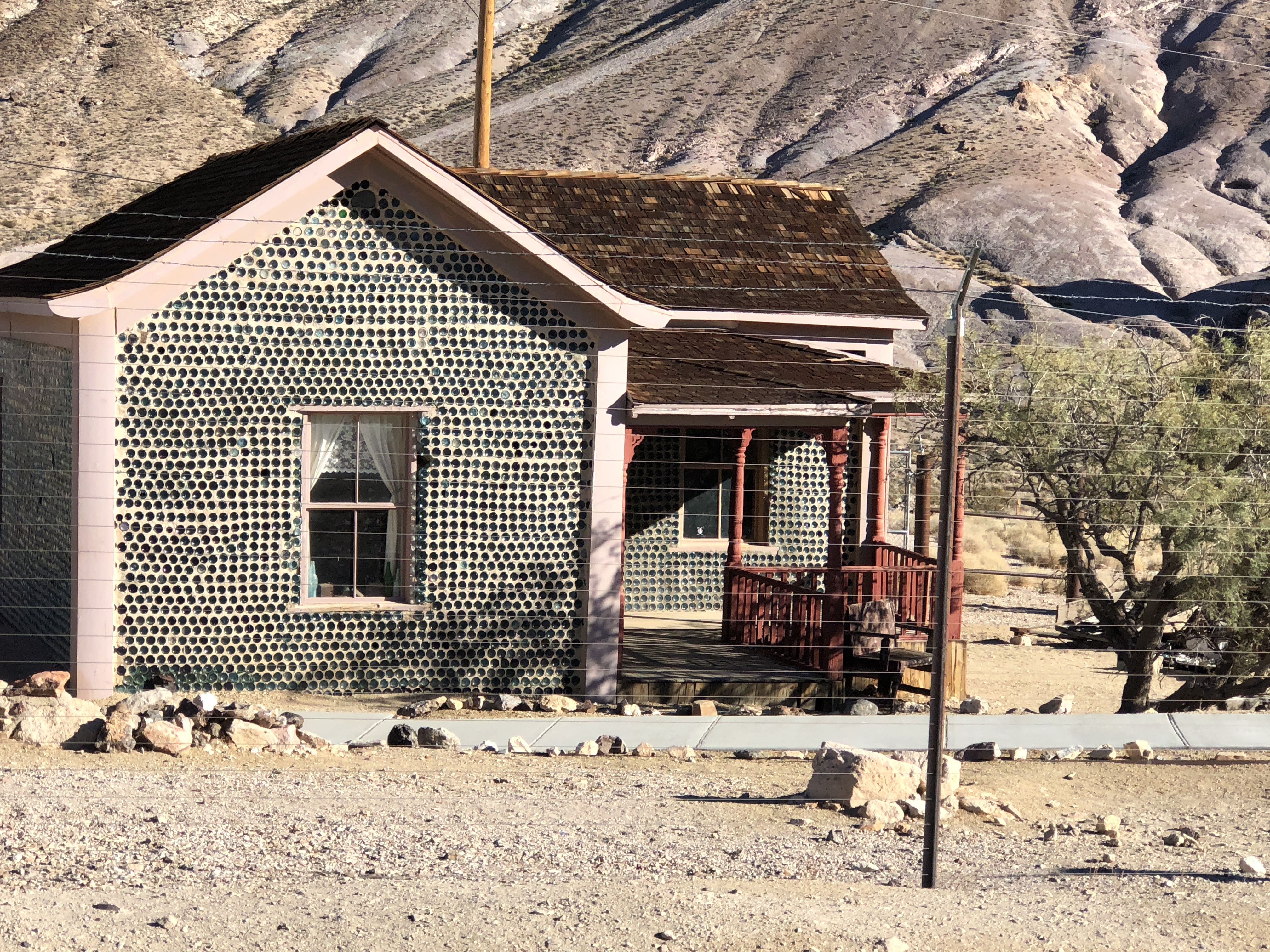
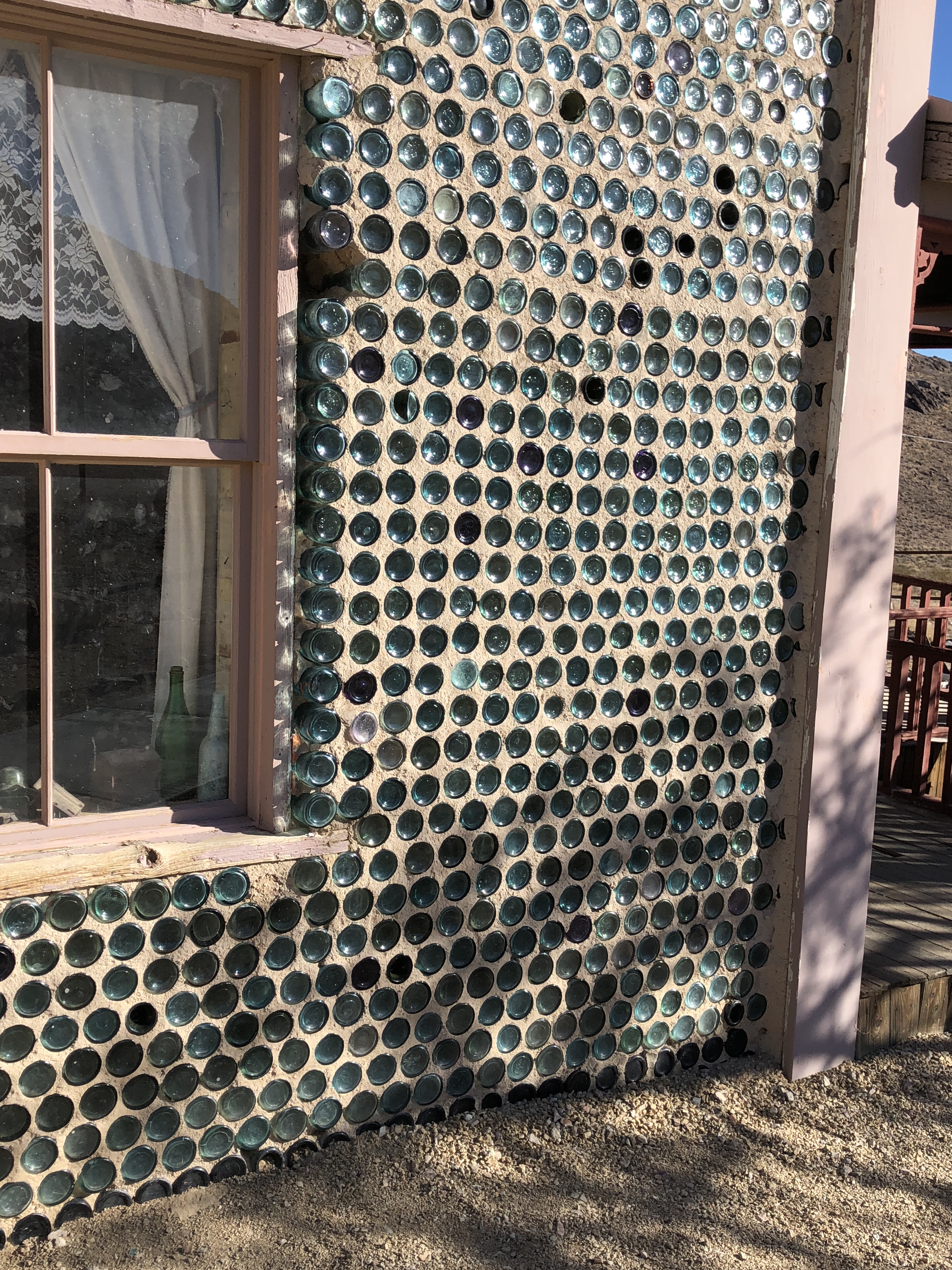
The one building that is still standing is oddly the Kelly’s bottle house, made entirely of bottles.
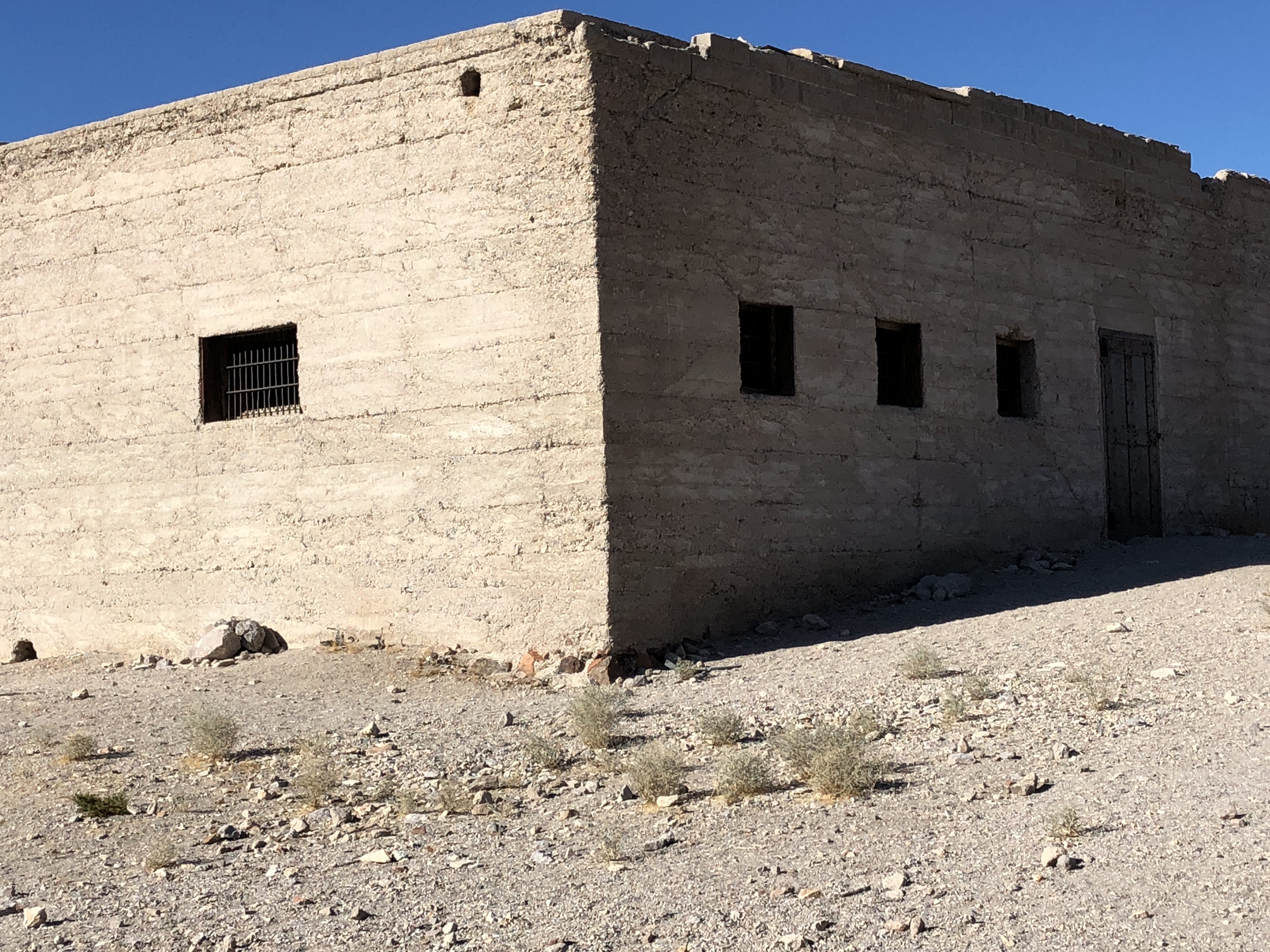
I believe this was the school.
There was also “the panic of 1907” which saw the stock markets fall 50%, so there was much less money to invest in mining, yet another factor in the demise of Rhyolite. Interesting to read about Charles Schwab as a major investor in this.
seeing the remains of this building I was wondering if the bars were to keep someone in (jail), or keep someone out (bank). Turns out it was the former.
And we can hardly have a day with out something going wrong with the motorhome, and this is what our motorhome looks like when the hood is up…. the engine is under the bed, and some spring dohicky broke off that keeps the engine from over revving or something like that. Ken managed to gerry rig it back to being hooked up again and all was good.
and Tucker now has booties, now that we are into the cactus. So we do not have to use pliers to get the thorns out of his paws.
We have spent our first night out in the desert. What a great day. We are just south of Fernley NV, and our rockhounding book suggested one area, which we did not immediately find, but still found lots of cool rocks, then we resorted to our gps and found more. My theory is that the guy that writes the book has a 4×4 and drives to all the spots, so that those of us who wander further find all the stuff no one else finds 🙂
There is a joke in Canada that from the prairies you can watch your dog run away for days, well we can keep an eye on our motorhome for MILES.
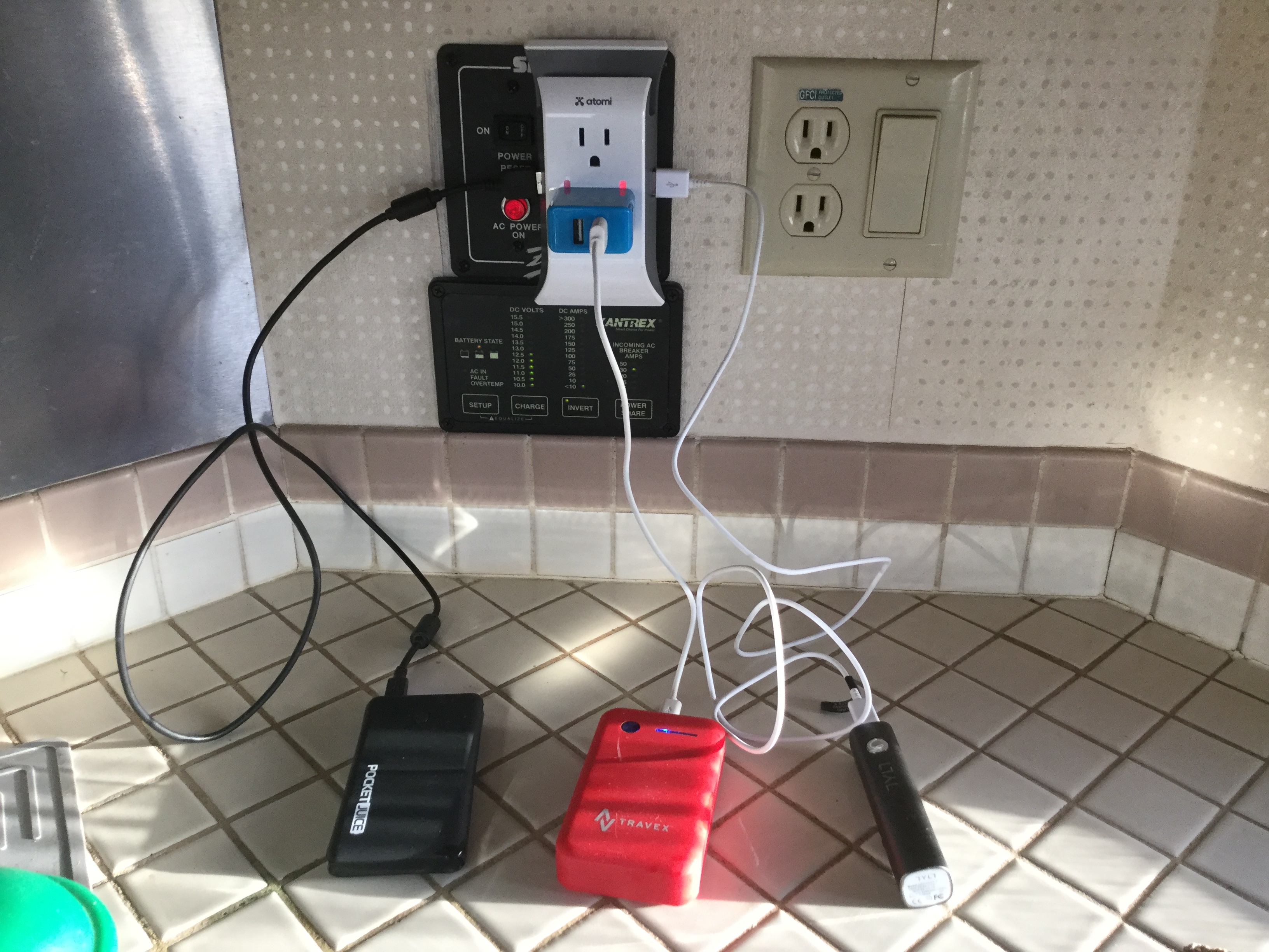
It was down to -3 Celsius (26 Fahrenheit ) last night, and we were warm as toast. (it was 15 celsius (59 Fahrenheit) in the day). This was an issue last year, as we were afraid we would freeze up overnight without electricity. This year we have our solar panels charging up our (house) batteries during the day, so at night the batteries run the furnace fan and the LED lights.(propane runs the furnace). So as long as we are conservative with our water, we can be pretty self sufficient for several days.
We are parked about half a mile off the highway, on BLM land. We have a lovely view in every direction, sunrise , sunset and everything in between.
We are also taking advantage of the sun during the day and charging all of our chargers. We need to keep all our devices charged, IPAD for gps, maps and weather. Computer to write this…… etc.
We are currently watching the weather it is supposed to drop down to -6 in 2 days and we are not wanting to try camping that low. SOOOO we must either go south or to a lower elevation then.
So we really are alone out here…. well except for the wild horses, which seem to be plentiful here…. there is horsepoop EVERYwhere. A gardeners dream. I am sure if it ever rained here it would be a great place to grow things.
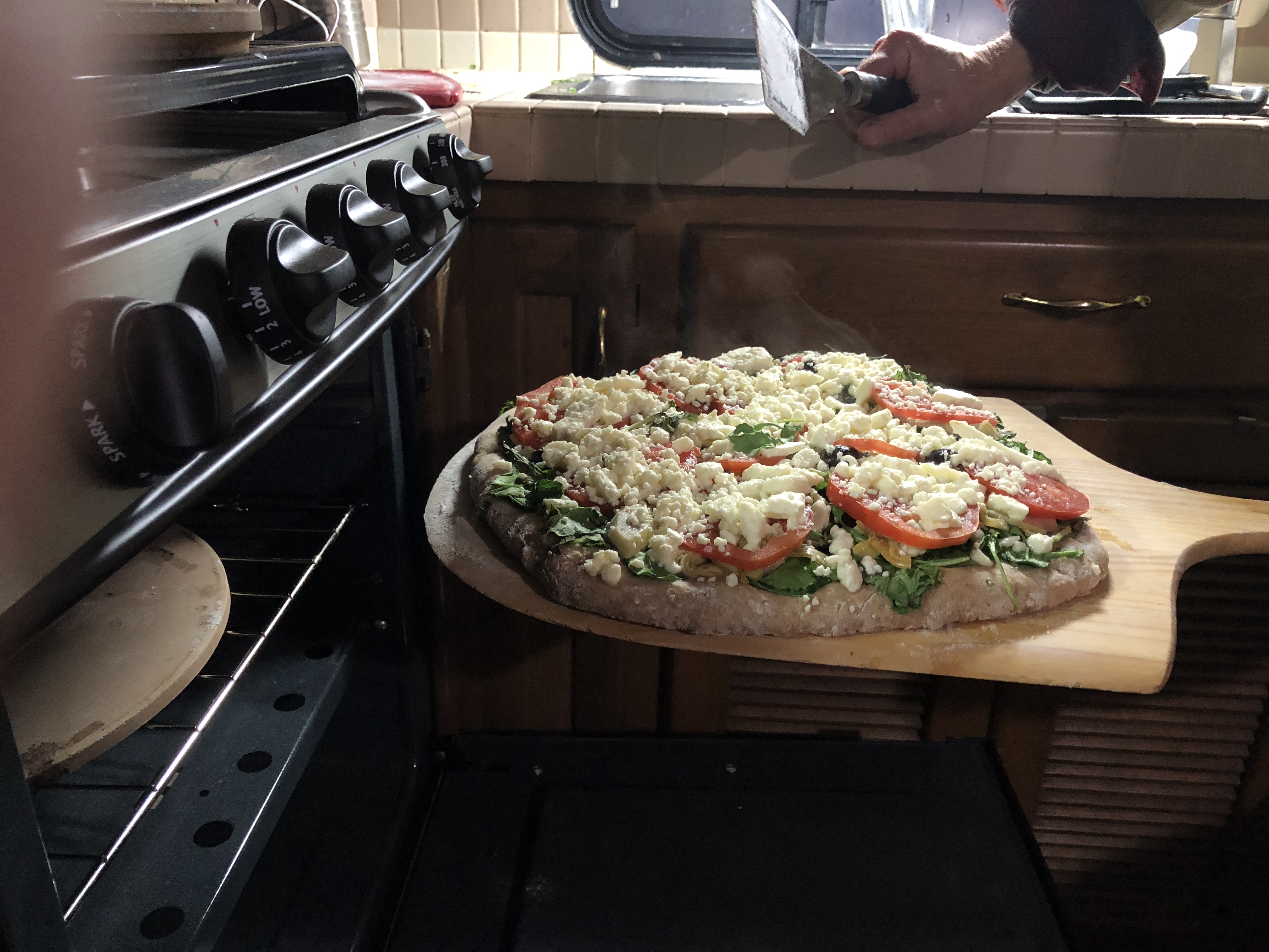
So we are warm and dry and have I mentioned that I LOVE THE NEW STOVE.
Hard to believe that it is almost 2 weeks since we left home. We had a brake problem that presented itself at 4 pm on the day before thanksgiving. We found out black friday that there was nothing going to be open until Monday, and then Monday, no one had an appointment free. So we left Eugene Wednesday and now it is Friday. We have thus far had a pipe burst at the beginning, then a leak from the new roof, which Ken has fixed and then the brakes. So we figure things go in threes so we should be good for here on..
Oh and there was this guy on a motorized glider who kept going by….
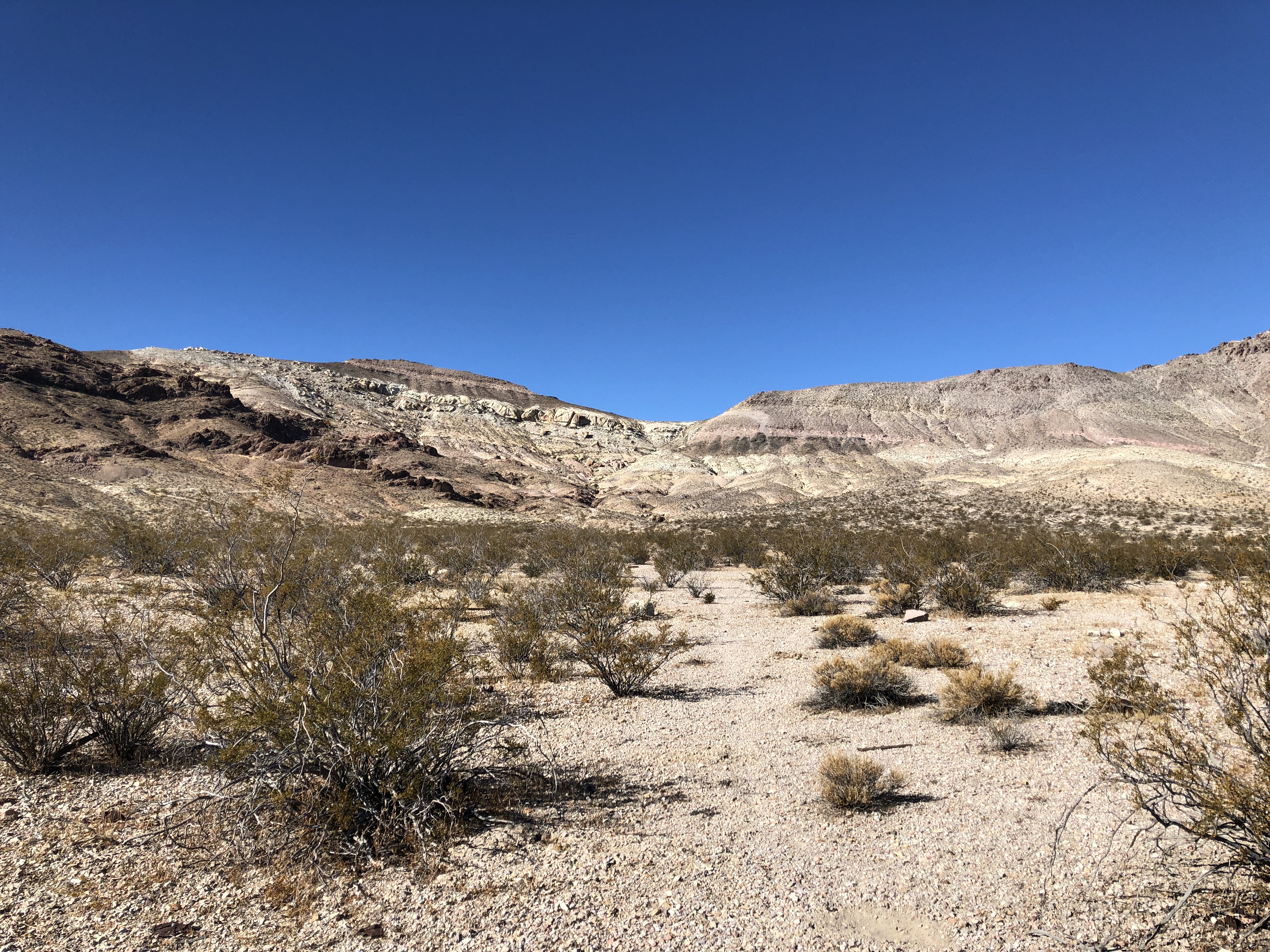
We have definitely stayed at some extremely cool spots thus far. I have been trying to take pictures of each of the places.
This was actually in a park, but no services, Valley of fire state park. wonderful red rock formations. Indian writing on wall. Just outside of Vegas.
This was next to where we had camped. WAY up a road in Nevada where a blue quartz mine was. We walked all the way up to the mine and looked all over to find that we really did not LIKE blue quartz. Funny how that works, but the view was worth the climb.
This was on the ROUTE 66, a very old little shop called Cold springs. We camped further out in the desert the night before, but the lady who ran the shop told us to stay there the next night, as the guy who usually did security was gone. Really a cool little museum. Here is link for more info http://azrt66.com/cool-springs/
To get any further on this road to Oatman was too risky for a long vehicle, so we stayed at cool springs.
We have to date managed 5 days in a row with no services, and have found that if you google RV dumps, you can find places where you just pay a fee of 10-20 bucks to sani dump and add fresh water.
Not all days have been totally perfect. Days like yesterday, the rockhounding book said that the “area” was 10.3 miles down a dirt road, and that all vehicles could make it. Said that there were soft areas, but that you should just keep moving. Well we have some to learn that “all vehicles” does not necessarily mean a 35 foot Motorhome. There are a few questions that go through our minds as we move one down these roads. One is….. I wonder if there will be a place to turn this rig around? Another is “I wonder if the AAA has limits to where they will go to haul out a motorhome? yet another question we wondered a few days ago was…. ” I wonder if Chains would work as well in sand as they do in snow”
WE are not at all sure if we are being as kind to our motorhome as it has been to us . After the bind we got into yesterday, we have vowed that we WILL Look closer on Google earth.
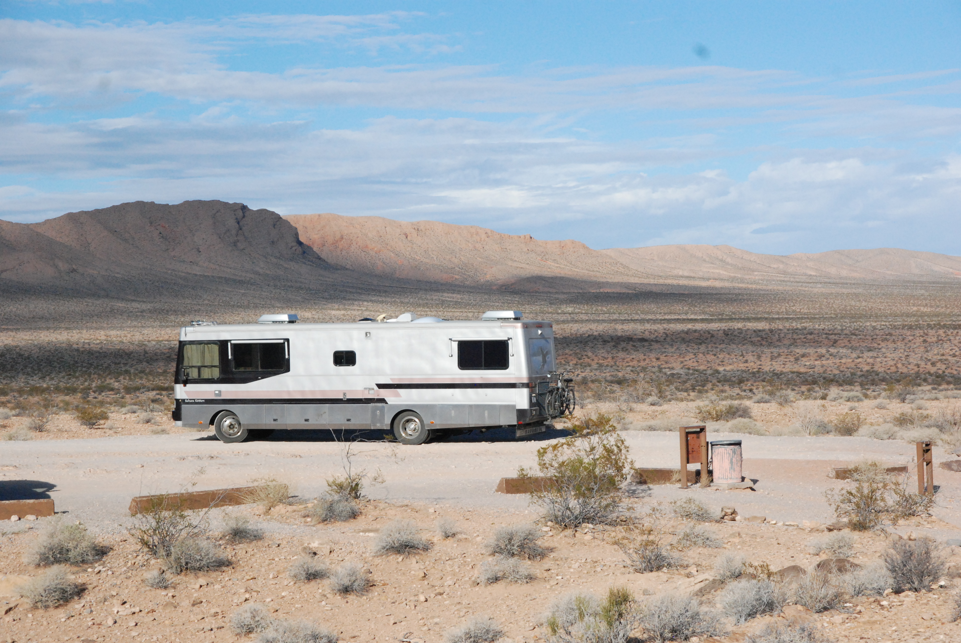
This was just outside Parker Arizona, … actually closer to Earp California. Not the greatest picture, but definitely a spot we will go back to. 6 miles from town and sitting above looking out a mountains all around.
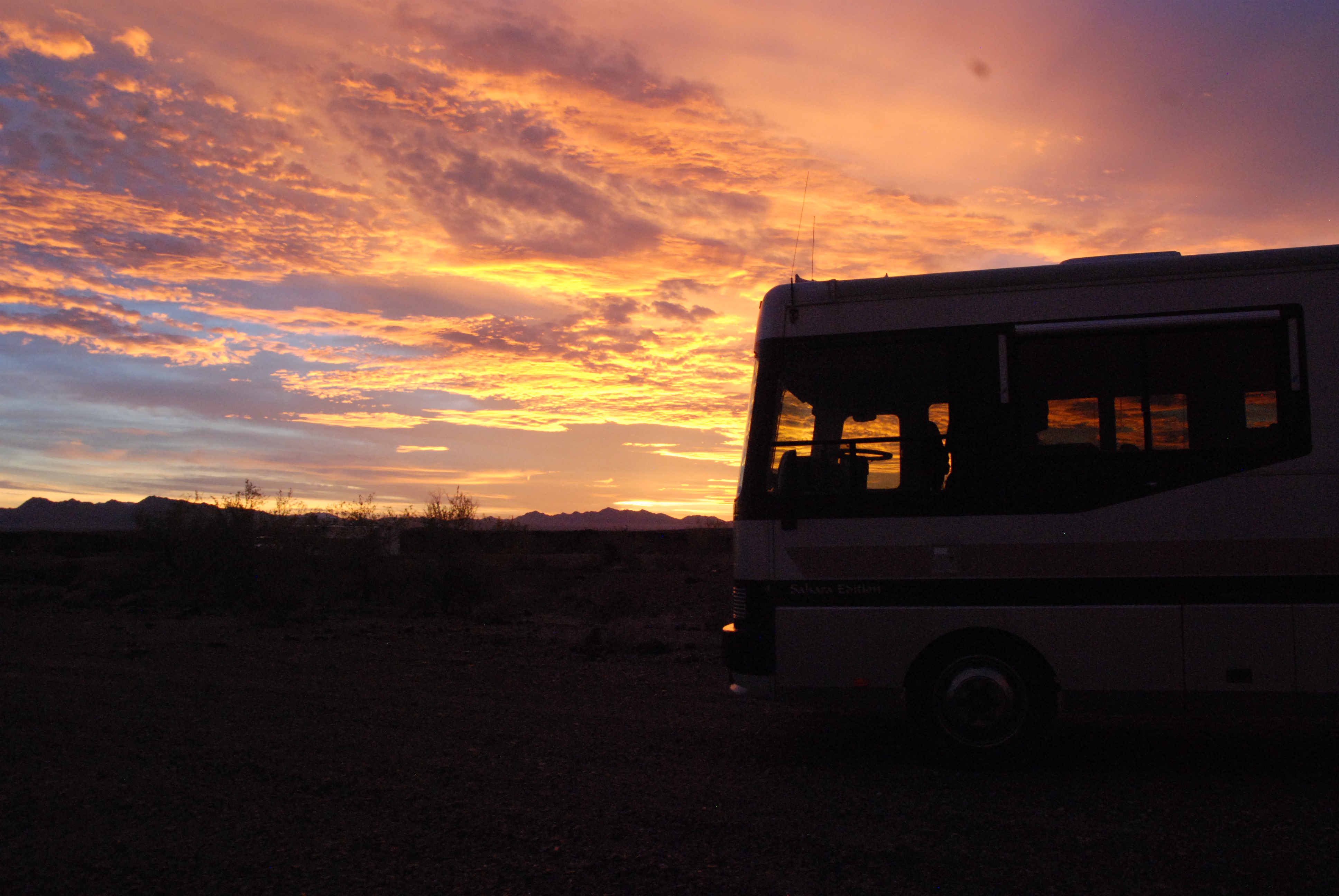
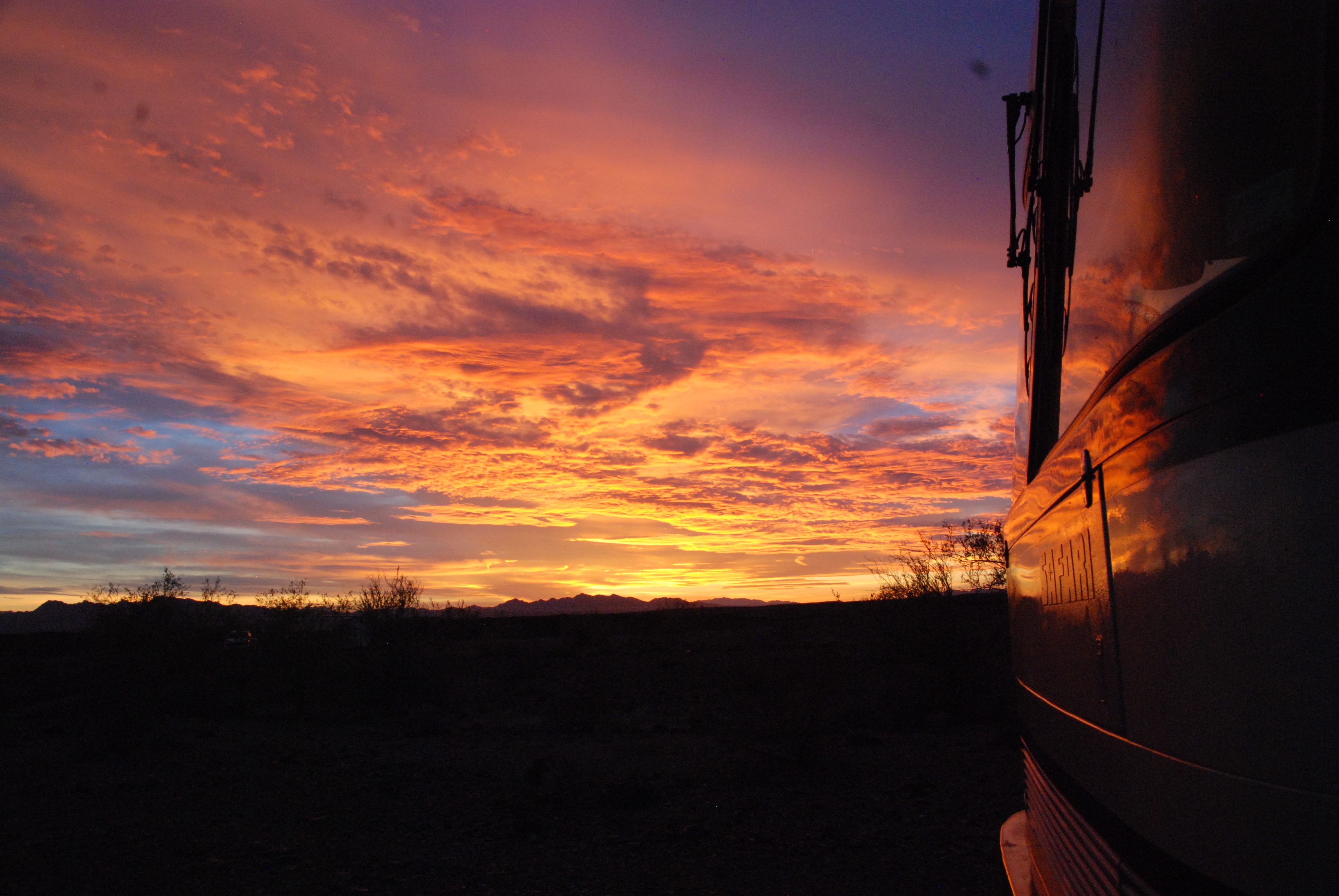
also one of the most dramatic sunsets I believe I have ever seen. Oh and sunrise as well.
We are now on the California side of Lake Havasu. Total wilderness, looking across the lake at a large city. After my last blog several people encouraged us NOT to head home too soon, as it is much colder. We WILL however slowly wind our way north now, and hope for better weather for those north of us.
I have to say we are having the time of our lives down here. I had always questioned the whole snowbird thing, go south, somewhere hot, play golf and hang around a swimming pool. Besides, I really hate the heat anyways. This year to avoid the dreadful storms along the Oregon coast that we experienced last year, we decided to go inland a bit, then a bit more and suddenly found ourselves down in Arizona. Last year we stuck to the coast to avoid the freezing temps, our RV is older and not set up for really cold temps. This year the weather was good in early November, so we cautiously went down through Nevada, closely watching temperatures and elevations. We took 95, which runs down a long valley with mountains on both sides. Essentially high desert. We did not spend as much time as we would have liked to, as we were trying to stay ahead of a storm that was bringing colder weather. (Perhaps next year we will hit this area earlier). Arizona is lower in elevation, and further south, and so warmer. Even where we are (near Quartzite) it gets down close to freezing at night.
We have also been staying out in the desert on BLM land. It is free and the views cannot be beat. Most of Nevada and Arizona are public land, and we have an APP, that shows is where BLM land is. Also signage usually indicates where private land is. We are self sustained, with 3 solar panels and an inverter to convert the power to ac power. SO if our water tank is full, we can actually spend several days out in the desert quite comfortably.
I had never really understood the beauty of the desert, but I realize it is more than something a picture can take. I am not even sure I can describe it in words. I guess it is one of those “you had to be there” things. I would have to say “solitude” would enter into the descriptive terms.
What has led us out here, has been the search of rocks, but we still love the days even when we find nothing. We have “THE BOOKS”, rockhounding in _______. You can get one for each state (and province by the way). They give descriptions of places to find certain “gems”. Then they describe how to get there. Usually they are at best vague, and at worst misleading. HOWEVER that just adds to the fun. I am up every morning studying the books, and have 3 different map types on my iPad. Oddly enough, often the RV camping app has the best maps. Oh and google earth as well.
So I start with a place that is interesting, then I have to figure out if we can get there. Our RV is not a 4 wheel drive, although we do get as far away from the main roads as we can. THEN WE WALK, or cycle to get to the designated places that most people take ATVs or 4 wheel drives. WE GET MORE EXERCISE, and find more rocks on the way TO the designated places.
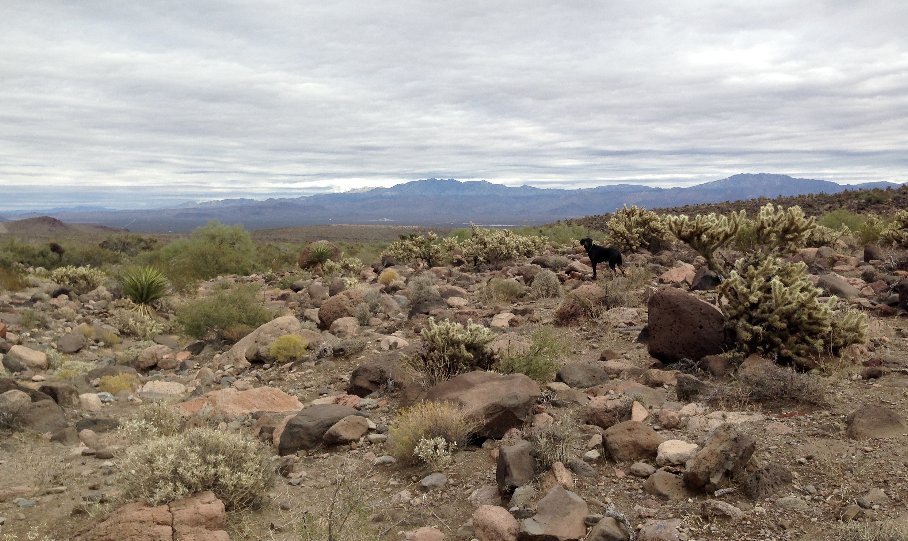
We likely also see more of the wild burros when walking. They were apparently let loose by prospectors who had run into bad times or other issues….and they have multiplied out in the desert over the many years. I wish I could get a better picture of them.
There is so much about all of this type of travel that I have found hard to find the info I wanted, so thought I would write a bit about it.
The sun has just come over the nearest hill, so I had better get to the books and plan today out.