Sonny Bono Salton Sea Wildlife refuge

So back to the Salton Sea story…… (see previous blog) in 1905, the Colorado River drained into the Salton see area for 2 years before they were able fix the area of the river.  Wintering waterfowl began flocking to the sea almost immediately, and before long, the area proved to be a major stopover destination for migrating birds. “Shown to have a greater diversity of avian species than that of the Florida Everglades, the Salton Sea is a vital habitat for more than 400 species of birds making it a one of North America’s premier birding locations.”  We decided prior to going there to give ourselves a new camera (?? christmas present)  So we took LOTS of pictures.   We “snuck up” on several birds attempting the perfect picture, and then while sorting out something with my camera in the car afterwards a HUGE heron flew within a few feet of our car (no time for a picture)

dsc00549

“The Salton Sea National Wildlife Refuge was established in 1930 at the southern end of the sea. Less than 1,800 of its original 37,600 acres remain manageable due to shoreline flooding. [1] In 1998, the refuge was renamed the Sonny Bono Salton Sea National Wildlife Refuge to commemorate congressman and former celebrity showman Bono who was an early champion of Salton Sea remediation efforts.”

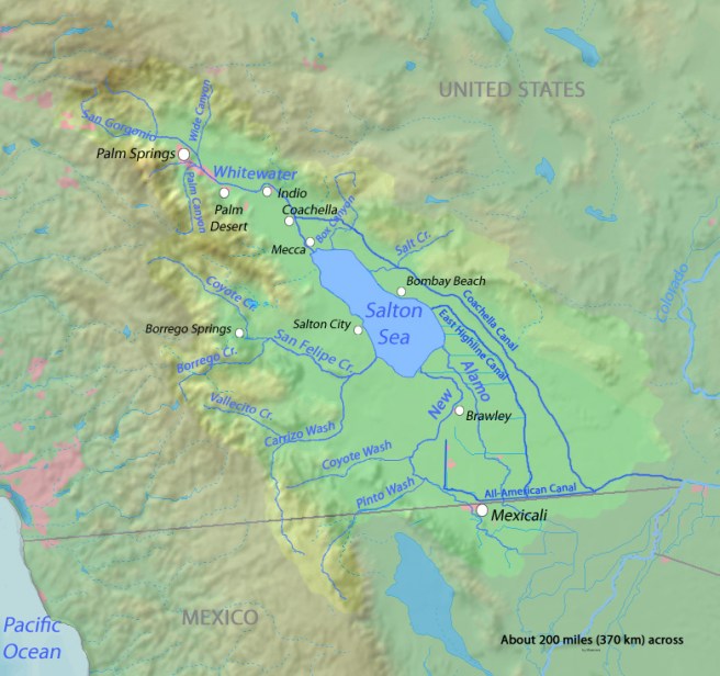
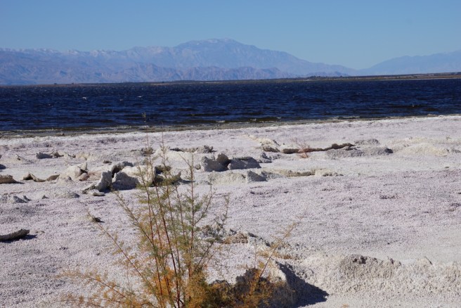
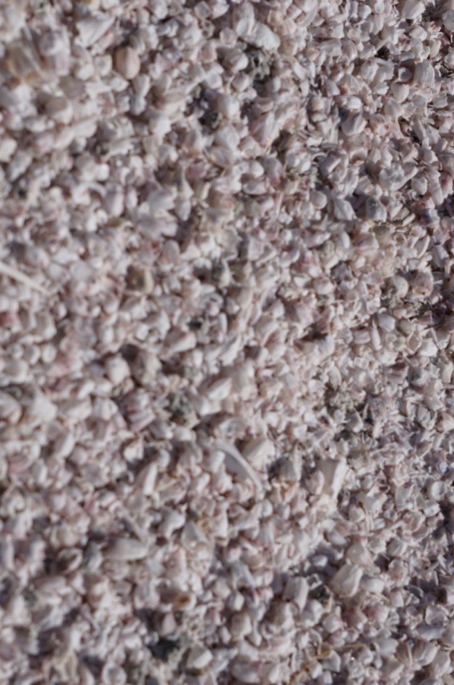
We went to the information centre, and it was quite interesting. She told us that the bird population that actually comes to the refuge has changed in recent years.  The salinity of the sea increases by about 3% per year, and very few fish can tolerate the concentration of salt. Apparently, though the sea has been a great fishing area for a long time, non one has actually caught fish there in the past 2 years, at least that they knew of.dsc00635

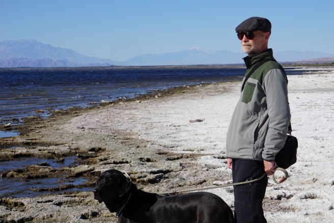
There are tales of boating several years ago, on a  calm day, you could look down into the water at the town that exists, where the salt mine was.  The OTHER really interesting boating story, is that because the lake sits ~260 feet below sea level, and with the increased salinity of the water, boats engines apparently perform much better.  So boats go much faster than they would elsewhere. So they had to initiate boating speed laws. We went down to the boat launch. As you can see there is no water for the first mile out from the launch.  The lake level is dropping all the time, and it sounds like it will eventually disappear again some day.dsc00601

In 1998 the sea was named after Sonny Bono. Part of the Salton Sea was in Bono’s congressional district, and cleaning up the lake became one of the issues he championed during his two terms in Congress. Bono’s death has created bipartisan support for the cleanup project.  It does seem that the area needs a new champion though.

dsc00586

dsc00588


dsc00697

So we are now almost to Oregon, we DID spend a few days in Ventura visiting with some friends we have not seen in years. Irene and Ken.  Also (not pictured here) Cindy and Paul.  We gave them a little concert of our newer songs. Who says you cannot have a party in a motorhome.:) 🙂 so wonderful to be with friends.

img_3465

Much Love

Janet, and Ken and Tucker.


The saltine stories of the Salton Sea.

We are currently staying at the Salton Sea, which is a shallow, saline endorheic rift lake that sits right on top of the San Andreas fault.   The lake sits on the lowest part of the Salton sink, which is the result of the actions of the San Andreas fault and the East pacific rise. A larger version of the Salton Sea,  Lake Cahuilla existed from 20,500 years to 3000 years ago. Apparently Indio would have been underwater then. It is felt from high water lines that the basin filled many times over thousands of years, creating a lake 105 miles in length and 300 feet deep.  From this picture  you can see where the salton sea sits in the basin and the faint blue waterway to the very right of the picture is the Colorado river.  The light green part is where the lake once extended to.

Saltonseadrainagemap

The cycle of filling has been repeated many times, most recently, an accident by the California Development Company. In 1905, in an effort to increase flow of water into the area for farming, irrigation canals were dug from the Colorado river to the valley ( mentioned in the previous blog about the All american  Canal and the Yuma syphon). The colorado river is very high in silt (which is what made the valley so fertile in the first place), and they made a cut in the bank of the Colorado river (dynamite). That action overwhelmed the canal, (the river was very high that year as well) and the river flowed directly into the Salton basin for 2 years, creating the sea which is there now.

lrg_dsc00433

It should be noted that an interesting note from explorers, …….the earliest ones found it and then after 1540 they did not 🤔🤔🤔  “For three centuries or more, from 1540 to 1902, the Salton Sink was a hot, and arid desert. Neither Melchior Diaz, a Spanish explorer in the service of Cortes who visited it in 1540, nor Juan Bautista de Anza, who crossed it in 1774, saw anything like a body of water. The only evidence that the Colorado River ran into the Sink within that fame span was a so called Roque map, now in the British Museum, which was compiled from all sources of information which were in existence in 1762. This map shows a considerable body of water in the Salton Sink, with the Colorado River flowing into it, but no written account accompanies the map.”

lrg_dsc00428

I should also note here that at one time, the salton sea was part of the gulf of California, there are tales of sunken ships found out in this desert. ( which according to my estimates would be under this sea)🤔🤔🤔.

So why is it so salty?  Its salinity is greater than the pacific ocean, and sadly increases by 3% per year because it has inflow from 3 sources, but no outflow, just evaporation.  Beneath the lake is a salt mine… In the late 1800s, 1885 to be exact, the New Liverpool salt company was formed, and “harvested” 700 tons/ day of the “white gold”.   At the time the “crop” sold for between 6 -34 dollars a ton.  So Mr Durbrow the owner, became quite wealthy, (for a time) and there were many buildings and homes at the site of the mine, which all became underwater when the area flooded in 1905-1907.  Interesting side note that Mr Durbrow also lost his home in the fire and earthquake in San Francisco in 1906. The railroad also became underwater.

So the “beach” we are walking on, is ankle deep in what appears to be shells, and old life forms, HOWEVER I found out the real story behind these “barnacles”

lrg_dsc00422


The Salton Sea also has a military history ….OF COURSE…. Starting in 1940, they had an Air force station, where they did sea plane training, and also “Additional activities at the base included experimental testing of solid-fuel plane-launched rockets, jet-assist take-off testing, aeroballistic testing of inert atomic weapon test units at land and marine target areas, training bombing at marine targets, testing of the effects of long-term storage on atomic weapons, testing of the Project Mercury space capsule parachute landing systems, parachute training and testing, and military training exercises.” 🙄🙄  SO BACK TO THE BARNACLES….. How did they get there?  Well the military brought in Ships to the Salton sea, which had barnacles on them, and they thrived in the Salton Sea.  We found that the barnacles were very different from the ones you might find on an ocean beach, much softer with thinner side walls.  SO none of this is sand, it is all barnacles.

lrg_dsc00428

lrg_dsc00437

This area is so interesting, I have decided to make it into 2 blogs…… so stay tuned for Salton sea part 2.

It was extremely cold yesterday, cold north wind blowing 25-30 mph, hope it is nicer today

Much love to all, and happy new year.

Love, Janet, Ken and Tucker