Who the heck was John Day?

Once again we are on the road and all the way down in Oregon, checking out the John Day river area. It does seem that everything in central/eastern Oregon is named after John Day. I have heard his name for years, and thought while we were in the area I would find out all about all the great things he did to get stuff named after him.  I started here at John Day National Monument :Site Clarno  (what this means is that there are more than one John Day National Monument sites.) This is one of 3.

img_5401

At this site there was a plaque with the question Who was John Day?  I had not thought I would find the answer so quickly.    🤔  This is what the plaque said:  “John Day came to Oregon in 1812 as part of an overland expedition to the new Pacific Fur Company post in Astoria. The once large party split up into many small groups before reaching the Oregon Territory. While camped where the mouth of the Mah-hah River meets the Columbia, John Day and Ramsay Crooks were robbed of all their belongings, including clothing. Luckily they were rescued by a party of trappers also headed to Astoria.

John Day became well known at the trading post. Whenever others would pass the spot of the incident, they would point out where he had been robbed. By the 1850’s, the Mah-hah River had been renamed the John Day River. As far as historians can tell, John Day never found a fossil nor came within 100 miles of the monument that indirectly bears his name.”

SO the RIVER was named after him. How it all started……img_5414

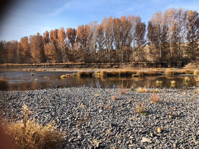
What a lucky guy, get robbed and then have a river named after you.   Look at how hard the present occupant of the white house is trying to get a wall named after him Thinking_Face_Emoji_large

But wait, the story does not end here. . . .

It turns out that it was Thomas Condon who named the national monuments after John Day, not that John Day had ever been anywheres near the fossil beds in the area, its just it was the John Day river that had carved out the area, exposing the fossils.  Thomas Condon was an Irish presbyterian minister, and amateur  geologist who actually was the one who discovered the fossils.   info on Thomas Condon

I guess I was particularly interested in the town of Condon, as it is the married name of one of my sisters.  So I stopped to take a pictureimg_5400

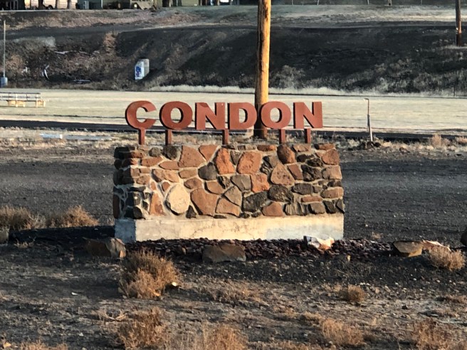
Turns out there is another town just down the way called “Bates”. It seems that a lot more things should be named Condon, VS John Day 🤔

img_5411

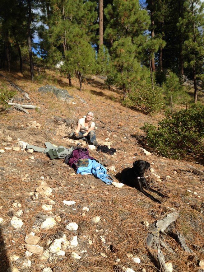
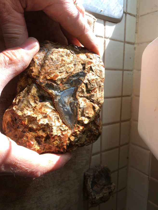
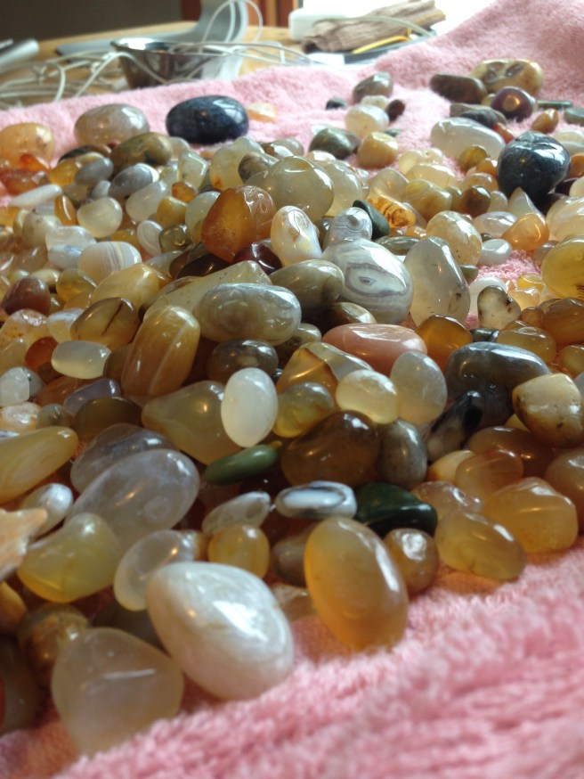
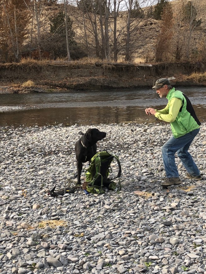
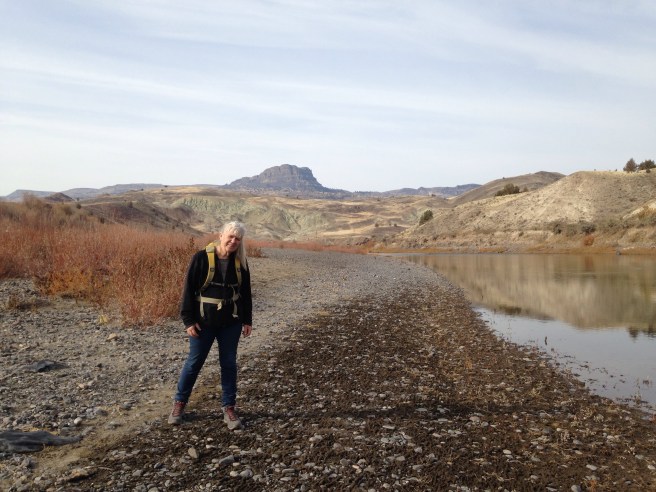
We have found plenty on the John Day river to explore, since this river winds through fossil beds, it also winds  through  a volcanic region, which is always great for agates and the things we hunt for.  The hard thing is finding gravel bars that are accessible. They usually seem to be across the river from where we are.img_5415

It really is a slow meandering kind of river, that suits us just fine.

img_5410

This series of 3 hills appeared to be the same except that the closest one was more eroded, the second one less eroded and the third un eroded.

img_5391

img_5405

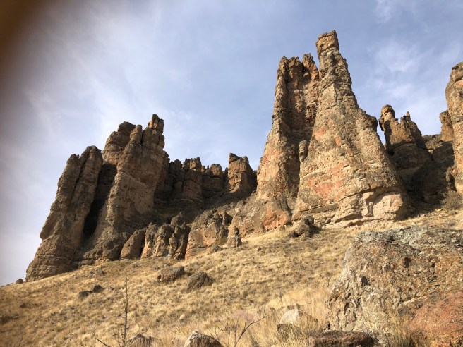
So these are the “palisades”. There are 3 sites that make up the John Day national monument and this one is called Clarno.  I found this info on it “The mostly grassy hillsides bordering the creek are interrupted for a mile or so by a line of jagged, eroded cliffs – the Palisades – which contain a large number of plant fossils, including leaves, sticks and trunks, plus less common animal fossils, all relics of a time when this region was moist and well vegetated, unlike the arid, high desert conditions that prevail today. Facilities are limited to a picnic area, interpretive notices and three trails; the unit is unstaffed, and there are no large towns nearby. It does have a research center (Hancock Field Station), facilitating ongoing paleontological investigations, but this, and the fossil excavation sites, are not open to the public.”

So pretty ho hum.  But we shall explore the other sites.

……Back to John Day…….. It turns out there is also a town named after him because the town is on the  John Day river.   Given the fame of his name, historians would attempt to find out more about him. It seems that there were 3 deaths he succumbed to as well, in 1812, 1813 and (perhaps finally) in 1819.    story of the city of John Day

Perhaps dying 3 times might be worthy of at least SOME fame……..True story……..image

img_1311

We have been on the road for a week now, our last evening visit with Dylan, Sarah, and the very clever Talon.

img_5323

Where other babies are working on mundane things like walking talking, crawling, Talon has mastered …….img_5363

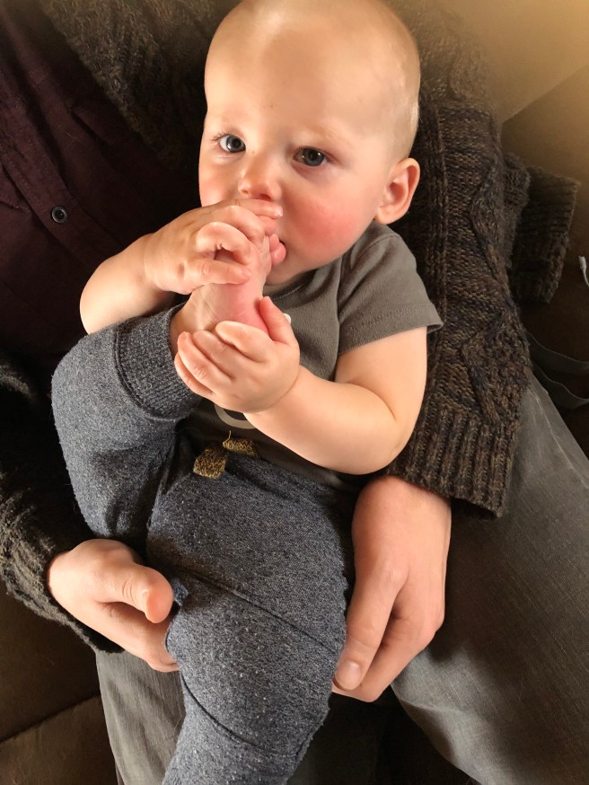
…..chewing his toenails… clever boy.img_1321

Thats all for now.

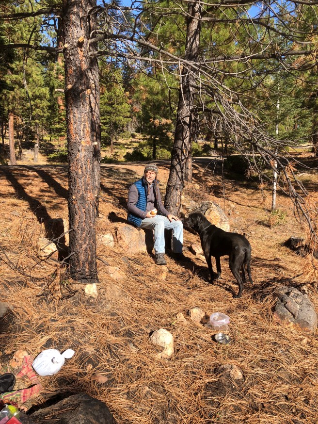
Much love from Janet, Ken and Tucker (the ever present rock hound)img_5399


Electric cars, accidents and insurance company logic


We are now in central Oregon, heading south.  With the snowing in the passes in  BC at the beginning of November, we opted to avoid passes and head directly south, through central Washington down to central Oregon. 

My car, the electric car, is currently traveling around BC without me.  I work in Kamloops, live in scotch creek and have an hours drive to work. On my very last day of driving in to work this year, I hit a deer on the 4 lane, HWY 1. Not sure if the deer survived, but left the scene. The right front end was crunched in, and the car was UN drivable because the wheel well was down wrapped around the right front tire.

img_1020

img_1022


Not having been in an accident I was at a bit of a loss in dealing with ICBC (british columbia’s Govt insurance).  SO the car sat in Kamloops for a few days, due to my inexperience with insurance companies. I was told that  they would only tow the car to the closest town (Kamloops), despite my information that there was no places in Kamloops that work on BMW cars.

So we used our BCAA insurance to have the car towed to Kelowna to a place that IS BMW certified. I made it VERY VERY clear that this was an electric car.  She assured me that YES they work on all BMWs.  So then we are driving along the Columbia river  when we got a message from the car repair place in Kelowna to say that they, turns out, cannot work on an electric car. Apparently there are special tools, AND specially trained technicians to deal with the batteries.

So there we were thinking that we had used up our BCAA free ride and were going to get stuck with a huge bill to get the car to Vancouver. Then we found out a little known thing about auto insurance that I wanted to share with you all.  Auto insurance companies guarantee to fix your car. If for some reason your car cannot be fixed in the closest town, it is their responsibility to tow it to where it can be fixed (for me it is Vancouver)

So the car is sitting in Kelowna, turns out they had taken it apart and not put it back together for the tow, so it will likely not get to vancouver until late next week.  This is good for us, because we have no idea how we will get it back to Scotch Creek when it IS fixed.

So in the meantime, we have gone MINING………

img_3688

NOW this is a kind of rockhounding that you can really get IN TO…. THUNDEREGGS. Oregon’s STATE rock.

img_1047

They lie just under the surface, so you have to get a bit DIRTY… as you can see, I really get into my work.

10aec90c-42b6-4ac8-936e-8466322b84a0-833-0000022cb11c3f30_file

56e99049-7182-479b-a480-cbbae1c09474-1003-000002339b89aab6_file

A thunder egg is essentially an agate (or jasper) inside a volcanic rock shell.  We were staying in Prineville, OR, which is the rockhounding centre of central Oregon. Beautiful forests, sadly many of them burned last summer.  It is

img_3692

We are managing to get way further in our side trips because we now have a jeep we are towing. We are just leaving the motorhome in one place and driving to other destinations with the jeep. MUCH better on the motorhome, not having to 4×4 anymore 🙂

We are actually today in North eastern California, hoping we can get through MEDOC forest today.

img_3699

Bye for now, much love to all.
janet

Agates 101…….

We have left the cabin tarpapered for the winter, planted 1200 garlic, harvested our grapes,

img_1082

and other fruit, and got our motorhome ready for the trip down south. WE did bring 12 jars of homemade heirloom tomato sauce, 5 jars of Jam, several bags of frozen raspberries, and even delicata squash, which I looked into on the border (what can I bring) site and it is all allowed, so we have MUCH of our garden.  My only concern was several thanksgiving day dinner leftover dishes, because they had meat in them. In the end we left them with Kens uncle in Chilliwack, who had just got out of hospital and maintained that those dinners saved his life  🙂

We had a lot of problems last year with leaking and eventually the whole roof started leaking in a storm, so had to replace that while down here.  Ken has done a lot of other repairs over the summer. It is a 1995 motorhome, so par for the course.  We are in Oregon, where we lived for 13 years, visiting friends, walking beaches, mushroom picking and …

so….a rainy day on the coast, imagine that! Time to once again resume my blog, especially now that we are onto our next obsession: agates.  These are from last year, we learned also how to tumble them.

img_1491

Only thing is that this year is our second year of being rock hounds, and while last year we were adolescent rock hounds, going mainly for the shiny agates, the prettiest  ones we tumbled from last year were the Jasper. Our “repertoire” has essentially doubled.  We are now looking for pretty jasper.

Agates, from what we learned last year, are formed from silica bearing waters that fill the gas bubbles in solidifying lava,  creating a gel.  The water, being alkali, reacts with the iron in the lava, which when it dries leaves lines of iron hydroxide, which forms bands in the finished agate.  I have seen the layers described like the Russian dolls.

Last year we met people on our beach walks who told us what to look for, and so then we had to find out where to find more.   We have only searched on ocean beaches, but they can be found in many other situations. In general they tend to be near where rivers meet the ocean, bringing agates down from areas where volcanoes have erupted years ago.

They say that agates are found near where rivers meet the ocean, and so we fully investigated the Elk river, the Sixes river and the Coquille river.

Problem with the Coquille river is that it has a large jetty fortifying the mouth of the river. I believe that that complicates the agate journey, so very few agates near the Coquille. However the Elk river opens into the ocean a few miles south of the Cape Blanco lighthouse and some days we found agates. It is a 1.5 mile walk down the beach to get to the river, and you might find agates there one day, and the next day it might all be sand, but for us we love the walk anyways.  In many ways we just need a reason for the walk, we also love hunting for mushrooms.

This year we walked to the Elk river from the south side, Paridise point. It was about a 3.5 mile walk.

The thing about agates is that over the summer they lie deep under all the sand that the wind brings, and they are only revealed when the winter storms with the large swells drag the sand back revealing the hidden treasures.  There are some “agate beds” that remain hidden for many years, only becoming visible with the most severe storms.  We were amazed last year with beaches like Merchants beach. It is north of Bandon, which is a very flat beach, all sand. WE were wondering what the booklet said about finding agates there, as we found nothing but old car engines,

img_1285

but then one day it all opened up and it became a gravel beach with large stones.  Mostly jasper… more on that later..  The other thing that is interesting is how much the direction of the river changes day to day, and year to year. I guess that is part of the reason for the Jetties….as well as break waters. I mean one day you could be river frontage and then next day you could be IN the river.

The next thing is the tides. It seems that the really low tides in the winter are always during the night.  THEN the size of swells, which I did not fully appreciate until being out on a low tide day with large swells, might just as well have been a high tide. Also on a high tide day with no swells it is like a low tide.  So figuring out how to get down a beach that disappears during a high tide, is important to make sure you do not get stranded somewhere.  Rain and wind are only “relatively” important. Depending on how water proof your clothes are, and just how motivated you are. We have gone out on days we should not have….. not photos though.

It really helps, when you are looking for agates, if the sun is shining. The sun actually “lights them up” like little lanterns, so you will see a bed of gravel and when you are facing the sun, the agates will shine like little flashlights.

So an ideal day is sunny, lots of gravel and a favourable tide.  Here are a few that show the lines..img_1163